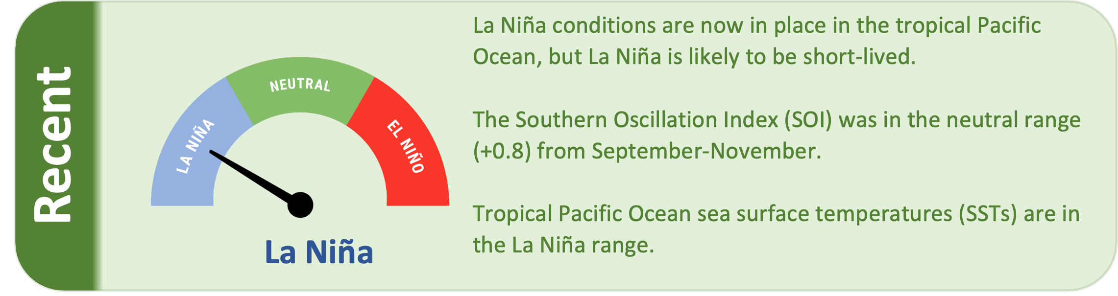
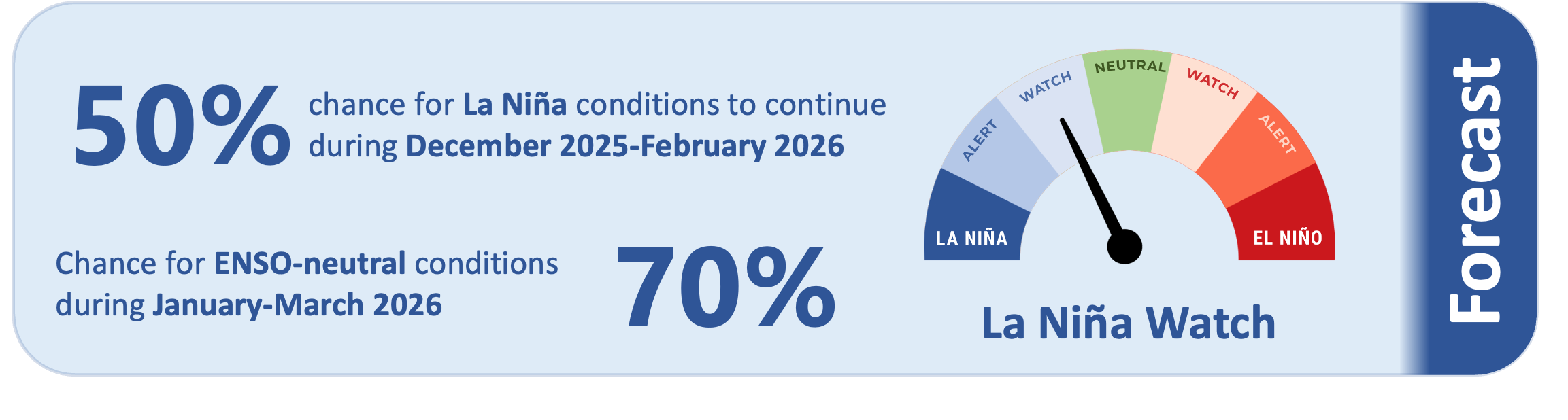
Conditions in the tropical Pacific reached La Niña in late October, and La Niña remains in place, but this event is likely to be short-lived. There is about a 50% chance that La Niña conditions will continue during December 2025- February 2026, with a 70% chance that the tropical Pacific will return to ENSO-neutral conditions during January- March 2026.
As of 18 November 2025, the 30-day NINO3.4 Index (in the central equatorial Pacific) was -0.67˚C, near the La Niña range. The 30-day relative Niño 3.4 Index (RONI) was -0.92˚C, in the La Niña range and reflective of the central equatorial Pacific being cooler than the average of the global tropics.
The Southern Oscillation Index (SOI) was in the neutral range during September-November (+0.8), while the preliminary November value was +1.2 (in the La Niña range).
Subsurface ocean temperatures in the equatorial Pacific remain above average in the western part of the basin with cooler than average temperatures in the east. Notably cooler than average temperatures are currently located in the eastern equatorial Pacific at depths of 50-200 metres. These cool water temperatures indicate a tropical Pacific in a La Niña state.
During early December, a pulse of the Madden-Julian Oscillation (MJO) is predicted to move across the western Pacific, which may result in an enhancement in convective activity and rainfall.
During December-February, model guidance favours an enhancement in convective forcing over the western Pacific and parts of Melanesia consistent with La Niña and collocated with the warmest sea surface temperatures. This may lead to enhanced rainfall for island groups such as Palau, the Federated States of Micronesia, and southern Papua New Guinea east to parts of French Polynesia. Conversely, drier than normal conditions are likely to occur for most island groups near the equator, including Kiribati, Tuvalu, Tokelau, northern Cook Islands, and northern French Polynesia (see pages 6-7 for more information).
