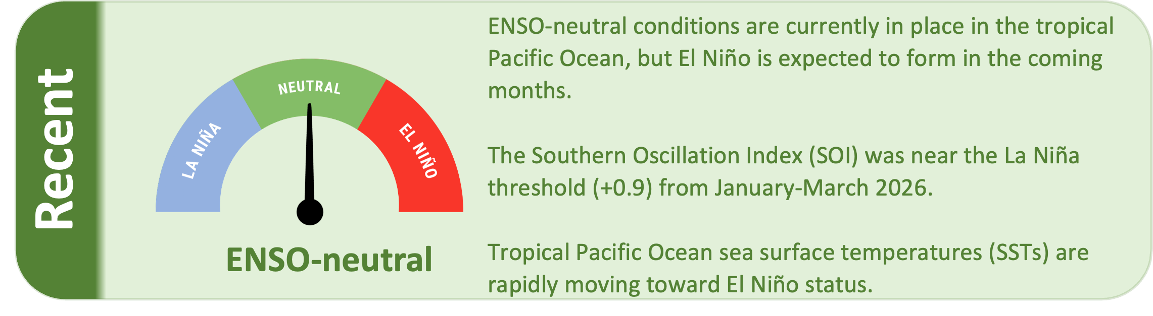
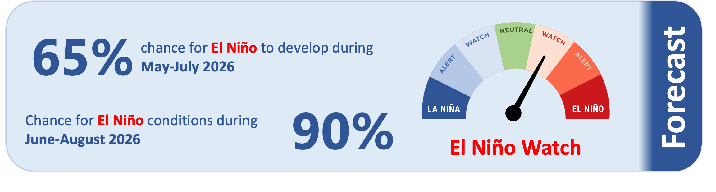
ENSO-neutral is currently in place in the tropical Pacific, but conditions are rapidly moving toward El Niño which is expected to form in the coming months. There is about a 65% chance for El Niño to form during May-July, with a 90% chance that El Niño will be in place during June-August. The upcoming El Niño may be a strong one.
As of 12 April 2026, the 30-day NINO3.4 Index (in the central equatorial Pacific) was 0.14˚C, in the neutral range. The 30-day relative Niño 3.4 Index (RONI) was -0.37˚C, on the La Niña side of the neutral range and reflective of the central equatorial Pacific being cooler than the average of the global tropics.
The Southern Oscillation Index (SOI) was near the La Niña threshold during January-March 2026 (+0.9), while the March value was +0.8 (i.e. on the La Niña side of neutral).
Subsurface ocean temperatures in the equatorial Pacific are now above average or well above average essentially everywhere across the basin.
Particularly warm water is located in the central equatorial Pacific between depths of about 100-200 metres, where temperature anomalies of 3-5°C are widespread. This continues to indicate the expectation for a potentially strong El Niño to form in the coming months.
During May-July, model guidance favours a continued chance of above normal or well above normal rainfall across most of Micronesia and several island groups along the equator. This may lead to enhanced rainfall for island groups such as Guam, the Northern Marianas, Federated States of Micronesia, the Marshall Islands, Nauru, and most of Kiribati.
Conversely, drier than normal or much drier than normal conditions are likely to occur for many island groups farther south, including southern Papua New Guinea east to Fiji, and especially from Tuvalu east to northern French Polynesia (see pages 6-7 for more information).
Tropical cyclone season in the southwest Pacific officially ends on 30 April, but a cyclone occurring after this date cannot be ruled out.
