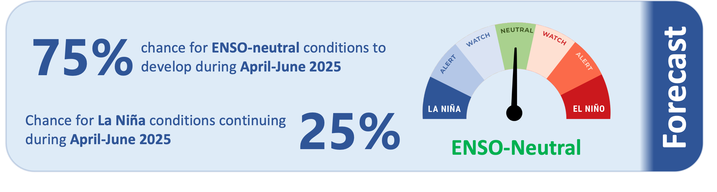
The ocean and atmosphere remain in a weak La Niña state, primarily focused on the central Pacific (i.e., La Niña “Modoki”). However, there is a 75% chance that ENSO-neutral conditions will emerge during April-June and only a 25% chance that La Niña will continue.
As of 17 March, the 30-day NINO3.4 Index (in the central equatorial Pacific) was -0.02˚C, in the neutral range. The 30-day relative Niño 3.4 Index (RONI) was -0.52˚C, reflective of the central equatorial Pacific being significantly cooler than the average of the global tropics. However, the RONI is also moving rapidly toward the ENSO-neutral range.
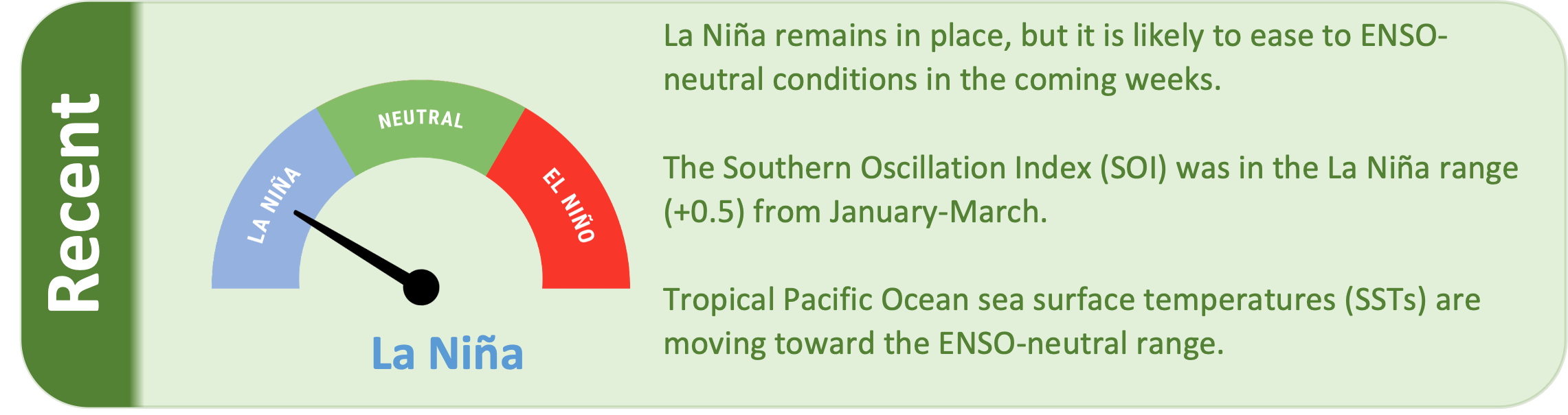
The Southern Oscillation Index (SOI) was in the La Niña range during January-March (+0.5), while the March value was +0.9 (in the La Niña range).
The subsurface equatorial Pacific is 1˚C to 2˚C cooler than average just below the surface in the central part of the basin, but above average temperatures are emerging in the eastern Pacific, indicating the decay of La Niña. However, above average upper oceanic heat content continues in western parts of the Pacific basin.
The South Pacific Convergence Zone (SPCZ) was located slightly south of its climatological normal position during March.
During April-June, model guidance favours an enhancement in convective forcing over the western Pacific and Melanesia, collocated with the warmest sea-surface temperatures and position of the SPCZ. This may lead to enhanced rainfall for some island groups such as Guam, the Northern Marianas, and southern Papua New Guinea east to Vanuatu. However, drier than normal conditions are likely to persist for some island groups along the equator (see pages 6-7 for more information).
Tropical cyclone season officially continues through April, although tropical cyclones can form outside of the official season.
