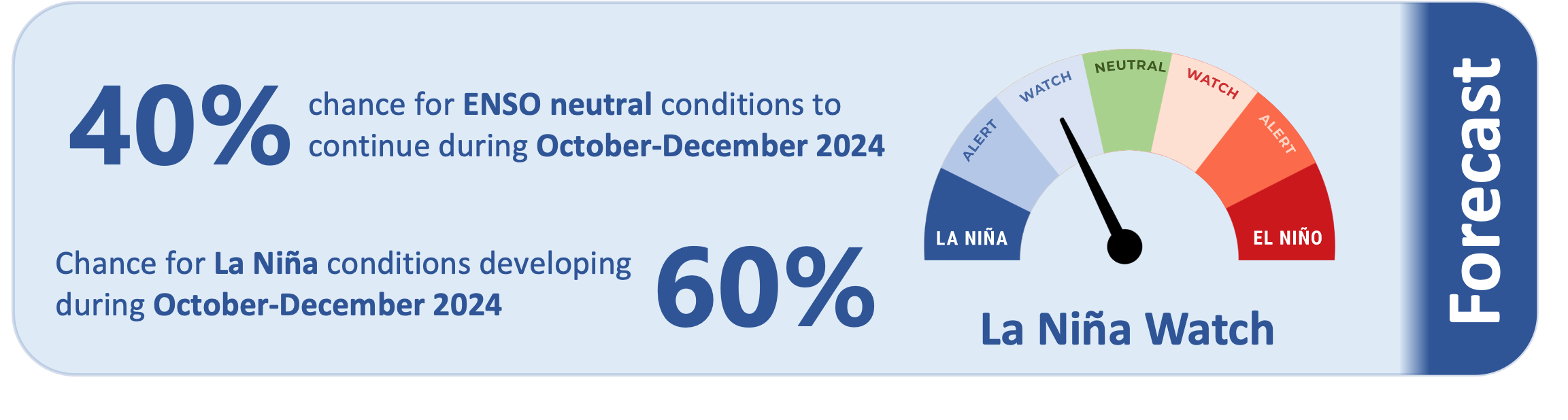
There is a 60% chance that La Niña will develop by the end of December. Tropical Pacific trade winds will continue to nudge the ocean in a La Niña-like direction.
An alternative measure of central Pacific SSTs, called the relative oceanic Niño Index, has had an average anomaly of -0.7˚C over the last month and is more aligned with La Niña-like oceanic conditions.
As of 17 September, the traditional 30-day Niño 1+2 Index anomaly was -0.16˚C, within the neutral range. The 30-day NINO3.4 Index anomaly (in the central equatorial Pacific) was -0.17˚C, also in the neutral range.
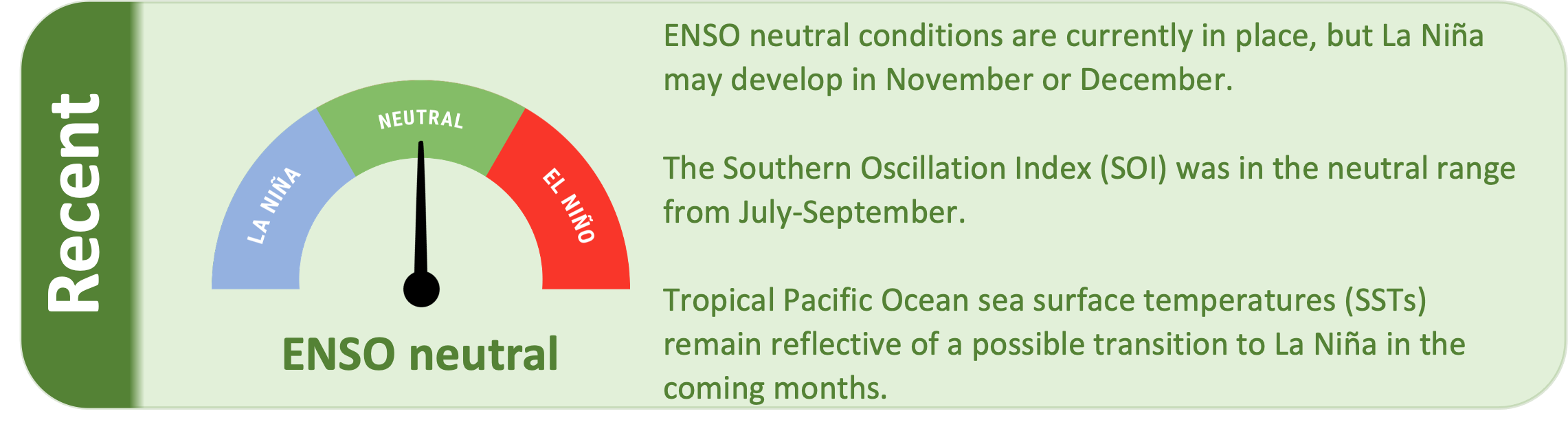
The Southern Oscillation Index (SOI) was in the neutral range during July-September (0.0), while the September value was -0.2 (in the neutral range).
The subsurface equatorial Pacific continues to be 3˚C to 5˚C cooler than average just below the surface in the east of
the basin.
Above average upper oceanic heat content continues in western parts of the basin. The West Pacific Warm Pool is becoming more unusually warm, which is also reflective of the potential development of La Niña.
The South Pacific Convergence Zone was generally close to its climatological normal position during September.
During October-December, model guidance favours an enhancement in convective forcing over the western Pacific and Maritime Continent, consistent with a developing La Niña. This may lead to enhanced rainfall for some countries such as Palau, Federated States of Micronesia, Papua New Guinea, and the Solomon Islands (based on the decile precipitation forecast for October and October-December; see pages 6-7 for more information).
Tropical cyclone season starts in November. While no out-of-season activity is forecast at this time, it is a reminder to remain vigilant and prepared as tropical cyclone season approaches.