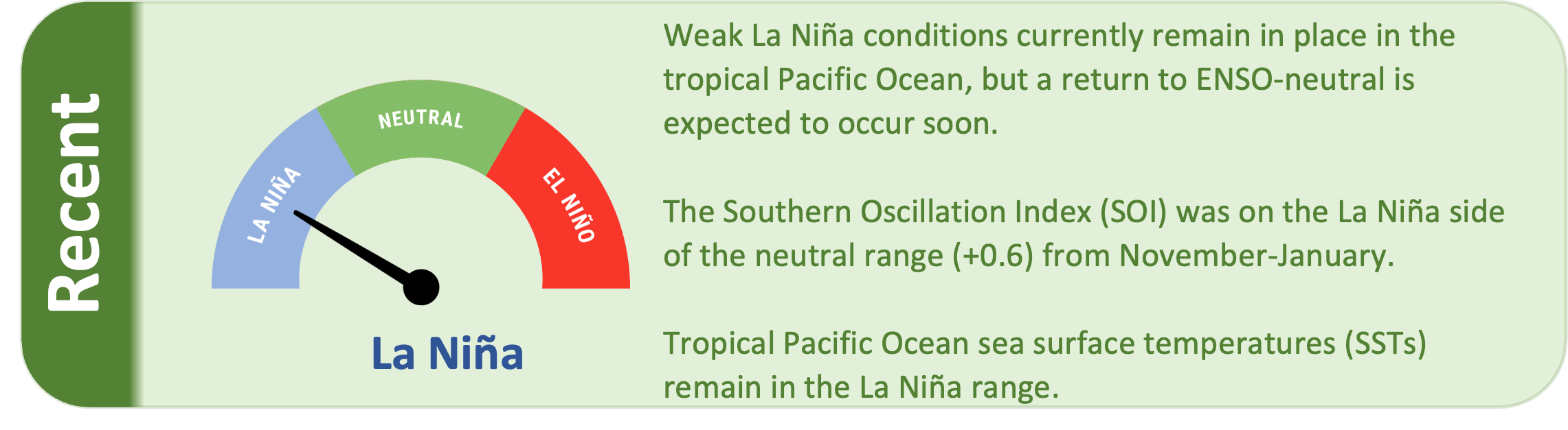
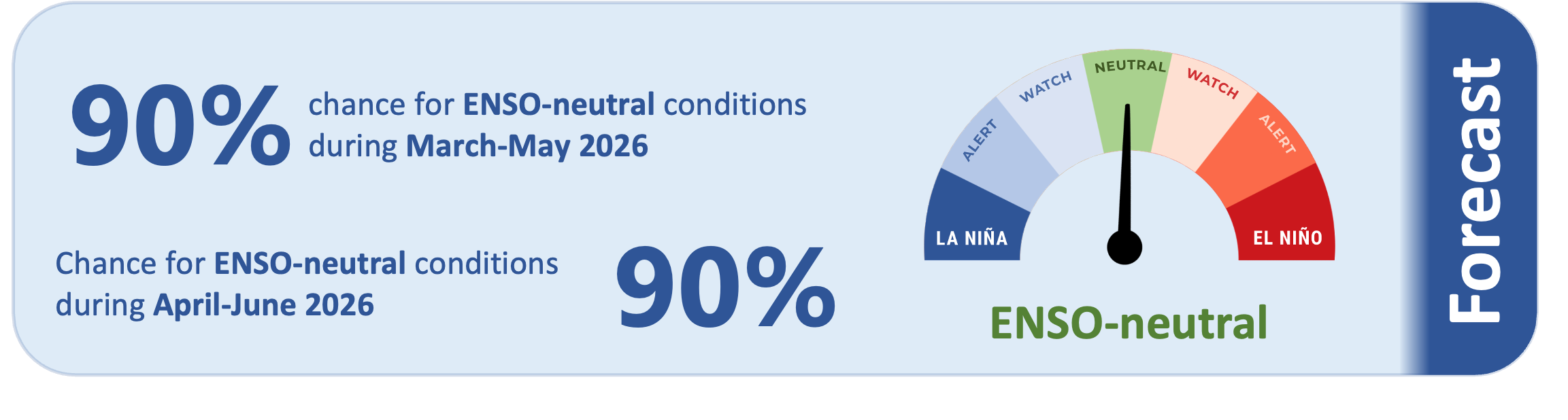
Weak La Niña conditions currently remain in place in the tropical Pacific, but a return to ENSO-neutral is expected to occur soon. There is about a 90% chance that La Niña will dissipate to ENSO-neutral during March-May, with a 90% chance for ENSO-neutral continuing during April-June.
As of 9 February 2026, the 30-day NINO3.4 Index (in the central equatorial Pacific) was -0.48˚C, on the La Niña side of neutral. The 30-day relative Niño 3.4 Index (RONI) was -0.88˚C, in the La Niña range and reflective of the central equatorial Pacific being cooler than the average of the global tropics.
The Southern Oscillation Index (SOI) was on the La Niña side of the neutral range during November-January (+0.6), while the January value was +0.8 (also on the La Niña side of neutral).
Subsurface ocean temperatures in the equatorial Pacific are now above average nearly everywhere except for some shallow cool anomalies in the central Pacific.
Cooler than average temperatures are currently located in the central equatorial Pacific to depths of about 50 metres. However, warmer than average temperatures below 50 metres continue to rapidly progress into the central and eastern equatorial Pacific, signalling that La Niña is nearing its end.
During March-May, model guidance favours an enhancement in convective forcing over Micronesia, collocated with the warmest sea surface temperatures. This may lead to enhanced rainfall for island groups such as Palau, Guam, the Northern Marianas, Federated States of Micronesia, and the Marshall Islands.
Conversely, drier than normal or much drier than normal conditions are likely to occur for many island groups near the equator, particularly from Tuvalu east to northern French Polynesia (see pages 6-7 for more information).
Tropical cyclone season in the southwest Pacific continues through April 2026.
