The warmth continues everywhere and wetness for some - and the warmest start to the year on record.
Overview
March 2018 was characterised by significantly higher pressure than normal to the east of New Zealand. This pressure pattern, in concert with the decaying La Niña in the tropical Pacific, caused more northeasterly winds than usual over the country. These warm, humid air masses, combined with the remnants of the marine heatwave in the Tasman Sea, influenced higher than usual temperatures over New Zealand as well as some heavy rainfall events.
March was a warm month across New Zealand, with well above average (>1.20°C of average) or above average (0.51 to 1.20°C of average) mean temperatures experienced almost everywhere across the country. Only isolated parts of Tasman and Southland experienced near average temperatures (-0.50 to 0.50°C). As was observed in February, the number of record and near-record high mean minimum (night time) temperatures in March exceeded the number of record and near-record high mean maximum (day time) temperatures, due to the combination of the marine heat wave along with warm and humid northeasterlies, thereby keeping overnight temperatures elevated.
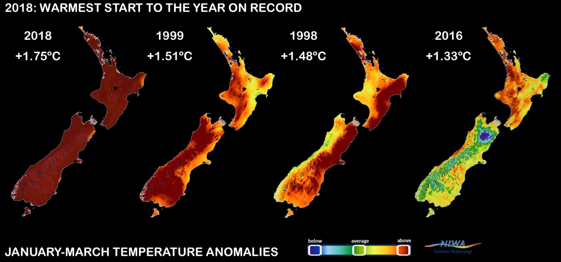
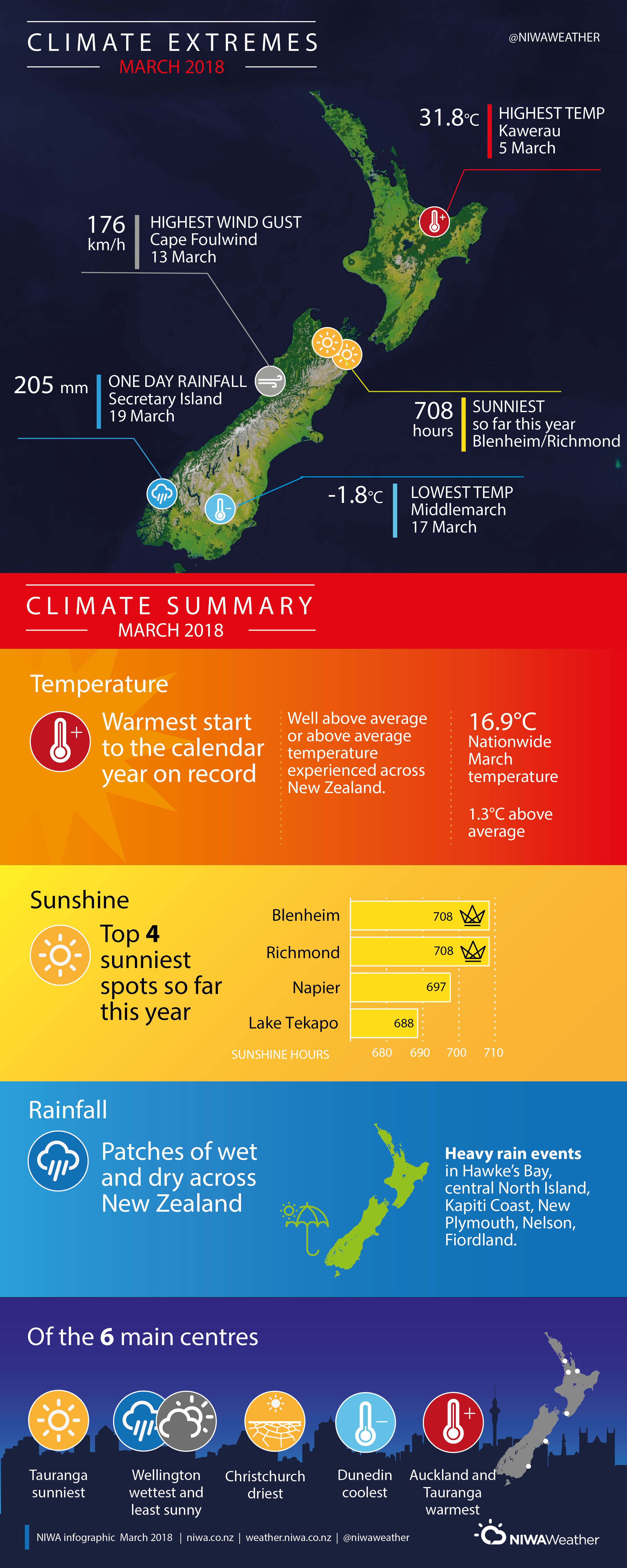
The nationwide average temperature in March 2018 was 16.9°C (1.3°C above the 1981-2010 March average from NIWA’s seven station temperature series which begins in 1909). March 2018 was the sixth-warmest March in the seven-station series. So far, 2018 has had the warmest start to the calendar year on record, with mean temperatures 1.75°C above the 1981-2010 average for January to March combined. The previous record was held by 1998, with January-March mean temperatures that were 1.51°C above average..
March rainfall was spatially patchy across New Zealand, with heavy rain leading to flooding in some areas. Well above normal rainfall totals (>149% of normal) were experienced in the central North Island, the eastern North Island south of Napier, Kapiti Coast, Nelson, south Canterbury, north and central Otago, and Fiordland. Rainfall was above normal (120-149% of normal) in Northland, the southern half of the North Island, and Tasman. Below normal rainfall (50-79%) was experienced in isolated patches of Auckland, Waikato, Bay of Plenty, East Cape, Christchurch, Dunedin, and Southland. Near normal rainfall (80-119% of normal) was observed elsewhere.
By the end of March, soil moisture levels were much above normal for the time of year across most of New Zealand. Soils were drier than normal for East Cape, parts of Manawatu-Whanganui, eastern Southland, and Stewart Island.
Further highlights
- The highest temperature was 31.8°C, observed at Kawerau on 5 March.
- The lowest temperature was -1.8°C, observed at Middlemarch on 17 March.
- The highest 1-day rainfall was 205 mm, recorded at Secretary Island on 19 March.
- The highest wind gust was 176 km/h, observed at Cape Foulwind on 13 March.
- Of the six main centres in March 2018, Auckland and Tauranga were the warmest, Wellington was the wettest and least sunny, Christchurch was the driest, Dunedin was the coolest, and Tauranga was the sunniest.
- Of the available automatic sunshine observation sites, the sunniest four locations in 2018 so far (1 January – 31 March) are Blenheim (708 hours), Richmond (708 hours), Napier (697 hours) and Lake Tekapo (688 hours).
Contact
Petra Pearce, Climate Scientist, NIWA Auckland Tel. 09 375 2052
Download:
- March 2018 Climate Summary information [PDF 550 KB]
- March 2018 Climate statistics [PDF 60KB]