Outlook Summary
- March is expected to feature spells of higher than normal pressure in Aotearoa New Zealand, especially during the first half of the month, with drier than normal conditions favoured in the North Island in particular. Late March and early April may feature a period of unsettled weather.
- La Niña is expected to transition to ENSO neutral conditions over the next three months, which will come with more climate variability.
- At the end of February, marine heatwave (MHW) conditions were occurring in the northern and western North Island and western and eastern South Island. Around the country, sea surface temperatures (SSTs) ranged from 1.0˚C to 1.6˚C above average during February. The MHW, while easing over autumn, will likely delay the seasonal transition to cooler temperatures and increase the odds for stormy weather in the New Zealand region.
- Air pressure is forecast to be lower than normal to the west and northwest and higher than normal to the east of New Zealand. This is expected to be associated with northeasterly quarter wind flow anomalies (northerly to easterly) for the season as a whole, although more variability in air flows is possible during April and May.
- Temperatures are very likely to be above average in all regions except for the east and north of the South Island where above average or near average temperatures are about equally likely. Periods of warm, summer-like temperatures are likely during March, although an unseasonable cold spell may occur during the first half of April.
- Rainfall is about equally likely to be near normal or below normal in the north and west of the North Island, near or above normal in the west of the South Island, and most likely to be near normal in all other regions.
- Seasonal rainfall may be influenced by tropical cyclone activity in the SW Pacific. Any activity during early March is not expected to impact New Zealand, although there will be another chance in late March or early April. As the country has experienced several times in recent months, these systems can cause extreme rainfall and flooding.
- Soil moisture levels and river flows are most likely to be below normal in the north of the North Island and near normal in all other regions.


Regional predictions for March – May 2022
Northland, Auckland, Waikato, Bay of Plenty
The table below shows the probabilities (or percent chances) for each of three categories: above average, near average, and below average. In the absence of any forecast guidance there would be an equal likelihood (33% chance) of the outcome being in any one of the three categories. Forecast information from local and global guidance models is used to indicate the deviation from equal chance expected for the coming three-month period, with the following outcomes the most likely (but not certain) for this region:
- Temperatures are very likely to be above average (70% chance). Marine heatwave conditions will likely contribute to elevated humidity and warm temperatures during March and delay the seasonal transition to cooler temperatures during April-May.
- Rainfall totals are equally likely to be normal (40% chance) or below normal (35% chance).
- Extended dry spells are likely, especially during March. An elevated chance for atmospheric rivers and ex-tropical cyclone activity may increase the risk for heavy rainfall events later in March or early in April.
- In late February, very dry conditions were occurring in parts of Northland, Auckland, Waikato according to NIWA’s New Zealand Drought Index.
- Soil moisture levels and river flows are most likely to be below normal (50% chance).
The full probability breakdown is:
|
Temperature |
Rainfall |
Soil moisture |
River flows | |
|
Above average |
70 |
25 |
15 |
15 |
|
Near average |
25 |
40 |
35 |
35 |
|
Below average |
05 |
35 |
50 |
50 |
Central North Island, Taranaki, Whanganui, Manawatu, Wellington
Probabilities are assigned in three categories: above average, near average, and below average.
- Temperatures are very likely to be above average (70% chance). Marine heatwave conditions will likely contribute to elevated humidity and warm temperatures during March and delay the seasonal transition to cooler temperatures during April-May.
- Rainfall totals are equally likely to be normal (40% chance) or below normal (35% chance).
- Extended dry spells are likely, especially during March. An elevated chance for atmospheric rivers and ex-tropical cyclone activity may increase the risk for heavy rainfall events later in March or early in April.
- Soil moisture levels and river flows are most likely to be near normal (50% chance).
The full probability breakdown is:
|
Temperature |
Rainfall |
Soil moisture |
River flows | |
|
Above average |
70 |
35 |
15 |
15 |
|
Near average |
25 |
40 |
50 |
50 |
|
Below average |
05 |
25 |
35 |
35 |
Gisborne, Hawke’s Bay, Wairarapa
Probabilities are assigned in three categories: above average, near average, and below average.
- Temperatures are most likely to be above average (55% chance). Warmer than average coastal SSTs will likely contribute to elevated humidity and warm temperatures during March and delay the seasonal transition to cooler temperatures during April-May.
- Rainfall totals are most likely to be near normal (40% chance). Frequent onshore wind flows may contribute to more days with light rain, drizzle, and cloud.
- An elevated chance for atmospheric rivers and ex-tropical cyclone activity may increase the risk for heavy rainfall events later in March or early in April.
- Soil moisture levels and river flows are most likely to be near normal (50% chance).
The full probability breakdown is:
|
Temperature |
Rainfall |
Soil moisture |
River flows | |
|
Above average |
55 |
30 |
20 |
20 |
|
Near average |
40 |
40 |
50 |
50 |
|
Below average |
05 |
30 |
30 |
30 |
Tasman, Nelson, Marlborough, Buller
Probabilities are assigned in three categories: above average, near average, and below average.
- Temperatures are about equally likely to be above average (50% chance) or near average (45% chance). Warmer than average coastal SSTs will likely delay the seasonal transition to cooler temperatures, although a cold snap is possible during the first half of April.
- Rainfall totals are most likely to be near normal (45% chance).
- An elevated chance for atmospheric rivers and ex-tropical cyclone activity may increase the risk for heavy rainfall events later in March or early in April.
- Soil moisture levels and river flows are most likely to be near normal (50% chance).
The full probability breakdown is:
|
Temperature |
Rainfall |
Soil moisture |
River flows | |
|
Above average |
50 |
30 |
25 |
25 |
|
Near average |
45 |
45 |
50 |
50 |
|
Below average |
05 |
25 |
25 |
25 |
West Coast, Alps and foothills, inland Otago, Southland
Probabilities are assigned in three categories: above average, near average, and below average.
- Temperatures are very likely to be above average (65% chance). Marine heatwave conditions will likely contribute to elevated humidity and warm temperatures during March, although a cold snap is possible during the first half of April.
- Rainfall totals are about equally likely to be near normal (40% chance) or above normal (35% chance).
- An elevated chance for atmospheric rivers and ex-tropical cyclone activity may increase the risk for heavy rainfall events later in March or early in April.
- In late February, extremely dry conditions were occurring in Southland and Stewart Island according to NIWA’s New Zealand Drought Index.
- Soil moisture levels and river flows are most likely to be near normal (45% chance).
The full probability breakdown is:
|
Temperature |
Rainfall |
Soil moisture |
River flows | |
|
Above average |
65 |
35 |
30 |
35 |
|
Near average |
30 |
40 |
45 |
45 |
|
Below average |
05 |
25 |
25 |
20 |
Coastal Canterbury, east Otago
Probabilities are assigned in three categories: above average, near average, and below average.
- Temperatures are about equally likely to be above average (50% chance) or near average (45% chance). Warmer than average coastal SSTs will likely delay the seasonal transition to cooler temperatures, although a cold snap is possible during the first half of April.
- Rainfall totals are most likely to be near normal (45% chance). Frequent onshore wind flows may contribute to more days with light rain, drizzle, and cloud.
- An elevated chance for atmospheric rivers and ex-tropical cyclone activity may increase the risk for heavy rainfall events later in March or early in April.
- Soil moisture levels and river flows are most likely to be near normal (50% chance).
The full probability breakdown is:
|
Temperature |
Rainfall |
Soil moisture |
River flows | |
|
Above average |
50 |
30 |
25 |
25 |
|
Near average |
45 |
45 |
50 |
50 |
|
Below average |
05 |
25 |
25 |
25 |
Graphical representation of the regional probabilities

Background
The NINO3.4 Index anomaly (in the central Pacific) over the last month (through 27 February) was -0.60˚C, near the La Niña threshold. The February monthly Southern Oscillation Index (SOI) was +0.7 and the December-February three-month average SOI was +0.8, the latter near the La Niña threshold. Overall, this indicates that the ongoing La Niña event is past its peak.
In the subsurface equatorial Pacific, a warm pool of water continued to eastward and progressed closer to the surface during February. For the first time since last winter, conditions in the upper 300 m of the equatorial Pacific were generally warmer than average.
This will likely be associated with a transition from La Niña to ENSO neutral between March-May. Between June-August, there is a 60% chance for ENSO neutral conditions. During September-November, ENSO neutral is favoured at a 43% chance. The so-called Northern Hemisphere “spring predictability barrier” could impact the long-range accuracy of ENSO forecasts over the next month or two.
During February, convective forcing focused over the eastern Indian Ocean, Maritime Continent, and western Pacific. As of the end of February, forcing was firmly entrenched over the Maritime Continent, although pulses of Madden-Julian Oscillation (MJO) and Kelvin Wave activity are expected to move across the Pacific from late March into early April. This is aligned with MJO phases 4-5-6 during late March to phases 7-8-1 during April. This may increase the odds for regional tropical cyclone activity and may also invigorate the sub-tropical jet stream. Weather-sensitive groups should remain aware of the potential for extreme events in New Zealand.
For New Zealand, phase 5 has historically featured above or well above normal rainfall during March. Phases 4 and 6 were wetter in the North Island but drier in the South Island. During April, phases 7-8-1 tended to be associated with more southerly winds – a deviation from La Niña’s typical patterns. Historically, temperatures were above or well average during phases 5+6 in March. A notable cold and active spell of weather could occur during the first half of April if the MJO reaches phases 7-8-1.
This event may also destructively interfere with and weaken the La Niña.
The Southern Annular Mode (SAM) was predominantly positive once again during February, aside from the period when Cyclone Dovi made landfall. In the coming weeks, the SAM is forecast to spend more time in its positive phase (than negative), likely continuing to limit the number of southerly fronts.
New Zealand’s coastal water temperature anomalies decreased in all regions during February except for the west of the South Island. This likely means that the peak of the marine heatwave (MHW) has passed, although climate model guidance remains consistent in its expectation for warmer than average conditions to carry on through autumn. Warmer than average coastal sea temperatures will likely delay the seasonal transition to cooler temperatures around the country. Enhanced baroclinicity in the New Zealand region, as a result of southerly air masses clashing with the remnant MHW, may result in more frequent cyclogenesis (low pressure formation) in the coming months, particularly later in autumn.
NZ coastal SST anomalies (through 27 February)
|
North NI |
1.29˚C |
|
West NI |
1.32˚C |
|
East NI |
1.03˚C |
|
North SI |
1.13˚C |
|
West SI |
1.58˚C |
|
East SI |
1.28˚C |

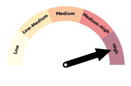
Forecast Confidence
Temperature
|
Forecast confidence for temperatures is high. The continuation of marine heatwave and La Niña conditions at the start of autumn is expected to have an upward influence on air temperatures and humidity, likely delaying the seasonal transition to cooler temperatures. Most of the climate models that NIWA surveys indicate a warmer than average March-May. |
Rainfall
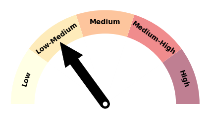
|
Forecast confidence for rainfall is low to medium. With rainfall patterns still likely being strongly influenced by tropical cyclone activity during the first half of autumn, there is more uncertainty than normal for New Zealand. Overall, the country should remain prepared for extremes – both on the wet and dry side of the meteorological spectrum. |
