This work is licensed under a Creative Commons Attribution-NonCommercial 4.0 International License.
The New Zealand Drought Monitor is a system for keeping track of drought conditions across New Zealand based on a standardised climate index.
The index, called the New Zealand Drought Index (NZDI), is a climate data-based indicator of drought based on four commonly-used climatological drought indicators: the Standardised Precipitation Index, the Soil Moisture Deficit, the Soil Moisture Deficit Anomaly, and the Potential Evapotranspiration Deficit. The index has five categories: Dry, Very Dry, Extremely Dry, Drought, and Severe Drought. It is presented as a map and as charts; updated daily (note, there is a two-day time delay to ensure all available data is used).
See more information on the NZDI.
The charts below are aggregated by district. Some of the larger districts have been divided in half into eastern and western or northern and southern zones. View a map of New Zealand districts [PDF 500KB].
New Zealand Drought Index map
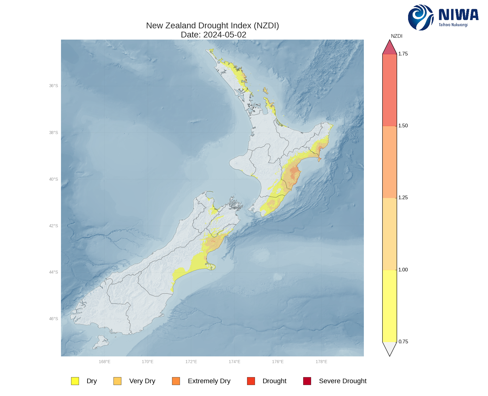
This map is updated daily. Contact us if you would like maps for a specific date(s). Maps can be provided for any date from 2007 onwards.
New Zealand Drought Index chart
Additional information
- A peer-reviewed paper has been published in the journal of the Meteorological Society of New Zealand: Mol, A., Tait, A. and Macara, G. (2017) An automated drought monitoring system for New Zealand, Weather and Climate 37(1), 23-36.
- Other drought indicator products and information
- Definitions of drought
- Classifying Adverse Events (MPI website)
- Copyright and Conditions of NIWA Data Access and Use
- Useful links and resources
