-

How cold is the Antarctic?
Write a report, with guided questions, to answer the question: “How cold is the Antarctic?” -
Tuna - life cycle and leptocephalii
Freshwater eels have an unusual life cycle which sees them travelling between the ocean, estuaries and freshwaters. -
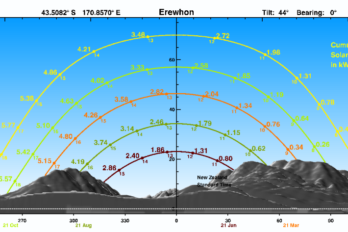
SolarView example
An illustrated example, showing how to input data and interpret SolarView results. -
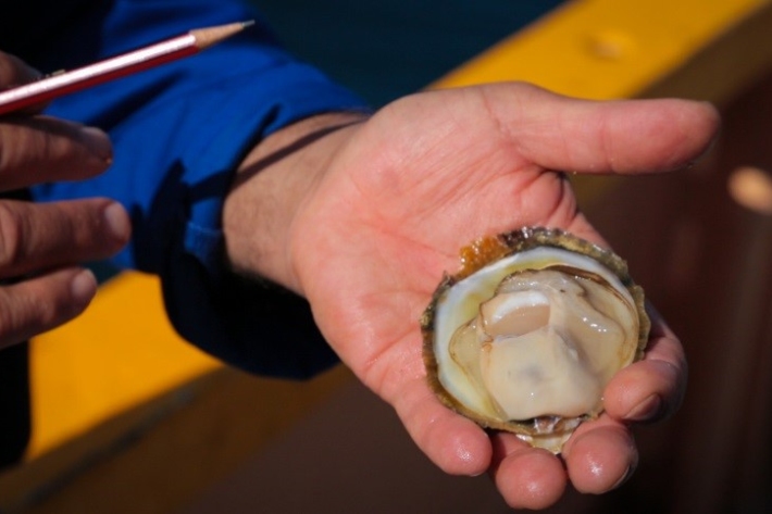
Questions and answers about oyster disease Bonamia ostreae
Media release06 June 2017NIWA is today issuing some scientific information on the parasite Bonamia ostreae, recently discovered in Big Glory Bay, Stewart Island, and the risk it poses to the Bluff oyster fishery. -
Kākahi
The kākahi or freshwater mussel was a valuable mahinga kai resource for many Māori. -
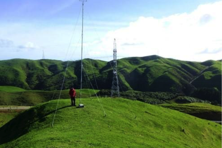
Estimating design wind speeds in complex terrain
Research ProjectThe current method for calculating wind speed-up is inadequate, and can grossly under-predict correct design wind speeds in NZ's complex terrain. -
Library
ServiceThe NIWA library collection contains items in a range of formats, covering subjects including atmospheric and climate research, aquaculture, oceanography, fisheries and marine sciences. -
Mean monthly sunshine (hours)
These datasets are available in a range of formats. -
Map E North
Education ResourceSheltered by high country to the west, the eastern zone of the North Island enjoys a dry, sunny climate. -
Droughts
Generally speaking, a drought is defined as a rainfall deficit which restricts or prevents a human activity – for example, farming or power generation. -
NZ Drought indicator products and information
Drought is a common feature of New Zealand's climate. On average, every year or two somewhere in New Zealand experiences a drought.