-

UVI smartphone apps
Several apps that provide forecasts of the UV index (UVI) are available for smartphones. -

Soil Moisture Deficit (SMD)
The 3-panel Soil Moisture Deficit (SMD) map shows the historical soil moisture deficit at the date shown (left), the soil moisture deficit at the same time last year (middle) and the current soil moisture deficit (right). -
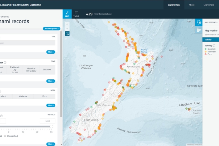
New Zealand Palaeotsunami Database
Software Tool/ResourceThe New Zealand Palaeotsunami Database (Database) brings together all known information about tsunamis that occurred prior to written records. -
Our partners & funders
NIWA has working relationships with hundreds of organisations in New Zealand and overseas. -

Climate Summaries
Publication seriesView annual, seasonal and monthly summaries of temperature, rainfall and sunshine data from across New Zealand. -
Tuna - recreational fisheries
The majority of New Zealanders are able to recall a story about catching eels when they were children. -
Freshwater databases online
More information about our online freshwater databases. -

NOAA Satellite data
Like the GMS satellite, the NOAA Series of polar orbiting satellites (operated by NOAA, the US National Oceanic and Atmospheric Administration) are a component of the World Weather Watch meteorological satellite network.