12 May 2017
Freshwater Update 73 brings you the latest information from our Freshwater & Estuaries Centre, with a focus on streams, rivers and irrigation, as well as introducing new members of staff.
In this issue

Mapping of gaining and losing streams
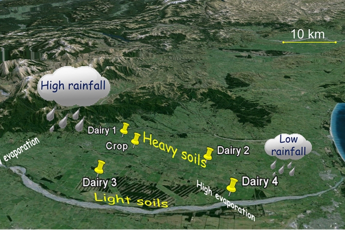
Many of NZ’s lowland rivers and streams are closely connected with the underlying groundwater.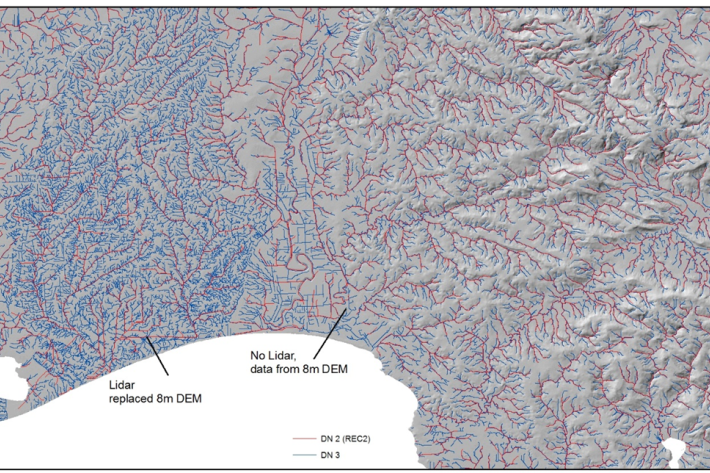
Improving the digital resolution of New Zealand’s river and stream maps
New Zealand boasts around 425,000 km of rivers and streams, with half of these being small headwater streams. Many of these small first order streams have never been accurately captured digitally, meaning that the true hydrological extent of many catchments is poorly or incompletely known.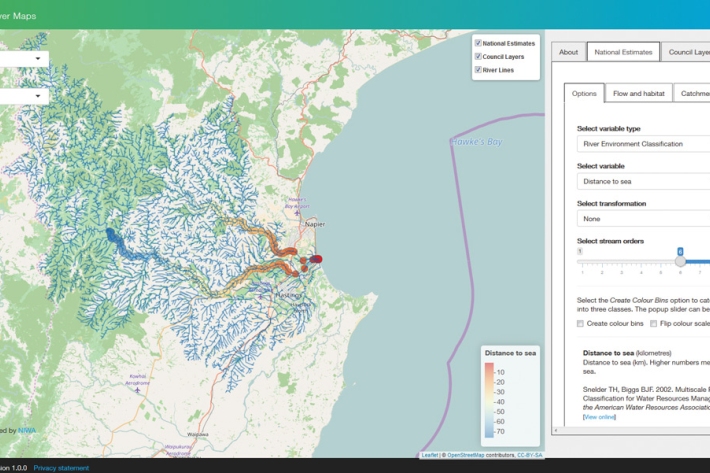
NZ river maps
This is an interactive web-based application being developed for exploring national scale predictions of a suite of river environmental variables, including water quality, hydrology, bed sediment size, invertebrate metrics, fish presence and bed sediment cover.-
New Freshwater and Estuaries Centre content
Links to the latest Freshwater and Estuaries information that's available since last update.