New Zealand’s fifth-warmest summer on record
|
Temperature |
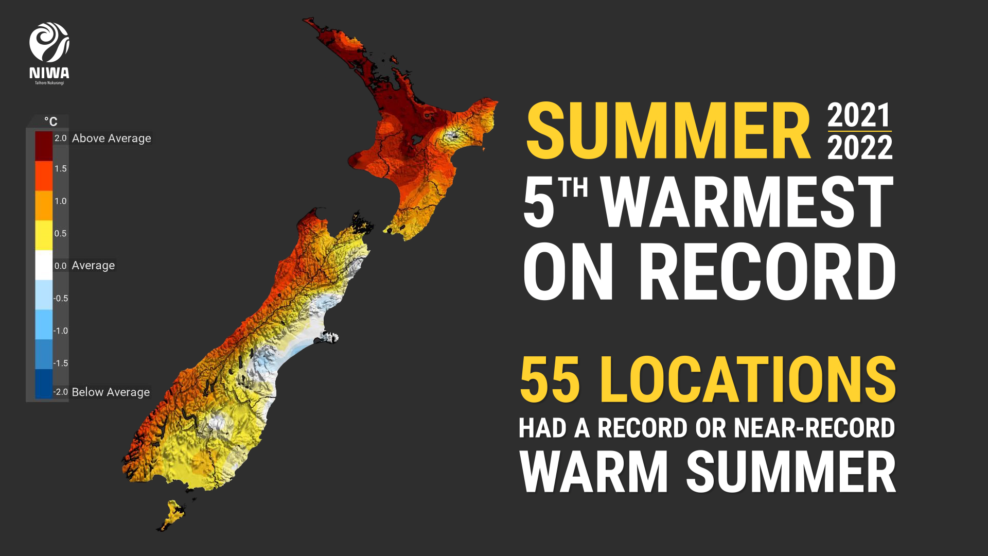
Summer 2021-22 was the fifth warmest summer on record in Aotearoa New Zealand. Temperatures were well above average (>1.20°C above average) for the majority of the North Island with the exception of the Greater Wellington region, and coastal Gisborne and Hawke’s Bay where temperatures were above average (0.51-1.20°C above average). Temperatures were also above average in Nelson, Tasman, Southland and parts of Otago and Marlborough. Well above average temperatures were observed for the West Coast. Temperatures were near average (±0.50°C of average) in Canterbury, eastern Marlborough and pockets of Otago. |
|
Rainfall |
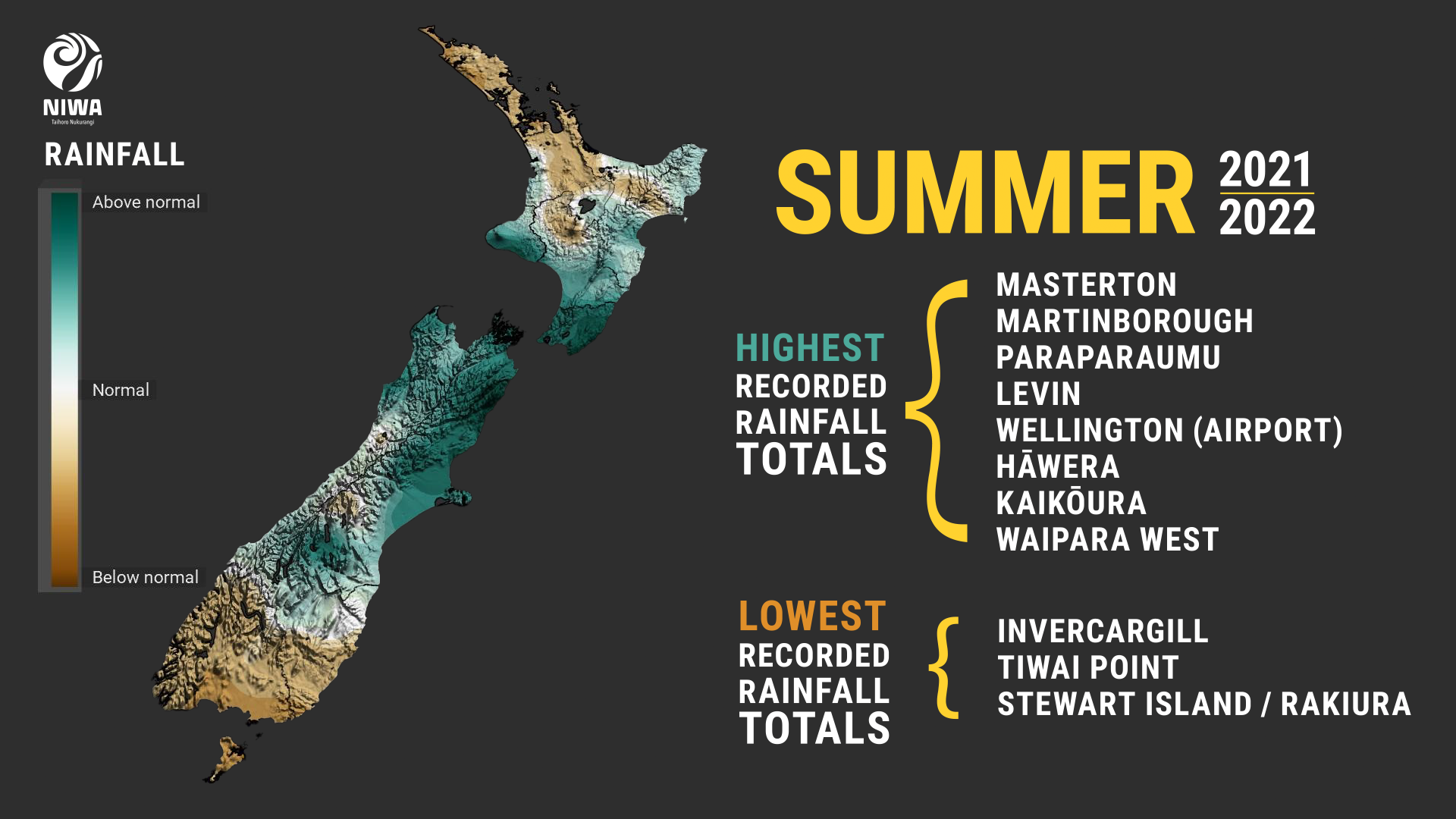
Below normal rainfall (50-79% of normal) was observed in Northland, Auckland, parts of Waikato and Southland. Pockets of well below normal rainfall (<50% of normal) occurred in western Kaipara and Far North districts as well as southern Southland. Conversely, well above normal rainfall (>149% of normal) occurred in Taranaki, Manawatū-Whanganui, parts of Hawke’s Bay, Greater Wellington, Tasman, Nelson, Marlborough, the Grey and Buller districts and large parts of Canterbury. Above normal rainfall (120-149% of normal) was observed in the Gisborne region and parts of Otago. Near normal (80-119% of normal) rainfall was observed elsewhere. |
|
Soil moisture |
At the end of February, soil moisture levels for the time of year were above average in coastal Gisborne, parts of Hawke’s Bay, the lower North Island, most of the upper South Island, and much of Canterbury. Soil moisture levels were below average in most of Northland, Auckland, northern Waikato, Southland, and Stewart Island. Elsewhere, soil moisture levels were near average. |
Overview
Summer 2021-22 was characterised by lower than normal mean sea level pressure to the north of the country, with above normal pressure over and to the south (Figure 1). This pressure setup was associated with more easterly quarter winds than usual for Aotearoa New Zealand and was influenced by the presence of La Niña throughout the season. Warm and humid winds from the sub-tropics resulted in widespread above average temperatures for all three summer months. December was the warmest of the three when compared to its monthly average and was New Zealand’s 4th-warmest December on record. Overall, the nationwide average temperature for summer 2021-22 was 17.8˚C. This was 1.1˚C above the 1981-2010 summer average, making it the 5th-warmest summer on record. Three of the five warmest summers on record have now occurred since the summer of 2017-18.
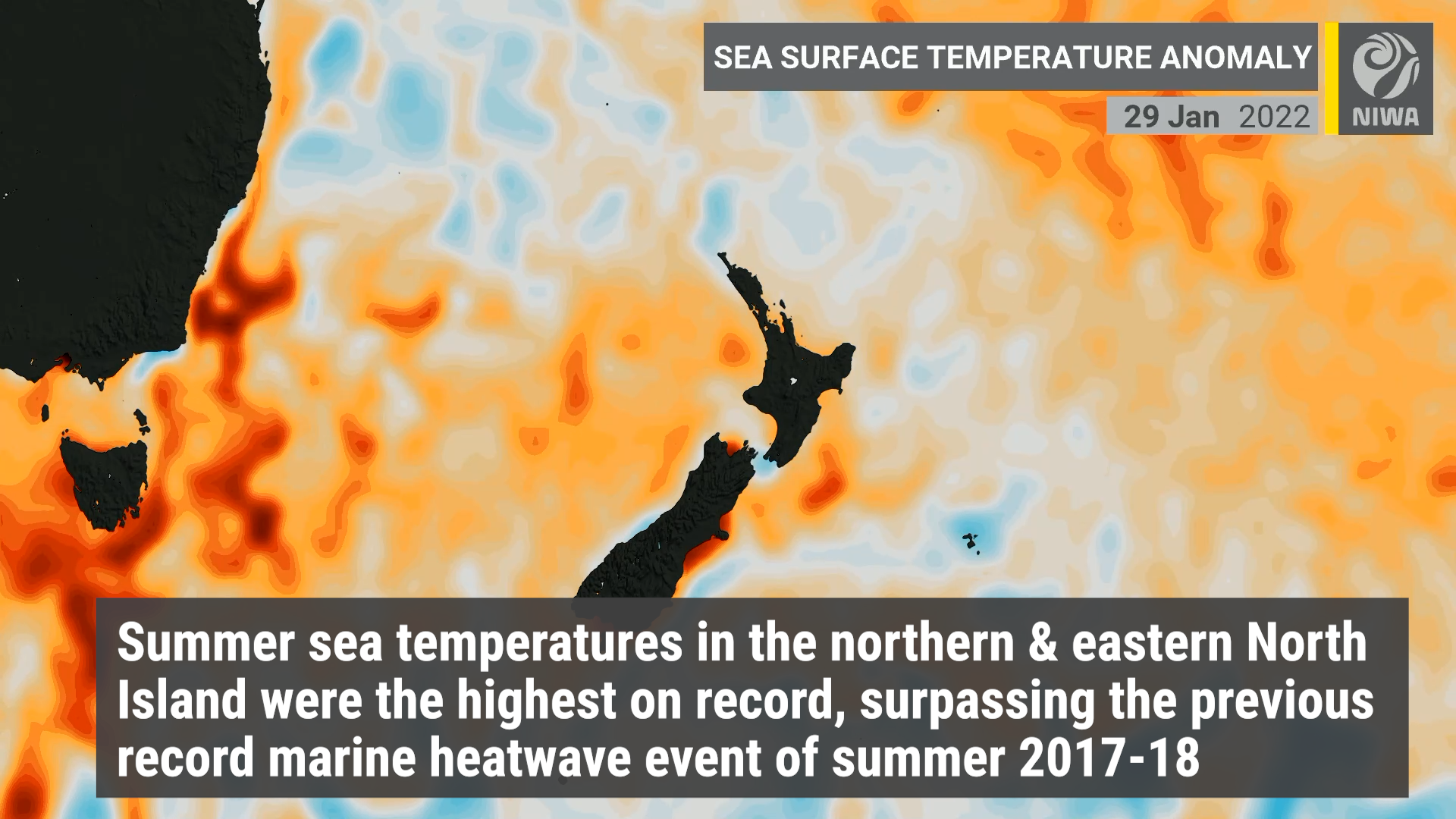
Fifty-five locations observed a record or near-record warm summer - the majority of these locations were in the North Island. The summer warmth was partly fuelled by warmer than usual coastal waters. Marine heatwave (MHW) conditions developed during November 2021 and were still active at the end of summer in the northern and western North Island and western South Island. In mid-December, daily sea surface temperature (SST) readings reached as high as 4-5˚C above average around coastal Waikato and Auckland. For summer as whole, SST anomalies in the northern (+1.7˚C) and eastern (+1.6˚C) North Island were the highest on record, surpassing the previous record marine heatwave event of summer 2017-18 (since at least 1982). For the rest of the country, the 2021-22 summer marine heatwave ranks second to 2017-18 (Figure 2). The atmospheric variables associated with this record-breaking MHW included higher than normal air pressure around New Zealand and in the Tasman Sea, weaker wind speeds than normal, more sub-tropical east to north-easterly winds around the North Island, and a relative lack of Southern Ocean fronts. These factors are consistent with La Niña in the equatorial Pacific and a Southern Annular Mode that was in its positive phase over 90% of the time during summer.
Summer rainfall was highly variable and featured extended dry spells alongside extreme rainfall events. Sixteen locations experienced their driest January on record, while Auckland endured a 37-day dry spell from 17 December 2021 to 22 January 2022, which was the city’s 2nd-longest dry spell since records began in 1943. For the season as a whole, below normal rainfall (50-79% of normal) was observed in Northland, Auckland, parts of Waikato and Southland. Pockets of well below normal rainfall (<50% of normal) occurred in western Kaipara and Far North districts as well as southern Southland. Notably, it was the driest summer on record in Invercargill with records extending back to 1900.
Summer also featured several extreme rainfall events (detailed in Highlights and extreme events section). A humid northerly flow was intercepted by a colder southerly, generating widespread heavy rain across Wellington from 5-7 December. Another heavy rainfall event occurred in Canterbury and parts of the upper North and South Islands between 13-15 December as moisture from Tropical Cyclone Ruby moved over New Zealand. January was a dry month right across the country, but active weather returned during the first half of February, with two atmospheric rivers (long corridors of atmospheric moisture) bringing heavy rainfall and flooding to parts of the upper South Island and lower North Island. Then on 13 February, the landfall of ex-Tropical Cyclone Dovi delivered a wide range of impacts to the North Island and upper South Island, including strong wind gusts, heavy rain, and flooding. These rainfall events contributed a record and near-record wet summer for several locations. Kaikōura received 488 mm of rain – more than three times the summer normal, making it the wettest summer on record there since records began in 1898. In Christchurch more than two and half times the normal summer rainfall fell making it the 4th-wettest summer on record there since records began in 1863.
Further highlights for summer 2021-22:
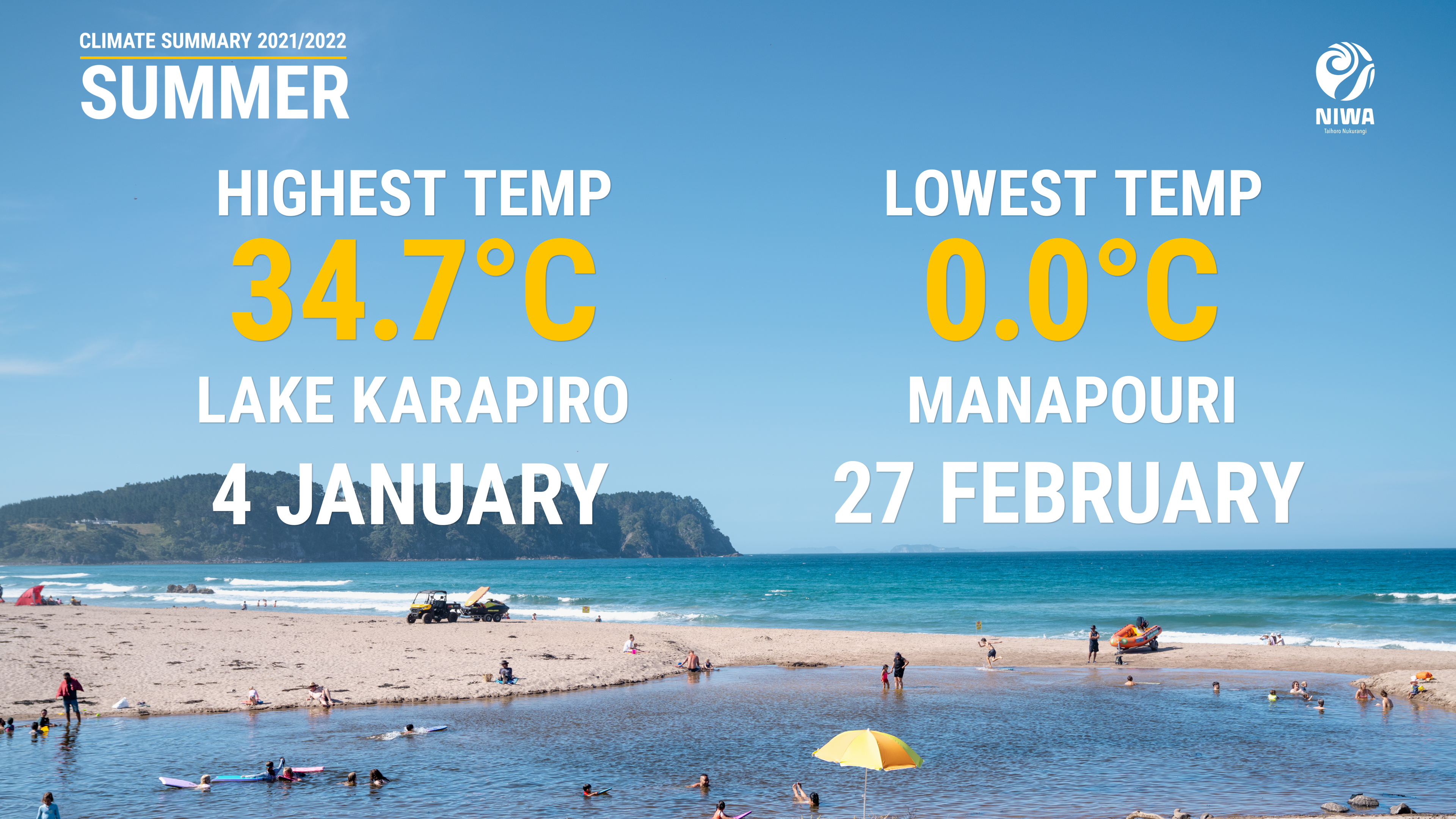
- The highest temperature was 34.7°C, observed at Lake Karapiro (Waikato) on 4 January.
- The lowest temperature was 0.0°C, observed at Manapouri on 27 February.
- The highest 1-day rainfall was 277 mm, recorded at Franz Josef on 2 February.
- The highest wind gust was 185 km/h, observed at both South West Cape and Puysegur Point on 20 December.
- Of the six main centres in summer 2021-22, Auckland was the warmest, Dunedin was the coolest and driest, Tauranga was the sunniest, Wellington was the wettest and Christchurch was the least sunny.
Download
- Climate Summary Summer 2021-22 (PDF 857.24 KB)