| Temperature | Winter temperatures were above average (0.51-1.20°C above average) for Northland, Auckland, Bay of Plenty, eastern Waikato, much of the West Coast, coastal South Canterbury, Dunedin, and Fiordland. Temperatures were near average (±0.50°C of average) for remaining parts of the country. |
| Rainfall | Rainfall was above normal (120-149% of normal) or well above normal (>149% of normal) for Dunedin, Marlborough, Nelson. Taranaki, Waikato, Bay of Plenty, Auckland, and parts of Northland. Rainfall was below normal (50-79% of normal) for central and southern Hawke’s Bay, Christchurch, Banks Peninsula, limited parts of Otago, and coastal Fiordland. |
| Soil Moisture | At the end of winter, soil moisture levels were lower than normal for central parts of Hawke’s Bay. Soil moisture was higher than normal for eastern Hurunui, and eastern parts of Central Otago. Near normal soil moisture levels were typical for the remainder of the country. |
Overview
Winter 2025 mean sea level air pressure was higher than normal over and to the southeast of Aotearoa New Zealand. This was associated with more easterly winds than normal for northern and southern parts of the country, with fewer westerly winds than normal. ENSO-neutral (El Niño – Southern Oscillation) conditions remained present in the tropical Pacific, but trended towards La Niña-like conditions during the season. Sea surface temperatures (SSTs) around New Zealand were above average, particularly off the west coast of the country with Marine Heatwave (MHW) conditions experienced in these areas.
The nationwide average temperature in winter 2025 was 9.1°C. This was 0.5°C above the 1991-2020 winter average, making it New Zealand’s 9th-warmest winter since Earth Sciences New Zealand’s seven station temperature series began in 1909. Temperatures were above average (0.51-1.20°C above average) for Northland, Auckland, Bay of Plenty, eastern Waikato, much of the West Coast, coastal South Canterbury, Dunedin, and Fiordland. Temperatures were near average (±0.50°C of average) for remaining parts of the country, with no locations observing below average winter temperatures (0.51-1.20°C below average).
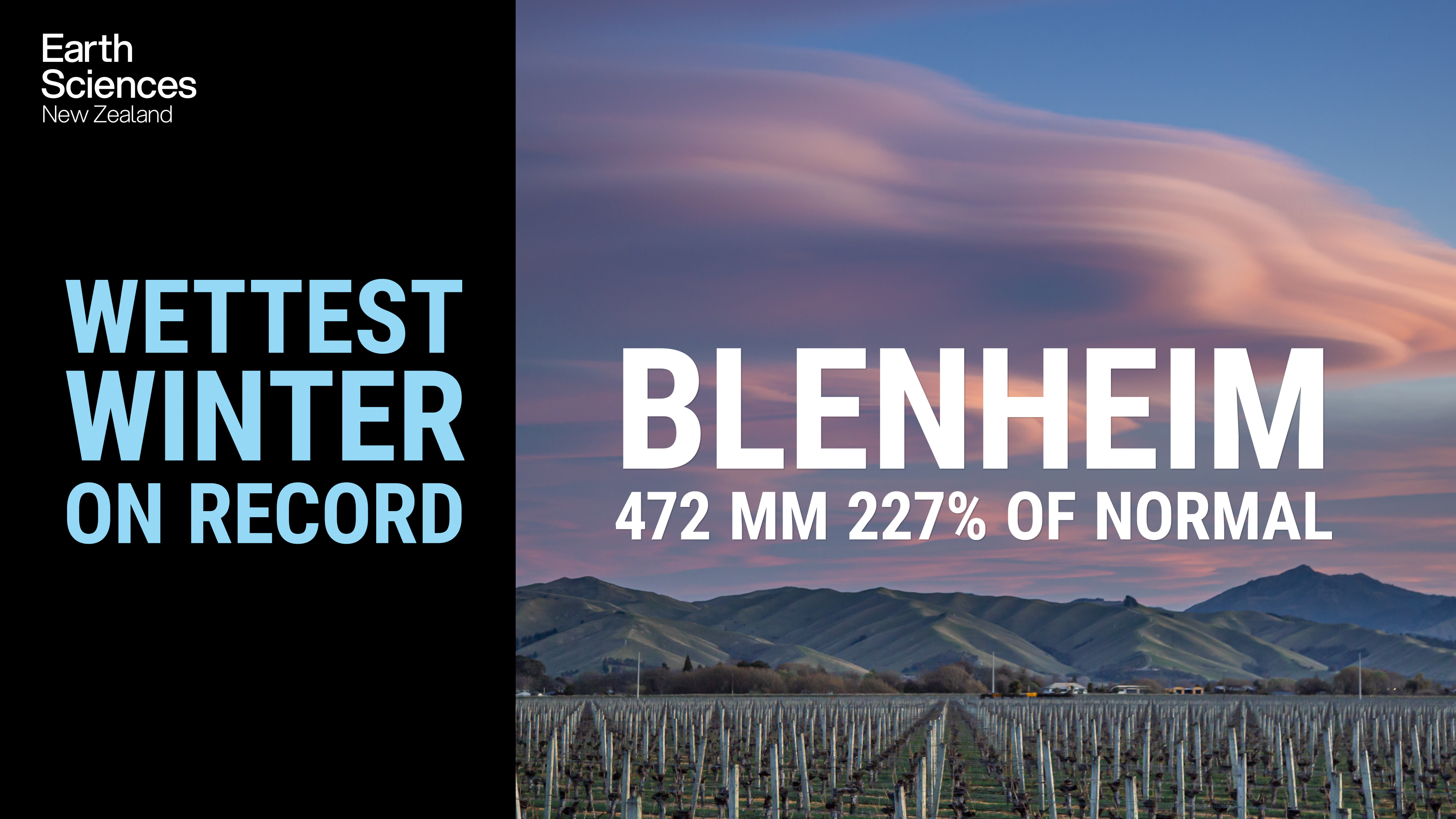
Winter rainfall was above normal (120-149% of normal) or well above normal (>149% of normal) for Dunedin, Marlborough, Nelson. Taranaki, Waikato, Bay of Plenty, Auckland, and northeastern parts of Northland. Rainfall was below normal (50-79% of normal) for central and southern Hawke’s Bay, Christchurch, Banks Peninsula, limited parts of Otago, and coastal Fiordland. Two very heavy rainfall events (on 27 June, and 11 July) for the top of the South Island caused considerable flooding, with states of emergency declared during each event (see Highlights and extreme events section for further details).
Further Highlights:
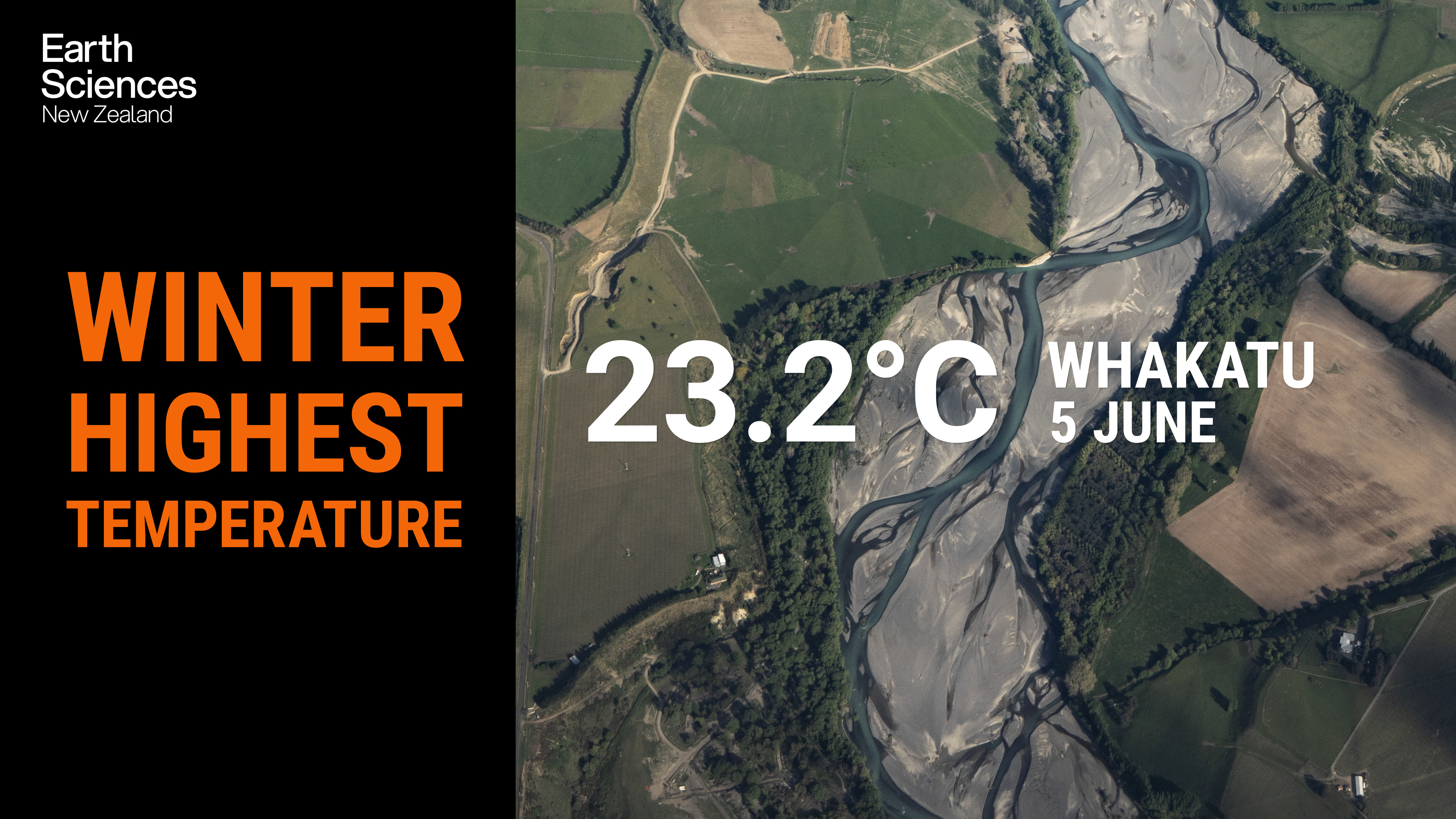
- The highest temperature was 23.2°C, observed at Whakatu on 5 June.
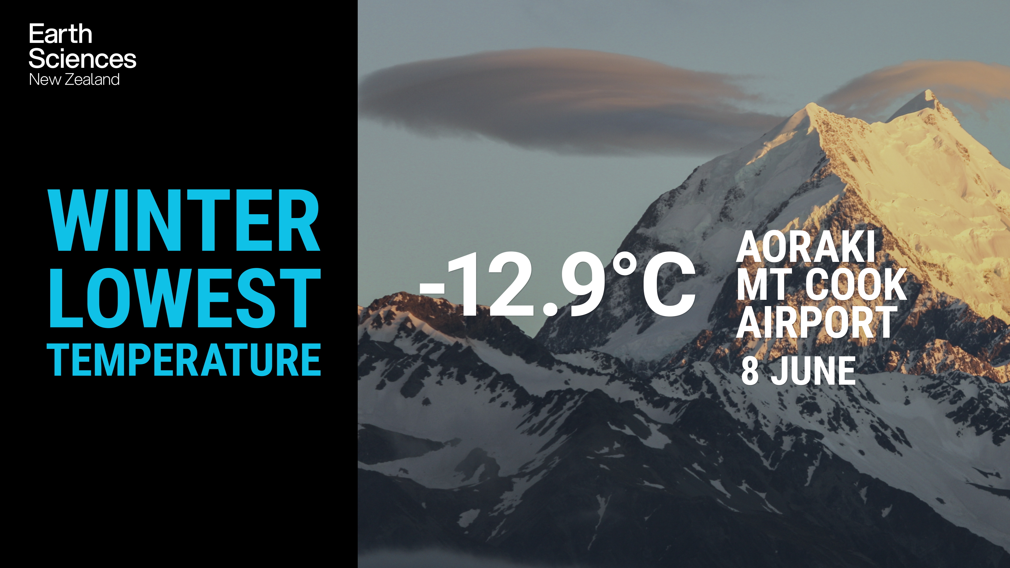
- The lowest temperature was -12.9°C, observed at Aoraki Mt Cook Airport on 8 June.
- The highest 1-day rainfall was 164 mm, recorded at Motueka on 11 July.
- The highest wind gust was 191 km/h, observed at Cape Turnagain on 1 June.
- Of the six main centres in winter 2025, Auckland was the warmest, Tauranga was the wettest and sunniest, Christchurch was the coolest and driest, and Dunedin was the least sunny.
- The sunniest four regions in 2025 so far are Taranaki (1788 hours), Bay of Plenty (1708 hours), Auckland (1693 hours) and wider Nelson (1664 hours).
