At Earth Sciences NZ, we have been using our hydrodynamic modelling capability to simulate how aquatic invasive species can spread within lakes. These simulations can be used to support decisions-making on the management or potential eradication of invasive species.
Aquatic invasive species, such as invasive weeds, are present in many of our lakes. Eradicating them can be challenging, especially after they have become well established. The best chance of eradication is in the early stages of an invasion.
Once an invasive organism is introduced, they can spread through several processes. A common means of spread is when larvae or plant fragments are transported or dispersed by water currents. By understanding how water moves in lakes, predictions can be made about where invasive organisms may spread or where they may have come from, enabling monitoring, control and eradication efforts to be more effectively targeted. Knowing when it is unlikely that currents have transported an invasive species between locations can identify when other factors, such as transport by boats, are the more likely cause of spread within a lake, again allowing appropriate control strategies to be developed.
Hydrodynamic modelling as a predictive tool
Earth Sciences NZ’s hydrodynamic models are 3D simulations of lakes, using weather data and river inflows as inputs. The passage of ‘particles’ released in the model are used to simulate how aquatic invasive species are transported under different conditions. These particles can either move passively with the currents or be given rules to simulate the behaviour of particular species (e.g., swimming, preference for certain temperature ranges or habit).
The main driver of currents in lakes is wind, and key to predicting currents in lakes correctly is accurate information on how wind speed and direction vary over lakes. While wind is measured on or near some lakes, these are at single locations, and especially for large lakes do not capture how wind differs due to the surrounding topography. At Earth Sciences NZ, we are coupling high resolution weather models with lake hydrodynamic models to improve the accuracy of our predictions of how aquatic invasive species move within lakes.
Lake Wanaka hydrodynamic modelling
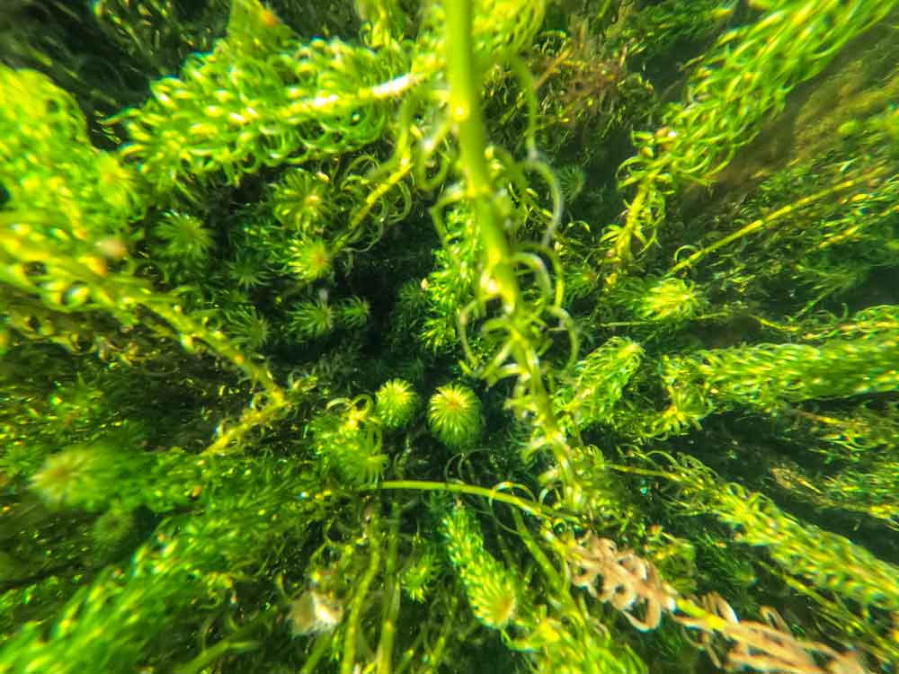
For example, Lagarosiphon major, commonly called lagarosiphon, has been present in Lake Wānaka since at least 1972. It can spread rapidly, forming dense weed beds that smother native aquatic plants and restrict access for swimming, boating and fishing, and poses a significant threat to biodiversity. Through sustained efforts over many years, lagarosiphon has been intercepted at an early stage or removed from much of the lake and is now largely confined the southern part of the lake, particularly Roys Bay and Stevensons Inlet.
To help prioritise next steps, we simulated how lagarosiphon fragments would spread from sites in the southern parts of the lake. These simulations show that sites along the eastern side of Roys Bay have the potential for spreading fragments to other parts of the lake, while most fragments released within Stevensons Inlet would remain within the inlet.
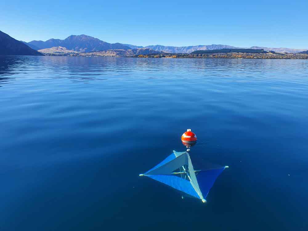
We are testing our models against measurements of currents from moored instruments as well as GPS-tracked drifters.
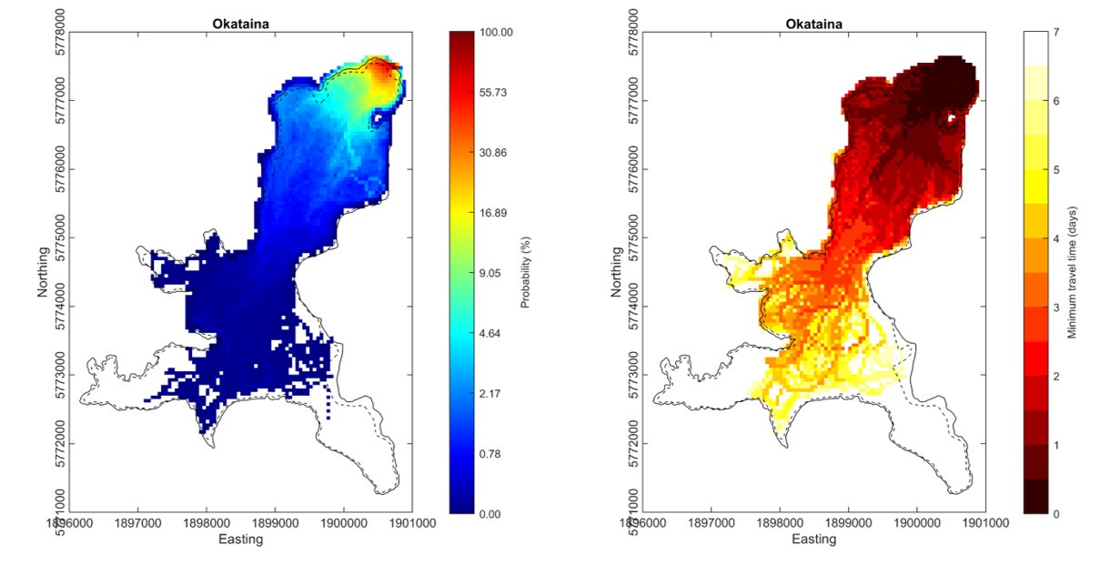
Lake Okataina hydrodynamic modelling
In Lake Okataina, we modelled how quickly an organism might spread if released from the boat ramp. We ran the model for a year, releasing particles every hour, and tracked how long it took them to reach different parts of the lake. The figure on the left (below) shows how likely it is that a particle released from the lake reaches different parts of the lake in less than 7 days. On the right (below), the figure shows the shortest time it takes a particle to reach different parts of the lake. The risk of spread is highest in areas where the most particles travel (high probability) and the travel time is short so that the invasive organism(s) is healthier.