-

Island Climate Update
Publication seriesA monthly summary of the climate in the tropical South Pacific islands, with an outlook for the coming months. -

Mean number of days of ground frost
These datasets are available in a range of formats. -
Virtual Climate Station data and products
Virtual climate station estimates are produced every day, based on the spatial interpolation of actual data observations made at climate stations located around the country. -
Hotspot Watch Updates
This weekly update helps assess likelihood of extremely dry weather preceding a drought. -
Map Chatham
Education ResourceExtremes of temperature are rare as the Chatham Islands are small land masses surrounded by sea. -

What is ocean acidification?
Education ResourceOcean acidification is the name given to the lowering of pH of the oceans as a result of increasing carbon dioxide (CO2) in the atmosphere. -
Regional climatologies
A regional climatology is a summary of the typical weather and climate of a region, based on historical data observations made at climate stations located within the region. -
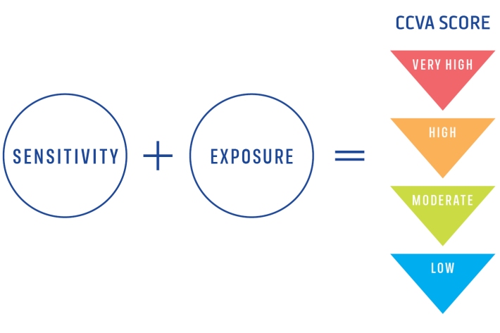
Climate Change Vulnerability Assessment (CCVA)
ServiceTo prepare for changes in climate, our freshwater and oceans decision-makers need information on species vulnerability to climate change. -
Tuna - glass eels
Glass eels (about 5.5 to 7.0 cm) arrive in fresh water during spring, especially during September and October, although they may be present from July to December.