
-
Wellington will get significantly warmer, new climate change report shows
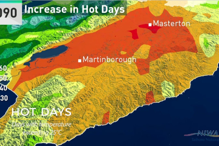
Media release07 August 2017Wellington city will have warmer autumns, almost a month of days over 25°C and up to 10 per cent more winter rain by 2090, according to a new NIWA climate report. -
Climate change and variability - report for the Greater Wellington Region
-
Climate change will cause more deaths from air pollution, study finds
Media release01 August 2017New research estimates that if climate change goes unchecked 60,000 more people will die globally from air pollution in 2030 – just 13 years away. -
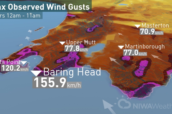
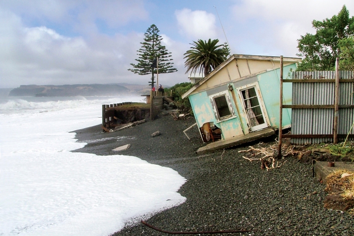
So far, so stormy
Media release13 July 2017Today’s low came spinning off the coast of Hawke’s Bay funneling strong winds through the Cook Strait and hitting Wellington region with strong winds before moving on to Taranaki and Auckland this afternoon. -
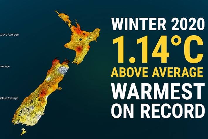
Winter 2020 – NZ’s warmest winter on record
Media release06 June 2017New Zealand has just experienced its warmest winter on record, according to official NIWA climate data. -

The Intergovernmental Panel on Climate Change (IPCC)
Education ResourceThe Intergovernmental Panel on Climate Change (IPCC) is charged with assessing the most up to date scientific, technical and socio-economic research on climate change. -
Sea-level rise
Education ResourceOne of the major consequences of climate change is rising global sea levels. -
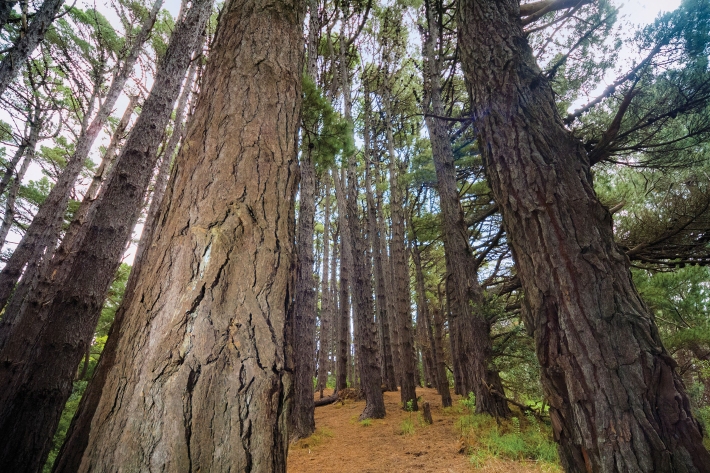
Native forests absorbing more carbon dioxide
Media release06 June 2017New Zealand’s forests and other land areas may be absorbing up to 60% more carbon dioxide than has been calculated, with much of this uptake likely occurring in native forests, NIWA scientists have discovered. -
Floods
Education ResourceRiver floods occur when water spills from a river channel onto land that is normally dry, and are one of New Zealand's costliest natural hazards. -

Climate Summaries
Publication seriesView annual, seasonal and monthly summaries of temperature, rainfall and sunshine data from across New Zealand. -
Mean monthly temperatures (°C)
These datasets are available in a range of formats.