
-

Dramatic sea ice decline limits NIWA’s Antarctic research
Media release18 October 2017A dramatic change in sea ice this year is likely to hamper a NIWA-led research project aiming to better understand how ice shelves will melt as the ocean warms. -
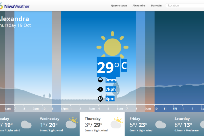
Southern spring sizzle
Media release17 October 2017An air flow extending from Australia on Thursday and Friday may bring near-record warmth to parts of the interior South Island, says NIWA forecaster Ben Noll. A large area of high pressure to the northwest of New Zealand will help steer this warm air across the Tasman Sea. -

Southwest Pacific Tropical Cyclone Outlook update October 2017
Media release10 October 2017Southwest Pacific Tropical Cyclone Outlook: Near-normal season expected, but with increased activity west, reduced activity east -

Scientists mark 10th anniversary of ocean acidification research
Media release09 October 2017A decade of scientific research into how ocean acidification is affecting New Zealand waters has led to far greater understanding of the vulnerability of our marine ecosystems, according to a newly published review. -

Joining the flooded dots
Feature story08 October 2017The term “joined-up government” was coined in the late 1990s to describe the coordination modern governments need to deal with large problems. -

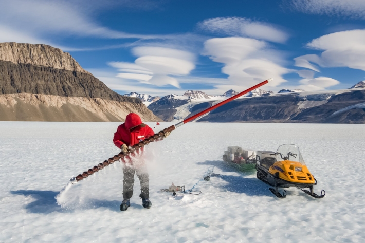
Breaking the ice
Feature story08 October 2017The Deep South National Science Challenge is one of New Zealand’s most audacious collaborative projects in recent times. -

From sea ice to sea bed
Feature story08 October 2017Pioneering NIWA scientists are returning to the cold continent in October, this time to focus on the seabed. -

Intensity of cyclones predicted to increase
Feature story05 October 2017Tropical cyclones forming in the south-west Pacific are becoming less frequent but those that do form are likely to be more severe. -
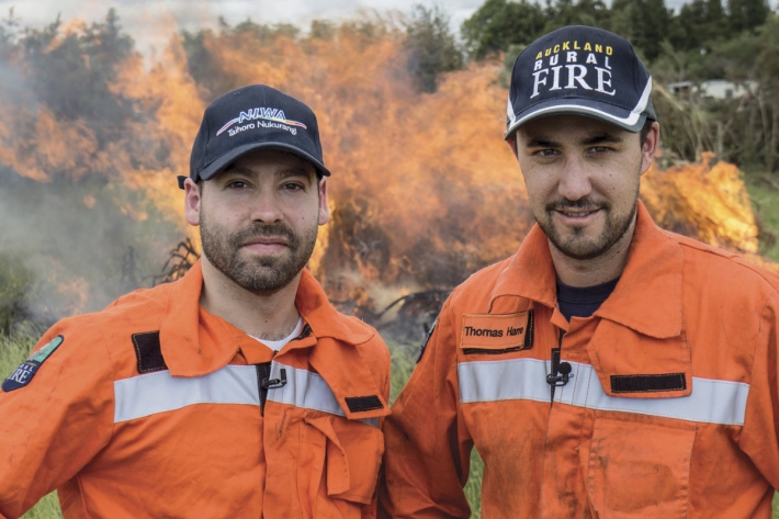
On-call forecasting helps fight fires
Feature story05 October 2017For the past year, NIWA’s meteorologists have been on call to provide real-time, comprehensive information about weather patterns that may accelerate a fire. -
Improved climate information and services in Vanuatu
Feature story05 October 2017The construction of improved climate information and services in Vanuatu has posed unique logistical challenges. -
Production of Hayward kiwifruit in Bay of Plenty at risk from climate change
Media release15 September 2017The most commonly grown variety of kiwifruit around Te Puke will not be commercially viable in the area by the end of the century, say scientists. -
Tiny air bubbles reveal new information about greenhouse gas emissions
Media release24 August 2017Sitting at the surface of Taylor Glacier in Antarctica, are layers of ice more than 10,000 years old. And trapped inside those layers are bubbles of ancient air – like tiny time capsules - able to tell scientists a story about what the world used to be like and how humans have changed it.