-

Sudden spring sun for south
Media release12 September 2018A cool start to spring is about to be replaced by a sudden burst of warmth, according to NIWA meteorologist Ben Noll. -

Councils get help to prepare for sea-level rise
Media release18 July 2018A senior NIWA scientist is concerned many councils are having difficulty “getting off the starting blocks” when it comes to planning for coastal climate change. -

Warmth dramatically outpaces chill so far this year
Media release04 July 2018It's a story of the warm and the wet. -
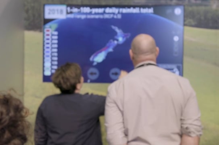
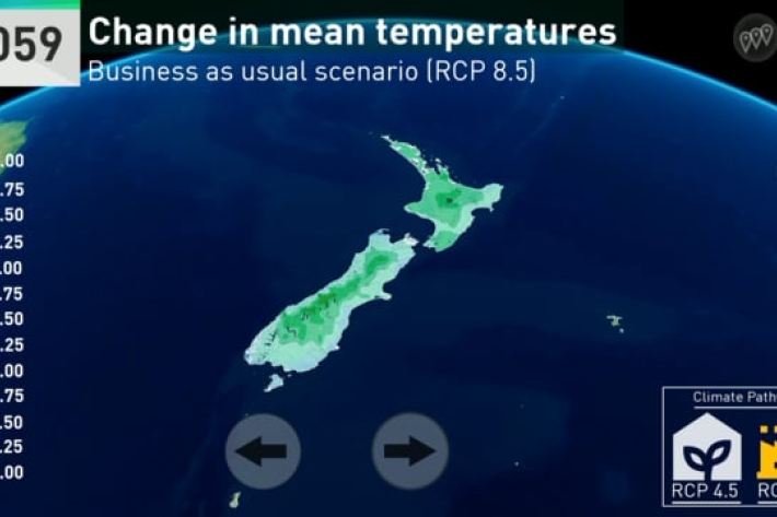
Climate change touch screen - Fieldays
The touch screen in action at Fieldays.revealing how our climate will change across the country. -

NIWA seaweed scientist tackling global climate change issue
Media release21 June 2018One of the world's leading scientific publishers has named a paper cowritten by a NIWA scientist as one of 250 groundbreaking findings that could "help change the world". -
Our Climate is Changing
Our climate is changing - we need to act now. -

NIWA urges farmers to prepare for climate change
Media release06 June 2018NIWA is encouraging farmers to plan for climate change so they can maximise their abilities to adapt and thrive as significant change begins to take place. -

La Niña's gone; wild and unruly arrives
Media release29 May 2018We've got hot temperatures, we've got cold temperatures, freezing temperatures, ice, snow, hail, rain - and even a few rays of sunshine. And one very confused weather pattern. -
Well-informed, better prepared
Our scientists provide the knowledge key for evidence-based decision-making and for our society as a whole. -
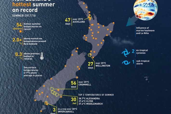
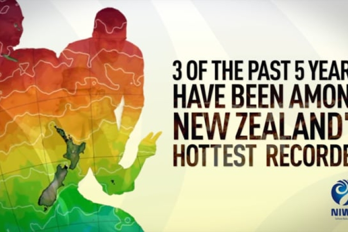
The record summer of 2017/18
Feature story30 April 2018Less than a week before the official end of summer on 28 February, temperatures dropped and a cool breeze made a whistle-stop tour of the country.