-
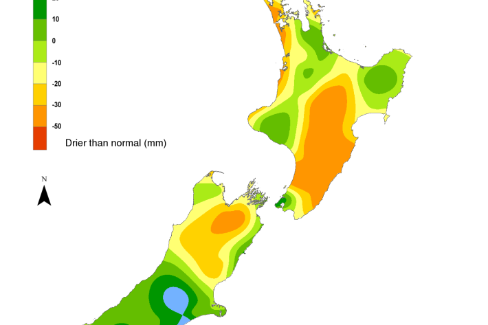
NIWA's Hotspot Watch for 19 December 2018
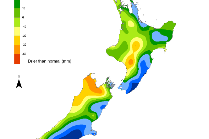
Hotspot19 December 2018Across the North Island, soil moisture levels either decreased slightly or remained the same during the past week. Across the South Island, soil moisture remained near normal or above normal in the central and eastern part of the island during the past week while areas in the west have near normal or below normal soil moisture. -
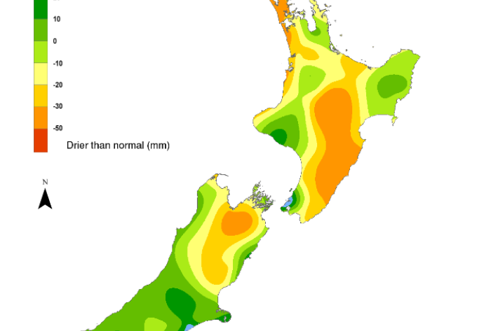
NIWA's Hotspot Watch for 12 December 2018
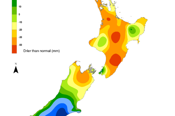
Hotspot13 December 2018The driest soils across the North Island compared to normal for this time of the year are found in an area stretching from coastal Manawatu-Whanganui northeast to Taupo. The driest soils across the South Island compared to normal for this time of the year are found in far southern Westland District. A small hotspot has emerged in Nelson in the past week. -
NIWA's Hotspot Watch for 6 December 2018
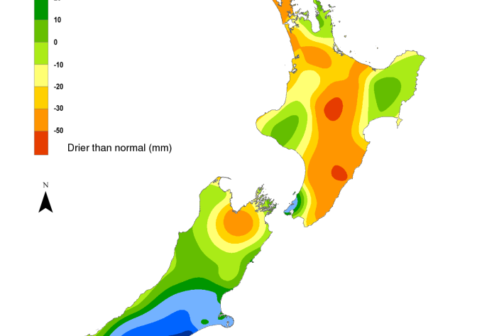
Hotspot06 December 2018A new hotspot emerged in the Rangitikei District in Manawatu-Wanganui during the past week. This is the only current hotspot in the North Island. There are currently no hotspots in the South Island. -
NIWA's Hotspot Watch for 29 November 2018
Hotspot29 November 2018All previous hotspots in the North Island dissipated this past week due to the heavy rainfall. Substantial rainfall in the past week caused the small hotspot in northwestern Marlborough to dissipate, and no other hotspots are currently in place in the South Island. -
NIWA joint winner of 2018 Terry Healy Coastal Project Award
Media release27 November 2018A trio of lead authors from NIWA has been named alongside the Ministry for the Environment and others as joint winner of the 2018 Terry Healy Coastal Project Award. -
NIWA's Hotspot Watch for 21 November 2018
Hotspot21 November 2018The driest soils across the North Island compared to normal for this time of the year are found in parts of Northland, Taupo, and Tararua District. A small hotspot is currently in place in northwestern Marlborough. -

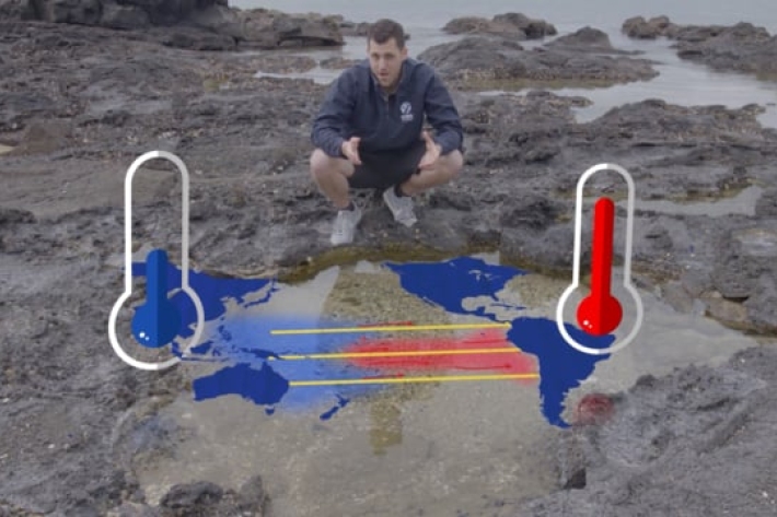
Update on El Niño
Media release21 November 2018An abnormal El Niño weather event is looking likely for New Zealand over summer, according to NIWA meteorologist Ben Noll. -
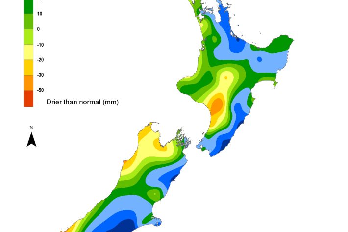
NIWA's Hotspot Watch for 14 November 2018
Hotspot14 November 2018The driest soils across the North Island compared to normal for this time of the year are found in Whangarei and Kaipara districts, along with Taupo and Tararua. No hotspots are currently in place in the South Island. -
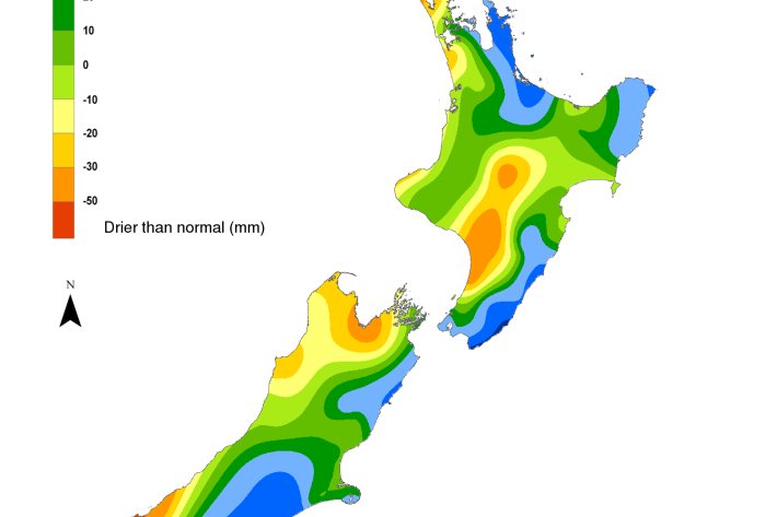
NIWA's Hotspot Watch for 7 November 2018
Hotspot07 November 2018The largest hotspot in the North Island continues to be found in Napier and southern Hastings District. A new, very small hotspot has also emerged this week near Cape Reinga. No hotspots are currently in place in the South Island. -
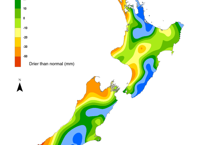
NIWA's Hotspot Watch for 31 October 2018
Hotspot31 October 2018With the recent rain, the soil moisture has generally improved across the North Island since last week. However, the soils are still drier than normal for the time of year in eastern Northland, western Auckland, western Waikato, western Taranaki, as well as Hawke’s Bay, central and southern Manawatu-Wanganui and Wairarapa.