-
Flood focus
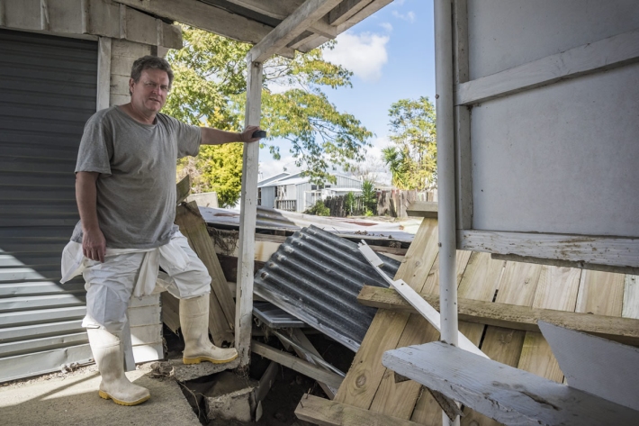
Feature story08 October 2017Autumn and winter rain caused damaging floods and slips across New Zealand, yet again. Susan Pepperell investigates the nation's evolving skill in avoiding and coping with water. -

Breaking the ice
Feature story08 October 2017The Deep South National Science Challenge is one of New Zealand’s most audacious collaborative projects in recent times. -

From sea ice to sea bed
Feature story08 October 2017Pioneering NIWA scientists are returning to the cold continent in October, this time to focus on the seabed. -
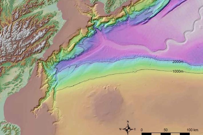
A wave of hazard research
Feature story05 October 2017It is well known that earthquakes can trigger tsunami but they can also be caused by landslides – with devastating effects. -
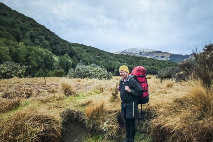
Profile: Wills Dobson - small town, huge horizons
Feature story05 October 2017If it wasn't for a damaged shoulder, Wills Dobson wouldn't be launching weather balloons or fixing high-precision atmospheric measuring instruments. -
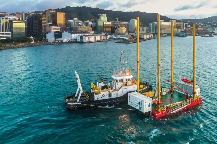
Q&A: going to sea for fresh water
Feature story05 October 2017Since the end of June, a barge has been stationed just off Wellington’s Miramar Peninsula drilling into the seabed to find an alternative water source for the city. -

Intensity of cyclones predicted to increase
Feature story05 October 2017Tropical cyclones forming in the south-west Pacific are becoming less frequent but those that do form are likely to be more severe. -
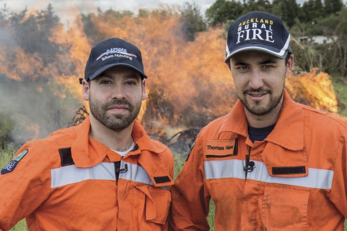
On-call forecasting helps fight fires
Feature story05 October 2017For the past year, NIWA’s meteorologists have been on call to provide real-time, comprehensive information about weather patterns that may accelerate a fire. -
Improved climate information and services in Vanuatu
Feature story05 October 2017The construction of improved climate information and services in Vanuatu has posed unique logistical challenges. -

Revealing toothfish secrets
Feature story05 October 2017The Ross Sea Marine Protected Area (MPA) in the Southern Ocean will help further research into the ecology of Antarctic toothfish. -
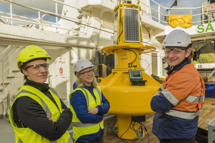
WRIBO’s phoning it in
Feature story05 October 2017A sophisticated buoy has been deployed in Wellington Harbour to “phone home” information about currents, waves and water quality in the harbour. -

NIWA riparian survey video
NIWA, supported by DairyNZ, are asking anyone who has planted along stream banks to take a short survey.