-
Erica Williams - Where the water is clean
Feature story20 June 2017Erica Williams' story starts with the website of Moerewa School, where pupil Tyra-Lee explains her connection to a very special place in her small Far North town. -
Raising the bar for swimmable rivers
Feature story20 June 2017The government has released the ‘Clean Water’ package of proposed reforms, aimed at making more of our rivers swimmable. But how is ‘swimmable’ to be measured, and do these measures stack up? -

Calculated risk
Feature story13 June 2017Imagine if you could foresee what would happen to your home in a severe flood or tsunami, and then work out how to prevent or reduce the impact before any such event occurred. -

Dairy turns the corner
Feature story11 June 2017NIWA's Freshwater and Estuaries Chief Scientist Dr John Quinn believes the dairy industry has been responsive in the tools it has adopted to reduce its impact on waterways. -
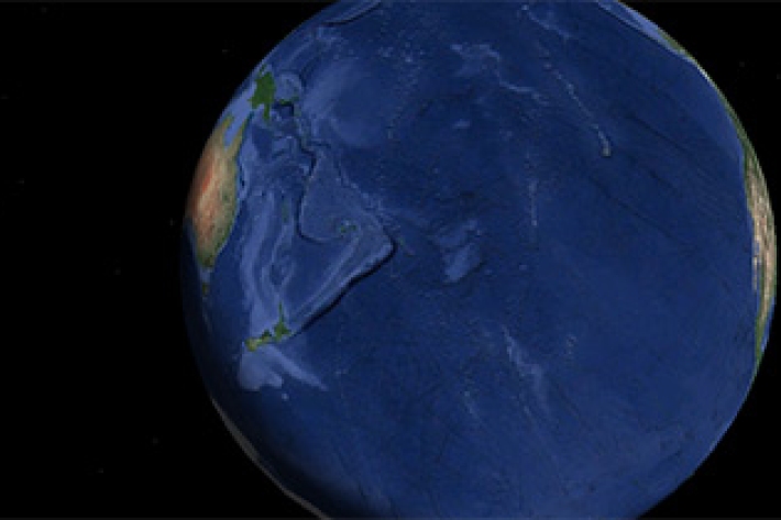
New Zealand joins global seabed mapping initiative
News article09 June 2017New Zealand joins global seabed mapping initiative -

NIWA invests $18 million in New Zealand’s future
Media release08 June 2017NIWA is placing the future of New Zealanders at the heart of its operation by investing in new supercomputers that will significantly enhance scientists’ abilities to solve crucial issues facing the country. -

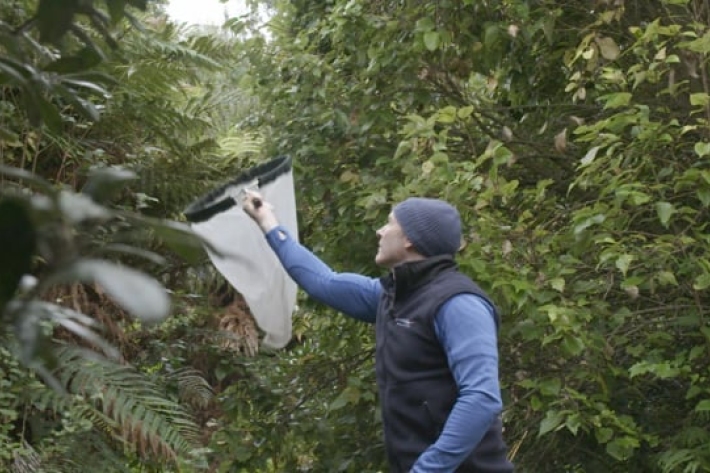
Scientists eavesdrop on endangered dolphins
News article07 June 2017The critically endangered Māui dolphin is getting a helping hand from scientists this month who are beginning a year-long research project to listen in on them. -
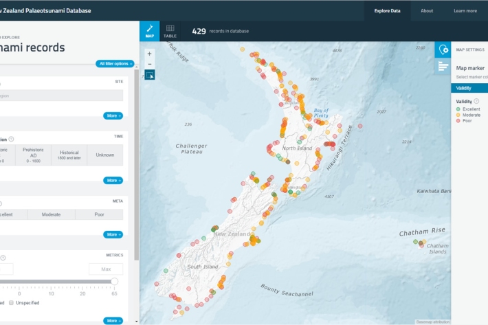
New Zealand Palaeotsunami Database
Software Tool/ResourceThe New Zealand Palaeotsunami Database (Database) brings together all known information about tsunamis that occurred prior to written records. -

Cloud Imagery
On this page
NZ Region Cloud Analysis Australasian Region Infrared Hemispheric Infrared NZ High-res Visible Contact
All transmissions from GMS-5 are no longer received at NIWA’s satellite reception station in Wellington. We are working on an alternative data feed and will be able to bring back these images later this year. Once we start receiving data again, it will then be calibrated, re-mapped onto standard map projections, and archived. -
Smelt
Smelt have a distinctly forked tail and a strong cucumber smell. -
Tuna - recreational fisheries
The majority of New Zealanders are able to recall a story about catching eels when they were children.