-

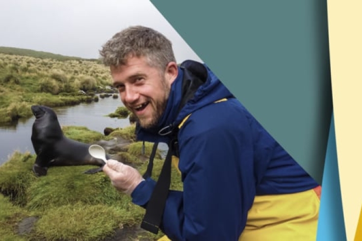
Spotted a leopard seal? Scientist seeks sightings
Media release17 August 2017A leopard seal has spent so much time in New Zealand waters she has prompted a NIWA scientist to challenge conventional thinking about the species. -

NZ’s future scientists show their work in Hamilton
Media release16 August 2017Waikato’s next generation of scientists are showcasing their latest discoveries at this week’s NIWA Waikato Science and Technology Fair in Hamilton. -
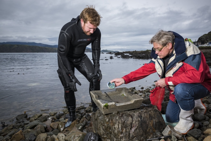
Scientist makes new homes for baby paua
Media release15 August 2017Concrete structures key to restoring the paua population wiped out by earthquake. -
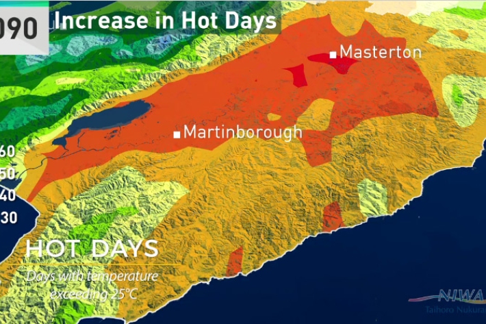
Wellington will get significantly warmer, new climate change report shows
Media release07 August 2017Wellington city will have warmer autumns, almost a month of days over 25°C and up to 10 per cent more winter rain by 2090, according to a new NIWA climate report. -
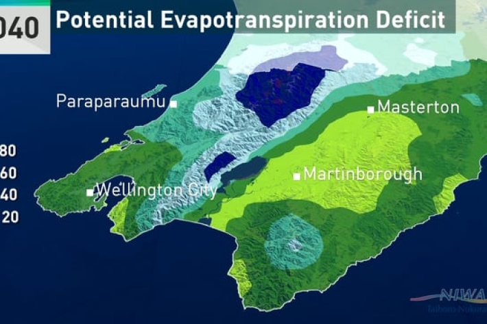
Climate change and variability - report for the Greater Wellington Region
-
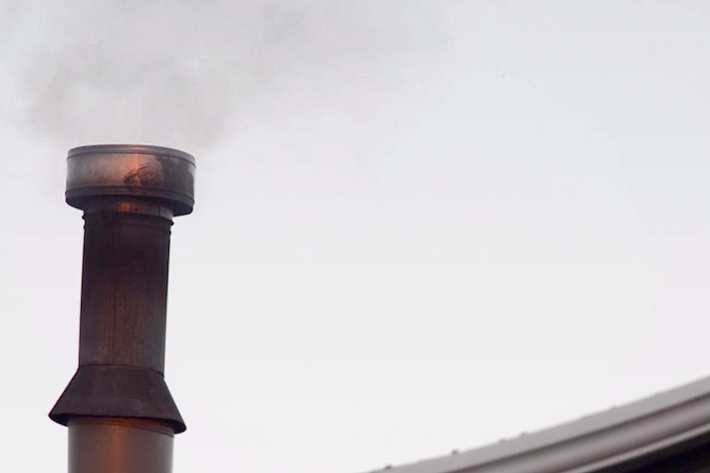
Climate change will cause more deaths from air pollution, study finds
Media release01 August 2017New research estimates that if climate change goes unchecked 60,000 more people will die globally from air pollution in 2030 – just 13 years away. -
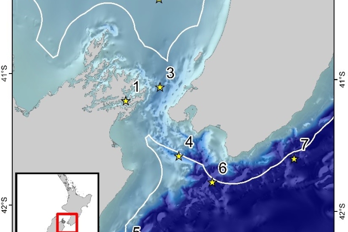
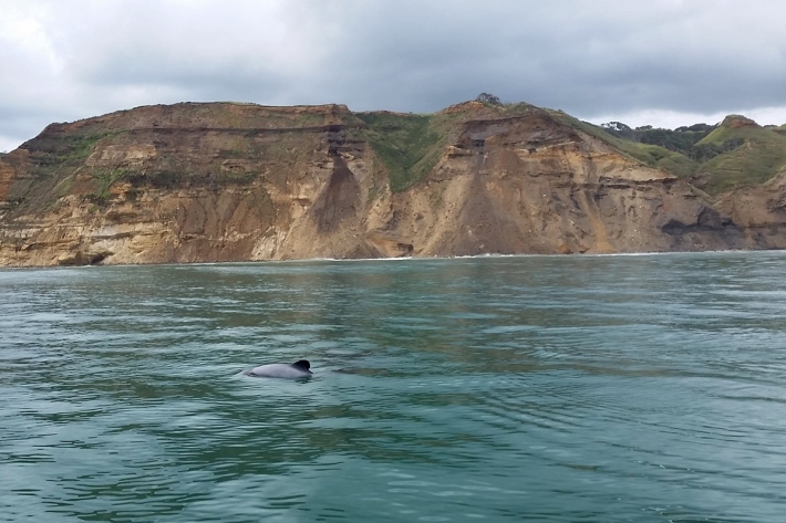
Acoustic Monitoring of whales and dolphins in New Zealand’s Cook Strait region
Research ProjectThe sounds of whales and dolphins rarely seen in New Zealand waters have been recorded in a pioneering underwater sound project. -
Acoustic monitoring of the critically endangered Māui dolphin
Research ProjectMāui dolphins, a subspecies of Hector’s dolphins, are listed as nationally critical in New Zealand with a population estimate between 57 and 75 dolphins over one year old. -
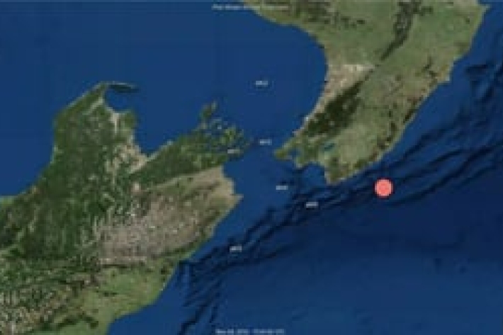
Pilot whale calls detected by acoustic recorder stationed in Cook Strait, New Zealand
Pilot whale (Globicephala sp.) calls detected by acoustic recorder stationed in Cook Strait, New Zealand from December 2016 to January 2017.