-

Software tools
NIWA develops and supplies custom software for environmental analysis and modelling. -
Map North
Education ResourceThis is a sub-tropical climate zone, with warm humid summers and mild winters. -
Tuna - habitat
Tuna are found in all sorts of habitats (places), including coastal estuaries, lakes, wetlands, rivers, mountain streams and even alpine tarns. -
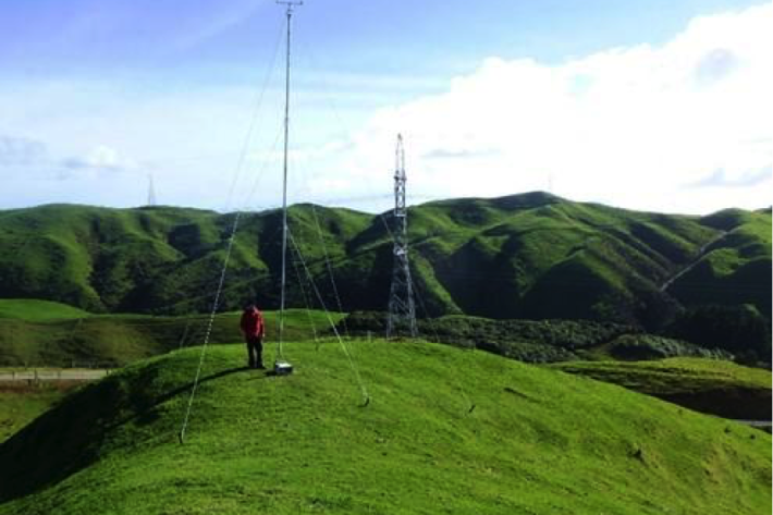
Estimating design wind speeds in complex terrain
Research ProjectThe current method for calculating wind speed-up is inadequate, and can grossly under-predict correct design wind speeds in NZ's complex terrain. -
Resources for teachers
NIWA's educational resources and scientific data are tools for young people to learn about science. -

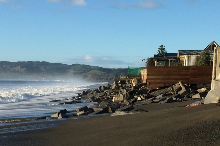
Wave action
Feature story06 June 2017New Zealand’s coast is sculpted by ocean waves. Some wave conditions bring joy to surfers and beachgoers, but, at other times, waves can cause major hazards at sea or along the shore. -
Sea level observations (near real-time)
ServiceThis system combines daily sea-level data from NIWA, regional councils, port companies, Antarctica NZ, Bureau of Meteorology and territorial authorities. -

Algal monitoring service
ServiceBlooms of hazardous cyanobacteria (blue-green algae) in rivers, lakes and reservoirs can cause problems for both animal and human health. -
NZ Drought indicator products and information
Drought is a common feature of New Zealand's climate. On average, every year or two somewhere in New Zealand experiences a drought. -
What is the greenhouse effect?
Education ResourceThe greenhouse effect is a warming of the earth's surface and lower atmosphere caused by substances which let the sun's energy through to the ground but impede the passage of energy from the earth back into space.