-

Soil Moisture Deficit (SMD)
The 3-panel Soil Moisture Deficit (SMD) map shows the historical soil moisture deficit at the date shown (left), the soil moisture deficit at the same time last year (middle) and the current soil moisture deficit (right). -
Water Level Instruments
There are different types of instrument available for measuring water level. -
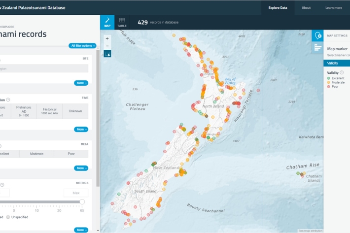
New Zealand Palaeotsunami Database
Software Tool/ResourceThe New Zealand Palaeotsunami Database (Database) brings together all known information about tsunamis that occurred prior to written records. -

Environmental monitoring
NIWA collects a vast range of environmental information about New Zealand’s environment from the sky to the seafloor. -
Pulp and paper
Wood chips and plant material make pulp that is used to produce paper products. -

Submerged plants as bio-indicators
Submerged plants have a number of advantages that favour their use as indicators of lake ecological condition. -

Wave action
Feature story06 June 2017New Zealand’s coast is sculpted by ocean waves. Some wave conditions bring joy to surfers and beachgoers, but, at other times, waves can cause major hazards at sea or along the shore. -
Regional climatologies
A regional climatology is a summary of the typical weather and climate of a region, based on historical data observations made at climate stations located within the region. -

Atlantis ecosystem model
Atlantis is a 3D, spatially-explicit, trophodynamic ecosystem model that integrates biology, physics, chemistry and human impacts to provide a synoptic view of marine ecosystem function. -
Mitigation and best practice options
Some simple steps to minimise the effects of aquaculture activities on water quality and mahinga kai.