-

Mitigation and best practice options
Some simple steps to minimise the effects of mining activities on water quality and mahinga kai. -
How deep is the snow at your place?
Measurements of snowfall at low elevations around New Zealand are few and far between, and yet the data would be really helpful in understanding how snowfall occurs and quantifying snow-related risks. -
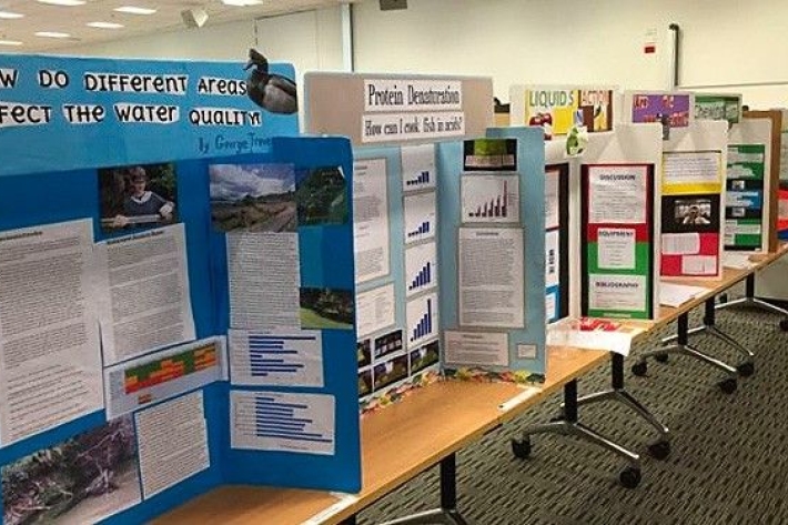
Science and Technology Fairs
NIWA is a major sponsor of the Auckland, Manukau City, North Harbour, Waikato, Wellington, Canterbury and Bay of Plenty – Science & Technology Fairs. -
Weather plots: temperature and relative humidity
Objective: to observe the relationship between temperature and relative humidity. -
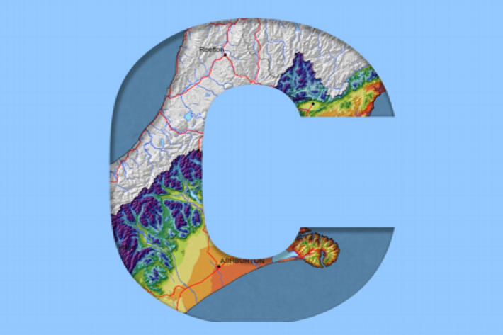
Canterbury
All aspects of the climate of Canterbury are dominated by the influence of the Southern Alps on the prevailing westerly airflows. -
Cloud Imagery
On this page
NZ Region Cloud Analysis Australasian Region Infrared Hemispheric Infrared NZ High-res Visible Contact
All transmissions from GMS-5 are no longer received at NIWA’s satellite reception station in Wellington. We are working on an alternative data feed and will be able to bring back these images later this year. Once we start receiving data again, it will then be calibrated, re-mapped onto standard map projections, and archived. -
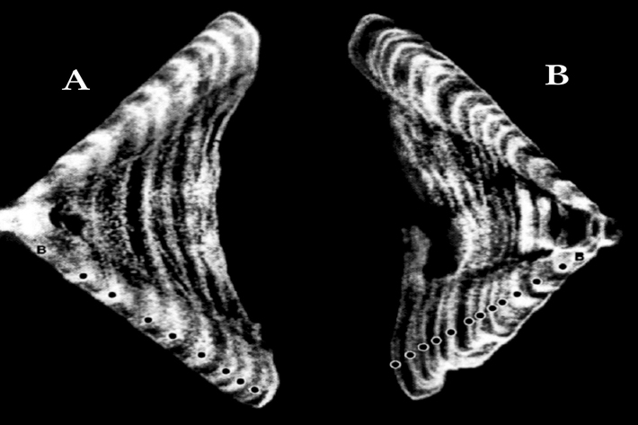
Determining the age of fish
Research ProjectNIWA expends considerable effort on determining the age of commercial fish species. But why age a fish? And how do we do it? -
Smelt
Smelt have a distinctly forked tail and a strong cucumber smell. -
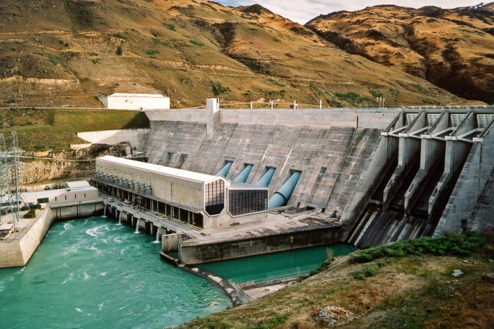
Water dams
Damming water for urban use, hydro-electric power generation, irrigation, and other industrial and commercial uses. -
Population modelling software
Casal2 is an advanced software package developed by NIWA for modelling the population dynamics of marine species. -
Investigating ocean acidification
Feature story06 June 2017The world’s oceans are acidifying as a result of the carbon dioxide (CO2) generated by humanity.