-

Researchers produce stunning images
Media release16 October 2021A break in the clouds in a remote Fiordland valley and a chance encounter with a jellyfish under the Antarctic ice provide just some of the highlights from this year’s NIWA Staff Photography competition. -

Coastal flooding likely to be main driver for adaptation
Media release12 October 2021New NIWA-led research shows increasing flood risk is going to be what leads people to make changes to adapt to sea-level rise. -

Commercial catch sampling
The Otolith is the earbone of the fish and like the rings on a tree it can tell us about the story of the fish's life. -
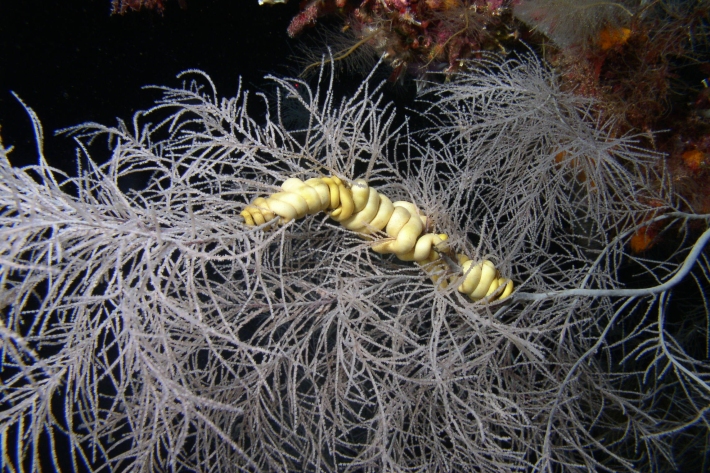
Fabulous Fiordland showcased in new e-Guide
Media release05 October 2021With cascading waterfalls and native bush tumbling down mountainous terrain, Fiordland is one of the most eye-catching parts of the country. But peer beneath the waves and you'll see that Fiordland's marine invertebrate and seaweed communities are every bit as remarkable and awe-inspiring. -
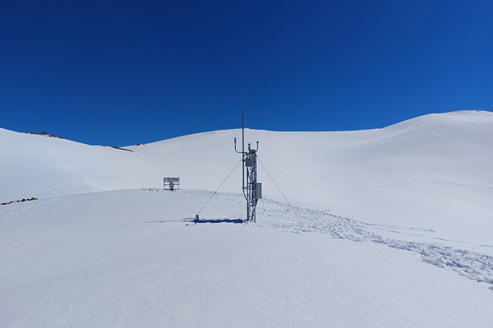
Field technicians greeted by thigh-deep snow
News article30 September 2021Christchurch-based environmental monitoring technicians Alec Dempster and Pieter Havelaar got way off the beaten track this week, heading to a snow-covered Mt Potts for weather station servicing in clear blue skies and some of the deepest snow they’ve ever worked in. -

Scientists, iwi investigate bringing back rock oyster industry
Media release28 September 2021A project is under way to determine whether Aotearoa New Zealand’s long defunct rock oyster industry can be revived. -

Retired scientist completes four-decade-long bibliographic work
Media release21 September 2021After 40 years of work, retired NIWA fisheries scientist Larry Paul has just published a 793-page bibliography of references to New Zealand marine fishes. Everything known and ichthyological that appears in our waters is referenced in the voluminous tome. -
Fabulous Fiordland
An interactive guide to the marine biota of the Fiordland (Te Moana o Atawhenua) Marine Area. -

It’s the warmest winter on record - again
Media release03 September 2021Aotearoa New Zealand has just experienced its warmest winter on record – well exceeding the previous record which was set just last year. -

Irrigation Insight
Feature story30 August 2021Irrigation Insight is a joint industry programme funded by MBIE to examine, on working farms, the ease and effectiveness of using high-resolution weather forecasting, production potential, and drainage estimations for on-farm water management. -

The weather’s better in lockdown, right?
Media release26 August 2021A record-equalling top temperature of 23ᵒC in Akaroa on Tuesday prompted a feeling of déjà vu for NIWA forecaster Ben Noll. -

Stewart Island gets new electronic weather station
Media release24 August 2021A closer eye is now being kept on Stewart Island’s climate thanks to the installation of a new electronic weather station.