-

Software tools
NIWA develops and supplies custom software for environmental analysis and modelling. -
Map North
Education ResourceThis is a sub-tropical climate zone, with warm humid summers and mild winters. -

Chemical contamination and wood processing
What are the sources of chemical contamination from wood processing? -
Algae ID guides
A collection of ID guides to algae. Groups include major freshwater algal groups, diatoms and blue-green (cyanobacteria), red and green algae. -
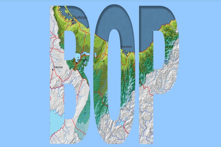
Bay of Plenty
The topography of the North Island has a profound effect on the weather of the Bay of Plenty region. -
Resources for teachers
NIWA's educational resources and scientific data are tools for young people to learn about science. -
NIWA Hydro Web Portal
NIWA's Hydro Web Portal provides river flow and water quality monitoring data from NIWA’s Benchmark river monitoring network. -
New map reveals New Zealand’s seafloor in stunning detail
News article06 June 2017 -
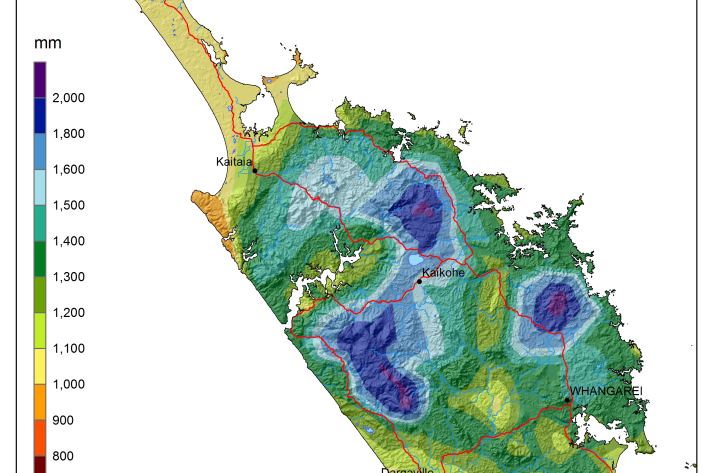
National and regional climate maps
Research ProjectMaps of average annual rainfall, temperature and other climate variables have been produced for all of New Zealand, based on the period 1981–2010. -
Sea level observations (near real-time)
ServiceThis system combines daily sea-level data from NIWA, regional councils, port companies, Antarctica NZ, Bureau of Meteorology and territorial authorities. -

Algal monitoring service
ServiceBlooms of hazardous cyanobacteria (blue-green algae) in rivers, lakes and reservoirs can cause problems for both animal and human health.