-

Map Chatham
Education ResourceExtremes of temperature are rare as the Chatham Islands are small land masses surrounded by sea. -
Marine geological hazards
Education ResourceNew Zealand faces a variety of hazards associated with undersea geological activity. -
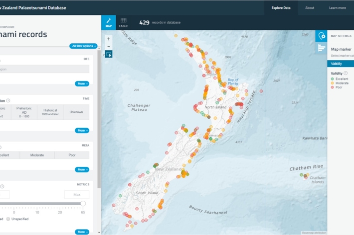
New Zealand Palaeotsunami Database
Software Tool/ResourceThe New Zealand Palaeotsunami Database (Database) brings together all known information about tsunamis that occurred prior to written records. -
Overview of SHMAK
An overview of what the SHMAK kit comprises, and various uses for it. -

NIWA Instrument Systems
Instrument Systems is a specialised technology-focused consulting group within NIWA. -

Submerged plants as bio-indicators
Submerged plants have a number of advantages that favour their use as indicators of lake ecological condition. -
Regional climatologies
A regional climatology is a summary of the typical weather and climate of a region, based on historical data observations made at climate stations located within the region. -

Atlantis ecosystem model
Atlantis is a 3D, spatially-explicit, trophodynamic ecosystem model that integrates biology, physics, chemistry and human impacts to provide a synoptic view of marine ecosystem function. -
What are whitebait?
Whitebait are the juveniles of five species of galaxiidae, a family of fish confined to the Southern Hemisphere. -
Mitigation and best practice options
Some simple steps to minimise the effects of aquaculture activities on water quality and mahinga kai.