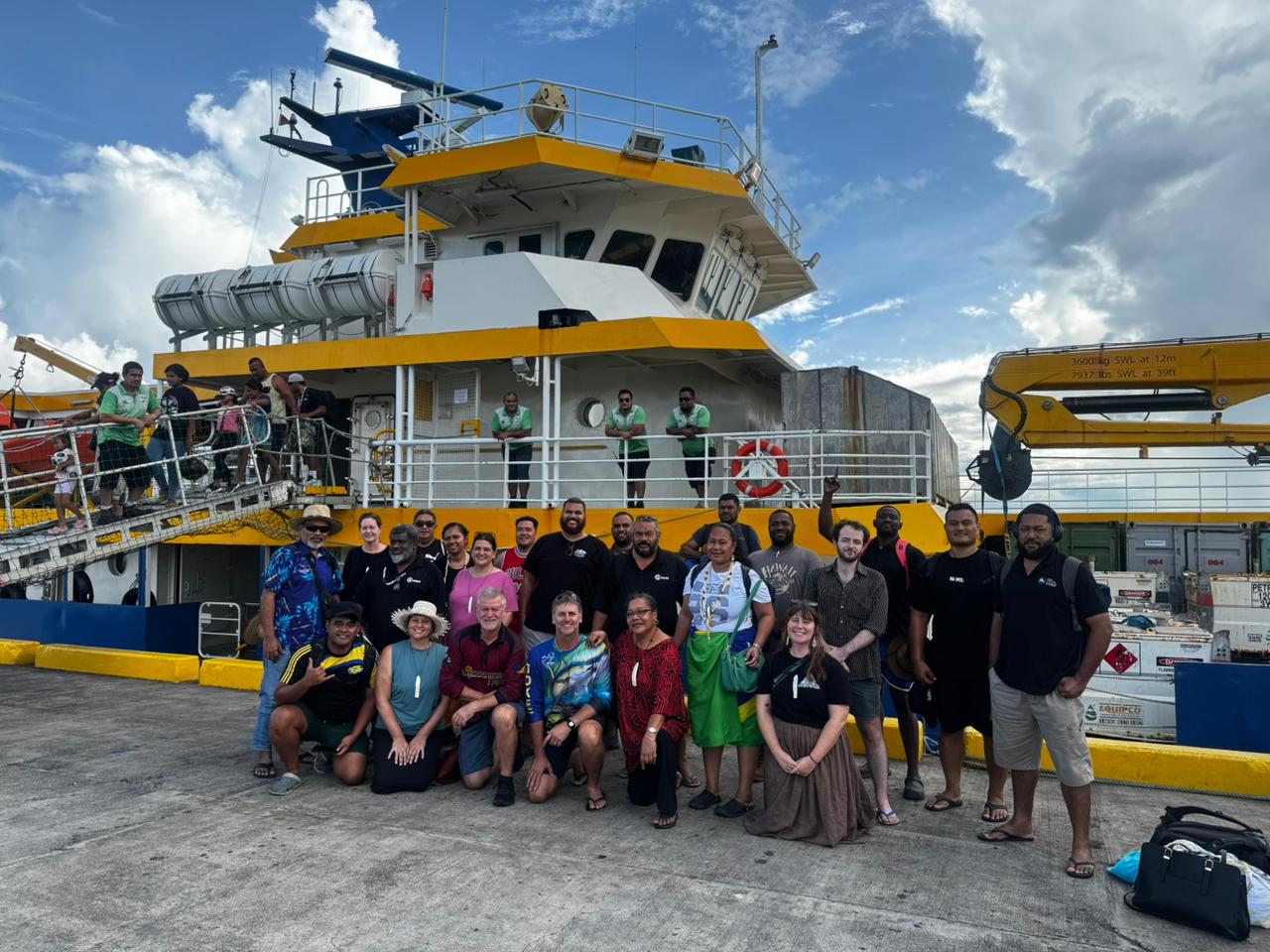
In late April, Earth Sciences NZ joined a multi-agency Joint Mission to Tokelau to support practical resilience work and strengthen coordination with Tokelau and regional partners.
Led by the Secretariat of the Pacific Regional Environment Programme (SPREP) through the Weather Ready Pacific (WRP) Programme, the mission brought together the Governmenst of Tokelau and Samoa, the Pacific Community (SPC), the World Meteorological Organization (WMO), UN Agencies, and the Australian Bureau of Meteorology (BoM).
Reaching Tokelau meant travelling 30 hours by sea from Apia, Samoa aboard the MV Mataliki, the ferry and lifeline to the atolls. Director of Tokelau Ministry of Economic Development, Natural Resources and the Environment (EDNRE), Ms. Asifangalua Pasilio, said:
“Tokelau's remoteness has always made it difficult to access the level of technical support and expertise that our communities need… having such a dedicated and experienced team make this journey speaks volumes.”
She added that strengthening meteorological services and building resilience across the atolls is a vital step “for generations to come.”
'Ofa Fa'anunu, WRP Programme Manager, highlighted that delivering meaningful support required a significant logistical effort. "You had to be there, to see the atolls, to really understand the conditions, and sit with the Taupulega and communities to truly grasp what is needed," 'Ofa said. The Tokelau Joint Mission provided an invaluable opportunity to engage directly with local leaders and communities, assess conditions on the ground, and identify how organisations can best support and strengthen Tokelau's Met Services for the future.
For ESNZ delegation lead Molly Powers-Tora, the voyage created valuable time with partners to discuss current and future work in Tokelau and across the Pacific.
“We got far more out of the Joint Mission than we would have achieved travelling on our own,” Molly says.
“It helped us align the development of our coastal forecasting system with other resilience activities underway and planned in Tokelau, and to work with partners to strengthen the overall coherence of what we’re delivering.”
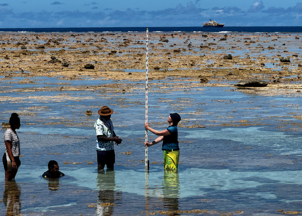
Across Tokelau’s three atolls, the mission combined relationship-building with practical fieldwork. With local technical support, ESNZ deployed a water-level monitoring sensor in the coastal zone of each atoll. The sensors will provide data to help develop a coastal flood forecasting model for Tokelau through the Weather Ready Pacific, supported by the New Zealand Ministry of Foreign Affairs and Trade (MFAT).
For Marty Flanagan, technical lead for the sensor deployment, the support from teams on the ground was a highlight. “It was amazing to have such communality and friendship… and the eagerness and assistance offered to our team to achieve our objective,” he says. “It’s great to see local people and EDNRE staff feeling ownership and understanding the purpose of this work.”
The team also worked with SPC to consult local teams on hazard risk priorities to support planning for the next phase of the MFAT-funded PARTneR project, which will expand tools and training to Tokelau. PARTneR project manager Juli Ungaro said it was valuable to hear local priorities directly and begin gathering information about infrastructure at risk.
Next steps include continued participation in the mission coordination group, helping shape a shared Tokelau country workplan, analysing data from the coastal sensors, and developing the forecasting model so Tokelau data can be integrated as it becomes available. ESNZ will also continue working with partners on the “last-mile” challenge: turning scientific information into clear, practical early warning advice for households and decision-makers.
Read more about the mission:
- SPREP Leads Historical Multi-Agency Climate and Resilience Mission to One of the World's Most Remote Island Communities
- Anchored in resilience, just not the kind you’d expect: A journey to Tokelau’s shores