In May 2024, a catastrophic landslide struck Yambali village in Papua New Guinea, burying homes and infrastructure under 250,000 cubic meters of debris.
The disaster, which occurred in the early hours of May 24, tragically claimed many lives and isolated communities due to a major road being cut off, prompting an urgent humanitarian response.
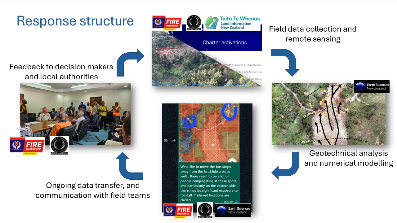
The New Zealand Ministry of Foreign Affairs and Trade (MFAT) contributed to the response, deploying Urban Search and Rescue and Fire and Emergency teams trained in geotechnical assessment. These teams made field observations, while Earth Sciences New Zealand provided remote support to both New Zealand and local PNG geotechnical staff.
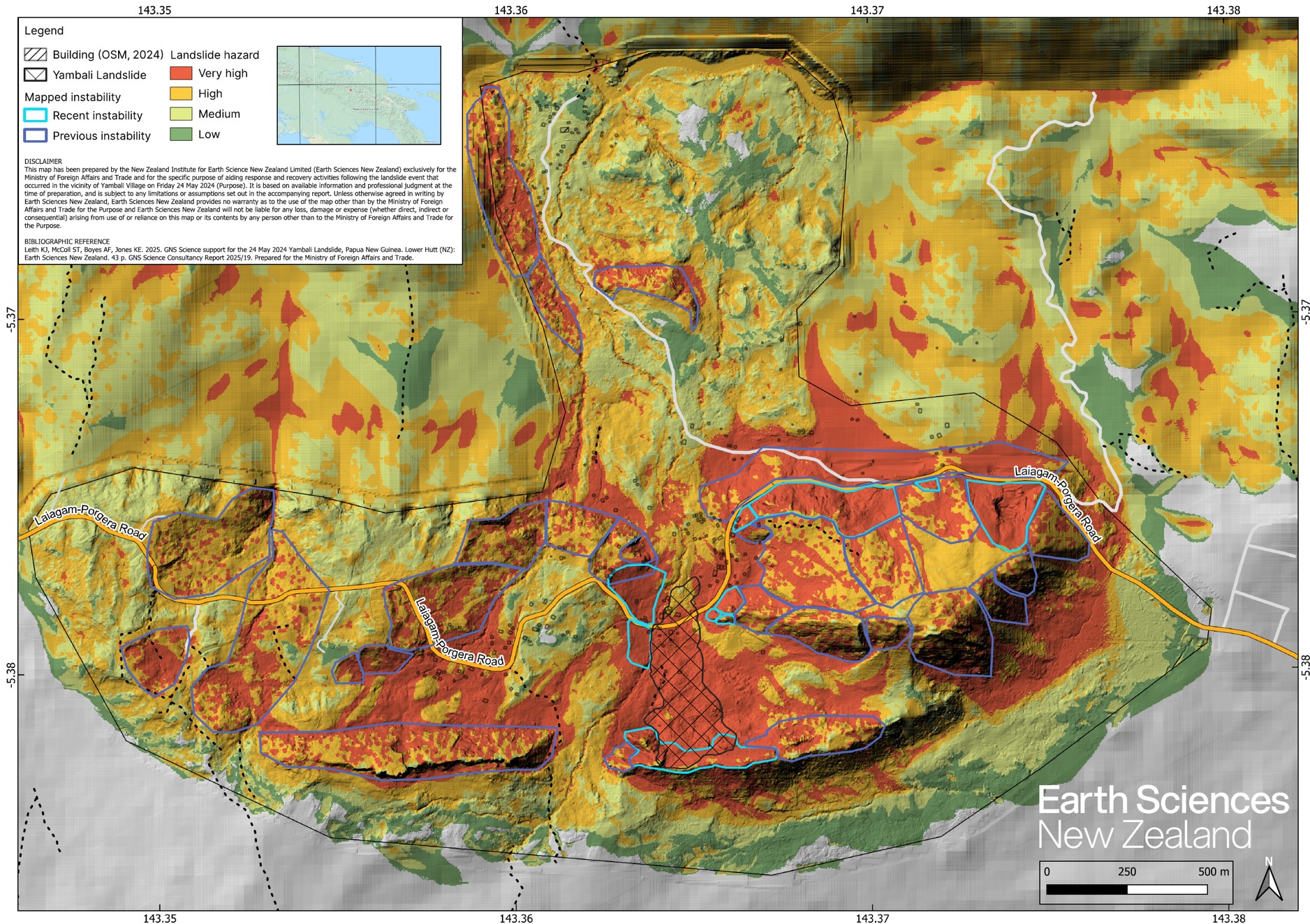
Preliminary landslide hazard maps rapidly produced by ESNZ during the response were instrumental in guiding local authorities and communities. They highlighted areas at risk of future landslides and provided actionable insights for disaster preparedness.
Those preliminary maps were subsequently refined using high resolution topographic data (LiDAR), providing a detailed landslide hazard assessment to support the long-term recovery.
Another part of ESNZ’s contribution was training provided to Chris Bazzy from PNG’s Department of Mineral Policy and Geohazards Management (DMPGM). Chris spent a week with the Engineering Geology team at Avalon, and the training covered identifying landslides from different types of imagery, and methods to forecast where landslides might occur and model how far they might travel. These tools will help the PNG government identify safer zones for resettlement and future development.
Further information:
- Papua New Guinea Landslide Response - Earth Sciences New Zealand | GNS Science | Te Pῡ Ao
- International landslide collaboration aims to save lives and livelihoods - Earth Sciences New Zealand | GNS Science | Te Pῡ Ao