-

Mitigation and best practice options
Some simple steps to minimise the effects of aquaculture activities on water quality and mahinga kai. -
New Zealand's Marine Realm
News article06 June 2017NIWA has transformed 1.5 million square kilometres of data into the most accurate and detailed map yet of the land underneath the sea around New Zealand. -
Map W South
Education ResourceThe climate of this area is greatly dependent on its exposure to weather systems from the Tasman Sea and the lie of the Southern Alps to the east. -
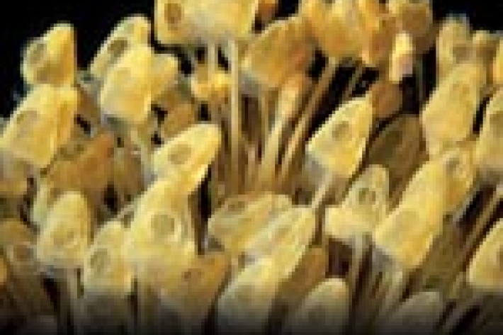
Tuna - age and methods of ageing
Currently, the most reliable method to estimate the age of tuna is by examination of their otoliths or "ear bones" -
Climate and weather
Information about climate and weather and links to climate-related websites. -

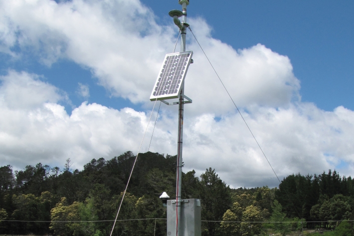
Environmental monitoring
NIWA collects a vast range of environmental information about New Zealand’s environment from the sky to the seafloor. -
Pulp and paper
Wood chips and plant material make pulp that is used to produce paper products. -
Standardised Precipitation Index (SPI)
The Standardised Precipitation Index (SPI) is a simple measure of drought (and also of very wet conditions) and is based solely on the accumulated precipitation for a given time period.