-

Suspended-sediment yield estimator
This national GIS ‘layer’ enables reconnaissance-scale estimation of suspended-sediment yields from New Zealand’s rivers and streams. It has been developed by NIWA in collaboration with Landcare Research. -
What ails our estuaries - problems and solutions
Estuaries are at the bottom of the freshwater drainage network and, effectively, are a part of it. -
Kōura
There are two species of kōura or freshwater crayfish in Aotearoa. -
Infectious substances
Waterways can easily become contaminated by pathogens when effluent is discharged nearby. -

River Environment Classification
The River Environment Classification (REC) is a database of catchment spatial attributes, summarised for every segment in New Zealand's network of rivers. -
Statement of Core Purpose
The Statement of Core Purpose spells out why the Government owns Crown Research Institutes and what it expects from them. -
Map N South
Education ResourceAs much of this climate zone is sheltered by high country to the west, south and in some areas to the east, it is the sunniest region of New Zealand. -

Wave hazard research
Research ProjectNIWA collects wave data, develops and verifies wave forecasting systems, and is developing and producing wave projections. -

Climate Summaries
Publication seriesView annual, seasonal and monthly summaries of temperature, rainfall and sunshine data from across New Zealand. -
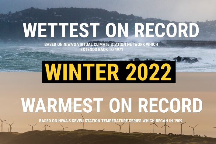
NZ's warmest and wettest winter on record
Media release06 June 2017NIWA’s climate scientists can now confirm what you may have suspected. After carefully poring through more than a century’s worth of data, it has been officially determined that winter 2022 was Aotearoa New Zealand’s warmest and wettest on record. -
Statement of Corporate Intent
This Statement of Corporate Intent (SCI) sets out NIWA's strategy for delivering against its core purpose over the next five years.