Earth Sciences NZ is proud to support the Cook Islands Meteorological Service (CIMS) through major upgrades to infrastructure and monitoring systems.
With backing from MFAT, COSPPac, UNEP and the Green Climate Fund, new equipment and improved analysis tools are boosting the nation’s ability to deliver accurate, timely weather and hazard information for safer communities.
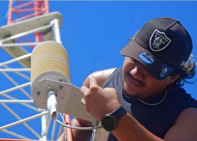
Automatic weather stations (AWS) have now been upgraded or installed across most of the country’s 15 islands, giving CIMS essential real-time data for forecasting and early warnings.
These observations feed into the Climate Database for the Environment (CliDE), and applications to translate the observation data into useful information is available through the Earth Sciences NZ developed CliDEsc platform, strengthening national climate services.
A weeklong workshop to support capacity development in the use of the CliDEsc platform was recently delivered in October 2025 by the Earth Sciences NZ team supported through COSPPac.
The value of these improved observations and ongoing capacity development was demonstrated at the end of January 2026, when the CliDEsc Extremes Dashboard, operated by CIMS, supported Emergency Management Cook Islands (EMCI) during a severe weather event.
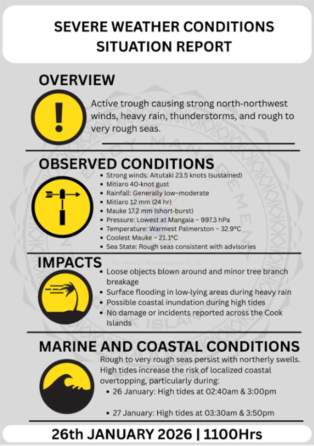
Realtime AWS data enabled EMCI to produce clear public infographics, improving visibility of conditions in the Outer Islands and strengthening situation reports to the Office of the Prime Minister.
EMCI has since requested direct access to integrate the dashboard into their operational systems, signalling its shift from technical tool to a frontline decision support platform and strengthening the critical relationship between CIMS and EMCI.
These investments are also building local capability. Met Service technicians are being trained to operate and maintain the new stations, manage data, and feed information directly into forecasting models.
As Geoportal Coordinator at EMCI Samuel Nga explains, the upgrades are empowering the CIMS to “put out our own stations, collect our own data… and create our own forecasting system,” strengthening self-reliance and service quality across the islands.
Together, these advancements are enabling the Cook Islands to better anticipate hazards and protect communities, ensuring even the most remote islands are better seen, heard and warned.
For more information: https://www.greenclimate.fund/story/forecasting-hope-climate-action-more-resilient-cook-islands