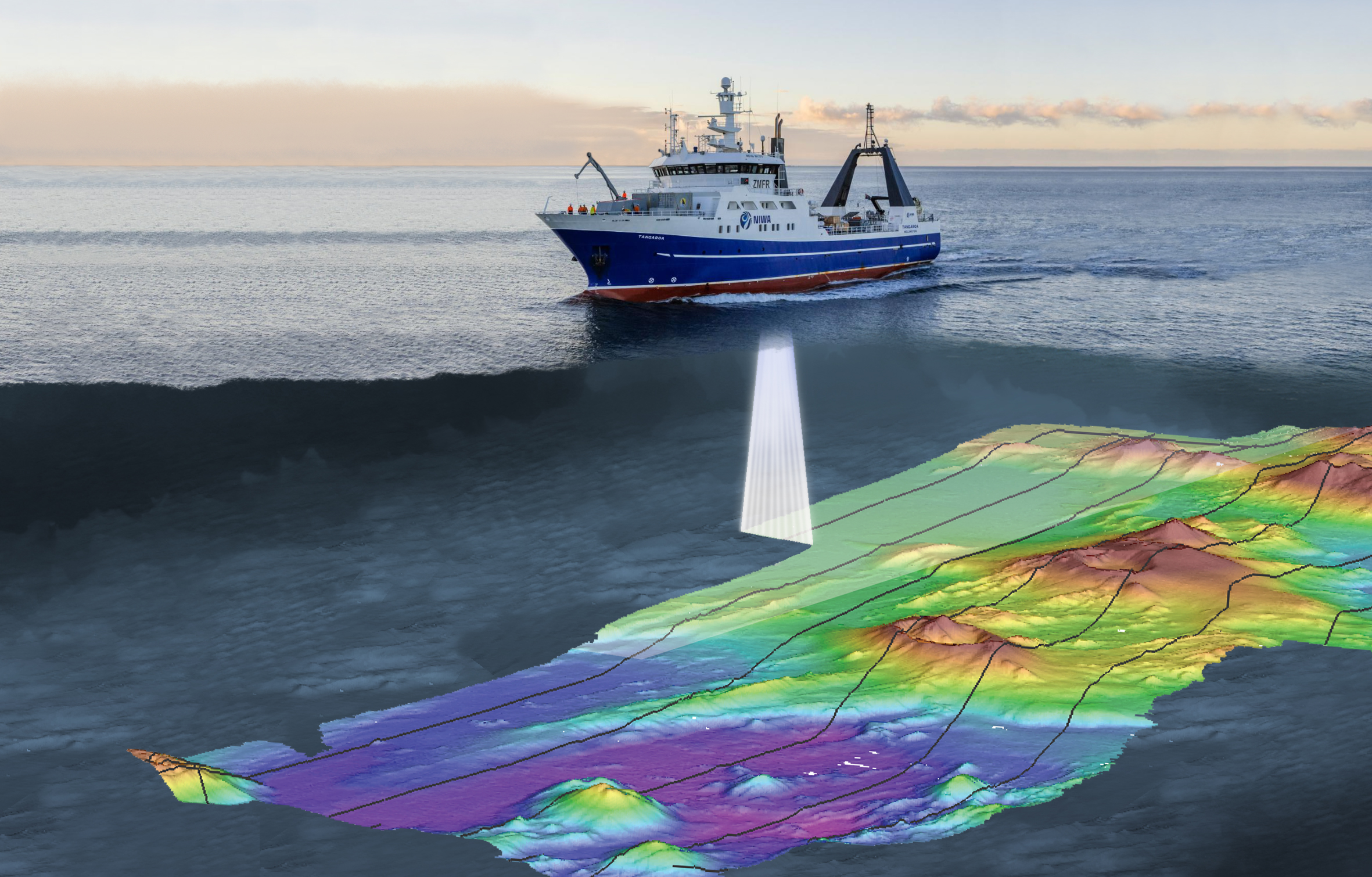
Hull-mounted on the RV Tangaroa, the EM 302 multibeam echosounder maps the seafloor using a fan of 288 acoustic beams, producing up to 864 soundings per ping in dual swath mode, providing 100% coverage of the seabed.
The resulting surveys show far greater detail than the earlier method of multiple lines using a single-beam sounder, as well as greatly reduced ship survey time and cost.
While bathymetry data reveals the shape and depth of the ocean floor, imagery data can also be produced using the strength of the return signal (backscatter). This data can indicate variations in bottom type and therefore what habitats may occur. In addition to bathymetry and backscatter, the system records water column information which can be used to identify seeps and plumes, fish schools and other features not normally imaged in the bathymetry data. The system is also mammal friendly, having the ability to reduce the system power if required.
The EM302 installation includes a POS/MV 320, which integrates positioning and motion compensation. The POS provides precise GPS navigation solutions, in addition to heave, pitch, roll, and yaw information for EM302. The precision of the POS/MV motion sensor allows for high calibration accuracy of the multibeam system and provides a freedom from acceleration errors induced when cornering.
Data are recorded using Kongsberg's SIS software, and processed on board using CARIS HIPS & SIPS and QPS Fledermaus along with ArcGIS, the end product being bathymetry data, geotiffs and backscatter imagery for use in both Hydrographic surveys and research programs.
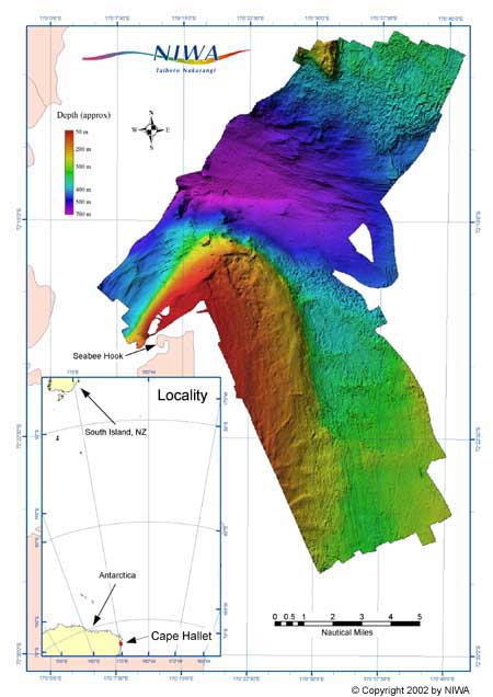
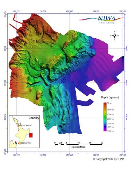
The EM302 and its predecessor (EM300) have now been used for mapping the New Zealand realm, from the Equator to the Antarctic and in the 18 years since first installation in excess of 600,000 km2 of the seafloor has been mapped.
Note that no part of these figures are to be reproduced or interpreted without prior, written permission of NIWA.