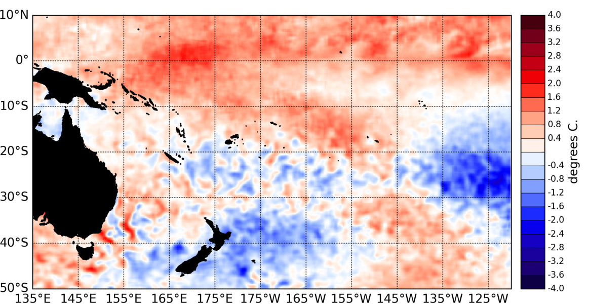
The atmosphere has yet to show a clear coupling to the anomalously warm equatorial Pacific Ocean.
Sea Surface Temperatures (SST) in the equatorial Pacific Ocean have changed little since November 2014, and are just over El Niño thresholds. Monthly SST anomalies are currently 0.8°C above normal in the NINO3.4 region. NINO3 monthly value is at +0.8°C and NINO4 at +1.0°C.
Sub-surface ocean temperature anomalies over +2°C persist at about 100m depth or shallower east of the Dateline to the South American coast. However, other ENSO indicators have yet to reach El Niño thresholds. The Southern Oscillation Index (SOI) value for December is –0.7, and still shows no signs of persistence below –1.
The latest TAO array observations show no significant westerly wind anomalies along the equatorial Pacific. Rainfall and convection anomalies are also lacking a clear El Niño signature at present. The NASA ENSO Precipitation Index (ESPI) for the 30 days to 4 January was –0.71, a value typically associated with weak La Niña conditions.
Both the Inter-Tropical Convergence Zone (ITCZ) and South Pacific Convergence Zone (SPCZ) were well–defined during December 2014; convection east of the Dateline has increased off the Equator, but convection is still weak close to the Equator.
Of the ten dynamical models that NIWA monitors 7 indicate El Niño over the next three months and 3 indicate borderline values (above 0.5°C but below 0.7°C). The recent IRI technical ENSO update (18th of December) indicates chances of El Niño reaching 70% or more.

