-

eDNA research and services
ServiceNIWA is active in a broad range of eDNA topics and can provide expert advice on applications and expected outcomes. -
Making big waves in the Pacific
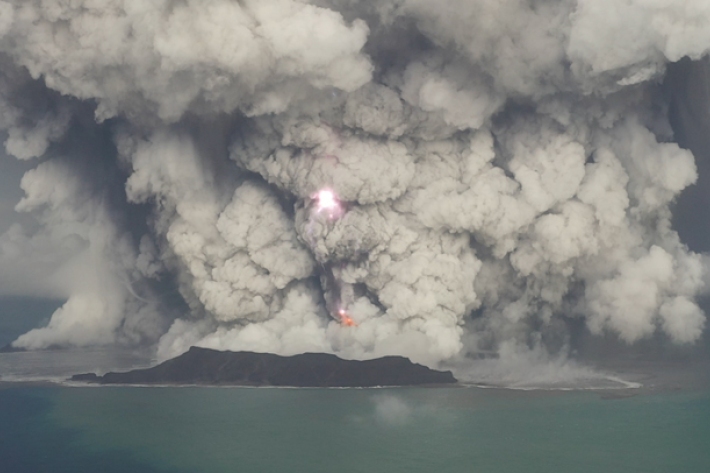
Feature story15 December 2022Prior to 15 January, Hunga Tonga-Hunga Ha'apai was a little-known undersea South Pacific volcano with a long name. Within 24 hours, it was a global phenomenon – the site of the largest atmospheric explosion in almost 150 years. Jessica Rowley looks at why a remote Tongan volcano took the world by storm. -
Preparing coastal communities for change
Feature story15 December 2022Our coastline is changing as sea levels rise. Lawrence Gullery looks at a five-year research programme designed to help communities with tough decisions ahead. -
Tonga eruption confirmed as largest ever recorded
Media release21 November 2022A New Zealand-led team has completed the fullest investigation to date into January’s eruption of the underwater Tongan volcano. -
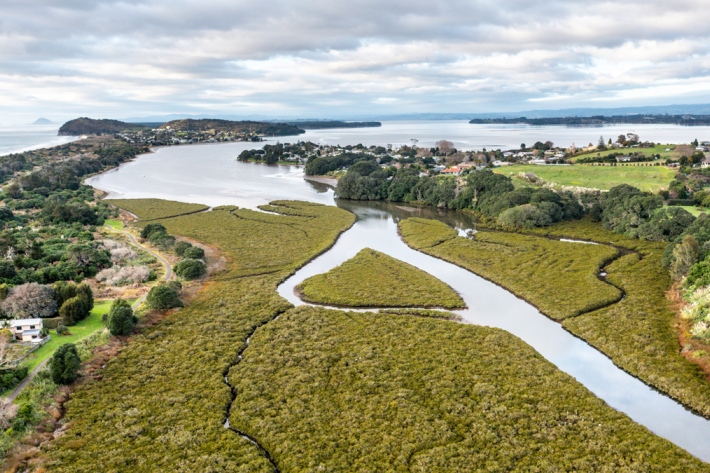
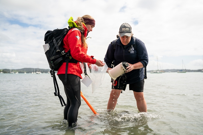
Climate change experts tour New Zealand’s coastal wetlands
Media release03 November 2022A group of international scientists are visiting some of New Zealand’s most significant coastal wetlands as part of a five-year research project to help the country adapt and prepare for sea-level rise. -
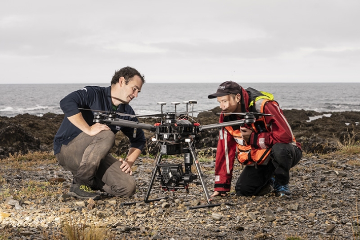
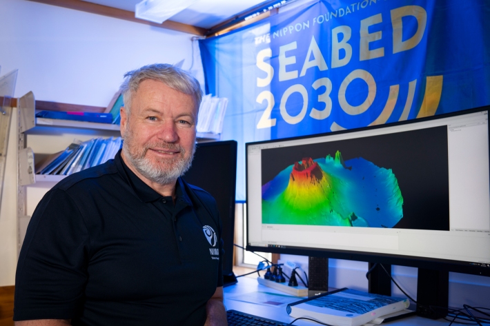
Technology provides views of life in remote habitats
Media release25 October 2022Aotearoa-New Zealand’s marine area covers 167,650 square kilometres presenting a staggering distribution of climates, from subtropical to subantarctic waters, to understand and manage. -
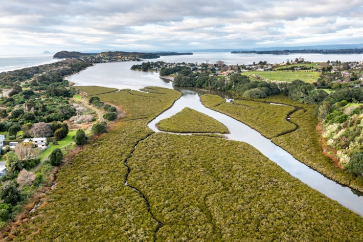
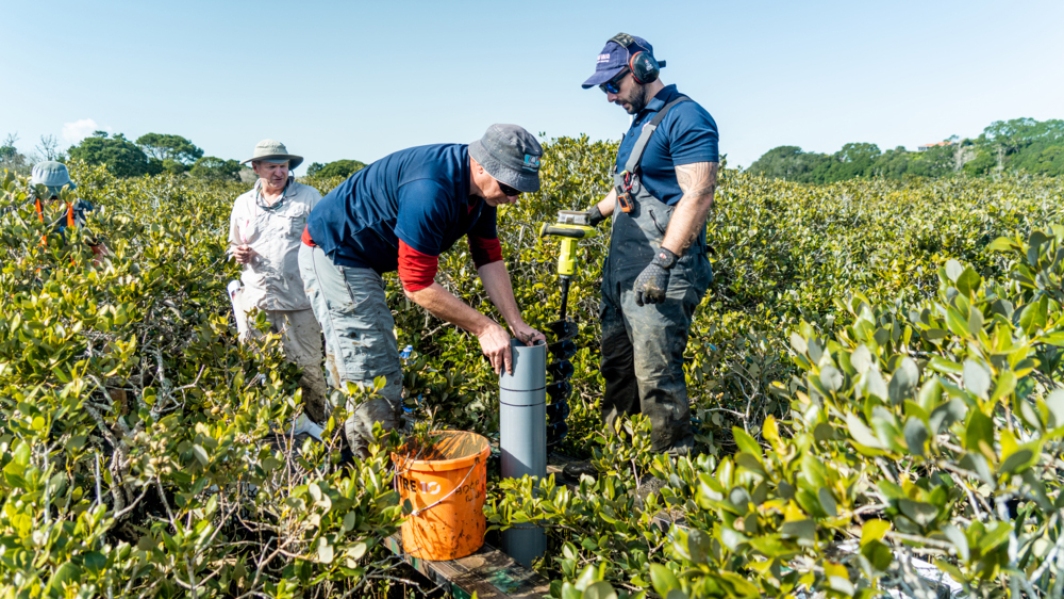
Understanding the threat of sea level rise to NZ’s wetlands
Media release07 October 2022Specialised monitoring equipment has been installed in Bay of Plenty estuaries to understand whether our coastal wetlands can survive the threat of inevitable sea-level rise. -
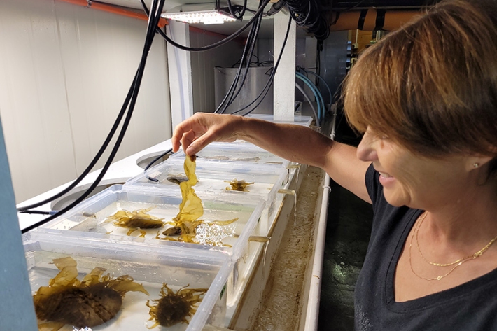
Seaweed research and services
ServiceNIWA has world-class expertise in marine macroalgae and extensive research on various aspects of seaweed ecology, growth and taxonomy. -
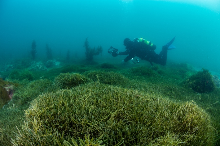
Marine invader Caulerpa triggers biosecurity response
Media release29 September 2022NIWA is part of a multi-agency biosecurity response to an invasive seaweed discovered at Aotea Great Barrier Island and subsequently at Ahuahu Great Mercury Island. -
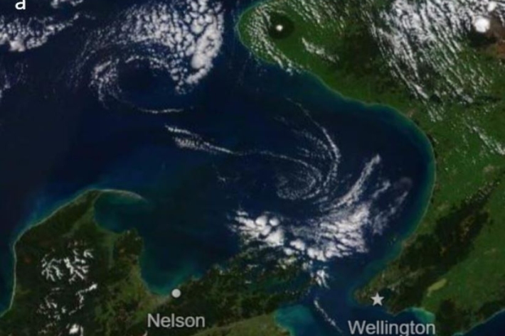
Satellites reveal NZ’s coastal health
Media release21 September 2022For the first time, satellites have been used to track coastal water health around Aotearoa New Zealand. -
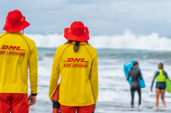
Identifying rip currents using artificial intelligence
Research ProjectNIWA and Surf Life Saving New Zealand are working together to develop a state-of-the-art, rip current identification tool. -
Ki uta ki tai: NIWA’s role in mountains-to-sea estuarine management
Media release09 June 2022Estuaries are coastal waterbodies where freshwater mixes with seawater. Many estuaries in Aotearoa New Zealand have been impacted by pollutants and contaminants entering via freshwater.