-
Blogs
Follow NIWA's scientists as they explore the natural world, make new discoveries and share how people use their science. -
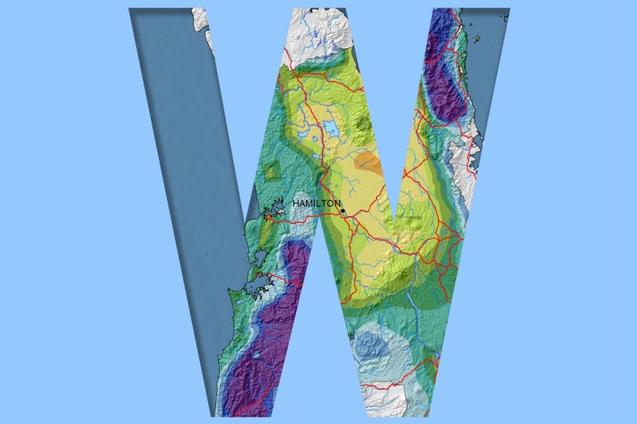
Waikato
Waikato exhibits a range of climates due to the variety of landscapes in the region. -

NOAA Satellite data
Like the GMS satellite, the NOAA Series of polar orbiting satellites (operated by NOAA, the US National Oceanic and Atmospheric Administration) are a component of the World Weather Watch meteorological satellite network. -

Tsunami
Education ResourceTsunami is a Japanese word meaning great wave in harbour. -
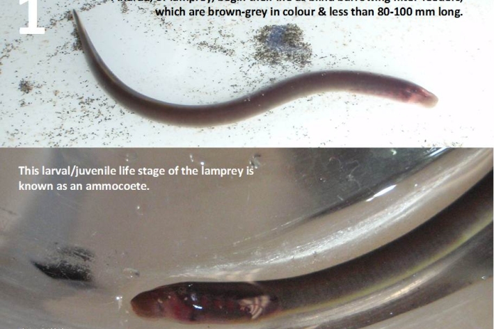
Restoration and enhancement of piharau / kanakana / lamprey
Research ProjectNIWA is leading a new six-year research project that seeks to increase our understanding of piharau/kanakana/lamprey, using Mātauranga Māori, social science and biophysical science approaches. -
Virtual Climate Station data and products
Virtual climate station estimates are produced every day, based on the spatial interpolation of actual data observations made at climate stations located around the country. -
Map Sw North
Education ResourceBecause of its exposure to disturbed weather systems from the Tasman Sea, this climate zone is often quite windy, but has few climate extremes. -
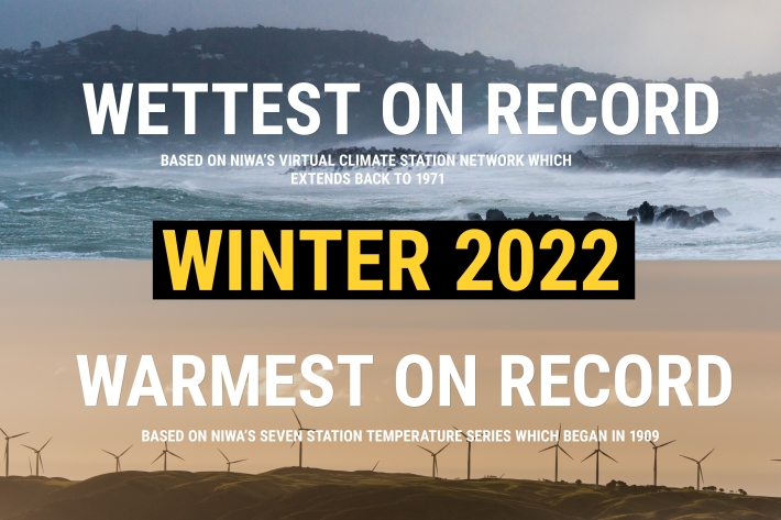
NZ's warmest and wettest winter on record
Media release06 June 2017NIWA’s climate scientists can now confirm what you may have suspected. After carefully poring through more than a century’s worth of data, it has been officially determined that winter 2022 was Aotearoa New Zealand’s warmest and wettest on record. -
Proud of your plants? 1 June 2017
News article01 June 2017NIWA is doing a nationwide study to discover what makes the best riparian projects. Help us give you the knowledge to make the best riparian management decisions possible by taking our 5 minute survey. -
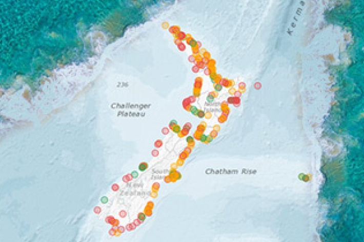
New database sheds light on prehistoric tsunamis affecting New Zealand
Media release31 May 2017The scientific records of palaeotsunamis to have affected New Zealand shores can now be accessed in a new one-stop information shop.
