-

RV Tangaroa
FacilityRV Tangaroa is New Zealand’s only ice strengthened and dynamically positioned deep-water research vessel. -

Climate Summaries
Publication seriesView annual, seasonal and monthly summaries of temperature, rainfall and sunshine data from across New Zealand. -

Altered water flow (hydrology)
Each waterway has its own particular characteristics relating to water flow, velocity, and quantity. -

Investigating ocean acidification
Feature story06 June 2017The world’s oceans are acidifying as a result of the carbon dioxide (CO2) generated by humanity. -
Mean number of days of ground frost
These datasets are available in a range of formats. -
Soil Moisture Deficit (SMD)
The 3-panel Soil Moisture Deficit (SMD) map shows the historical soil moisture deficit at the date shown (left), the soil moisture deficit at the same time last year (middle) and the current soil moisture deficit (right). -
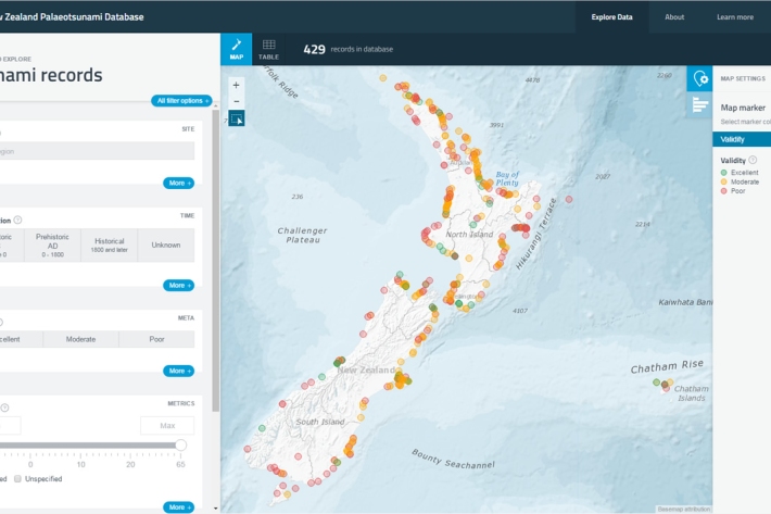
New Zealand Palaeotsunami Database
Software Tool/ResourceThe New Zealand Palaeotsunami Database (Database) brings together all known information about tsunamis that occurred prior to written records. -
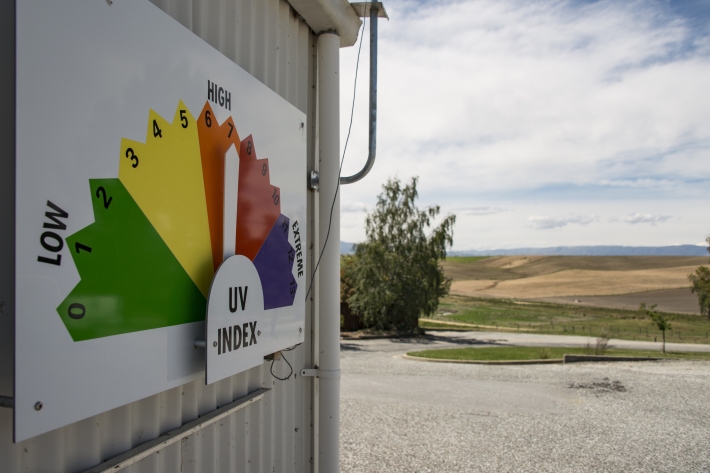
UV Index Information
Education ResourceThe UV Index is a measure of the intensity of UV radiation. The UV Index supersedes the idea of "Time to Burn" or "Burn Time", which has been used previously in New Zealand. -
Suspended-sediment yield estimator
This national GIS ‘layer’ enables reconnaissance-scale estimation of suspended-sediment yields from New Zealand’s rivers and streams. It has been developed by NIWA in collaboration with Landcare Research.