-
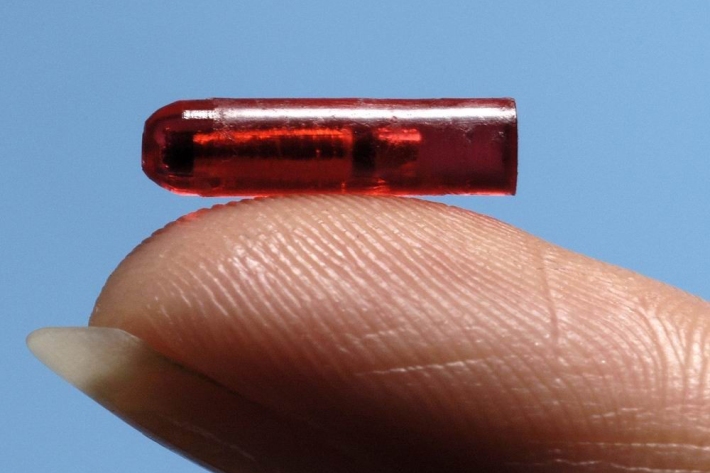
Snapped! Tag reveals fish’s 20-year history
Media release31 May 2022A fish has been caught in the same location that it was tagged, nearly 20 years ago to the day. -
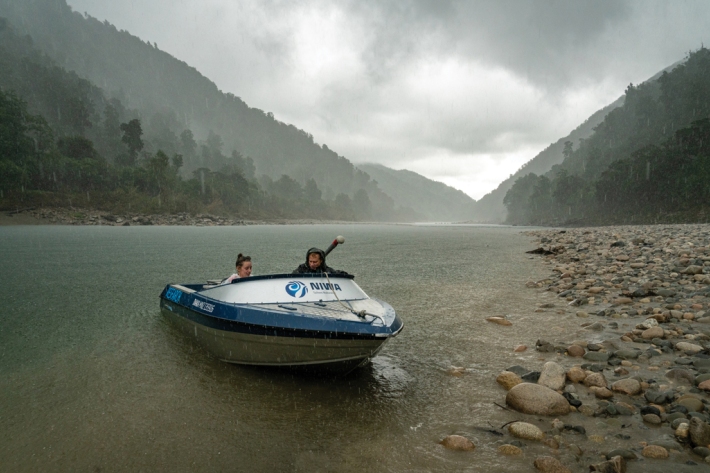
A Hard Rain’s A’Gonna Fall
Feature story31 May 2022Climate change means more intense storm systems are on their way. Science can’t stop it raining, but it can help communities prepare for the worst and plan for the future. -
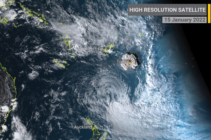
Tracking an eruption
Feature story30 May 2022Stacy Mohan looks at how the shockwaves from a remote Tongan island rippled through NIWA’s research community. -
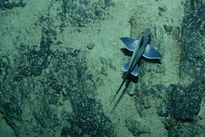
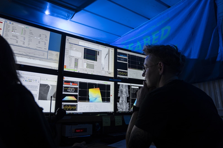
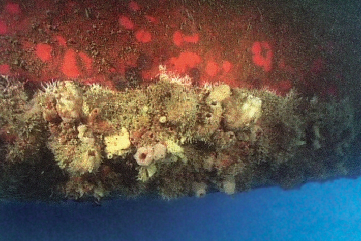
Chasing deepsea shadows
Feature story30 May 2022Mia Blyth catches up with a marine biologist hunting for ocean ghosts. -
Tonga eruption discoveries defy expectations
Media release23 May 2022New findings from the record-breaking Tongan volcanic eruption are “surprising and unexpected." -
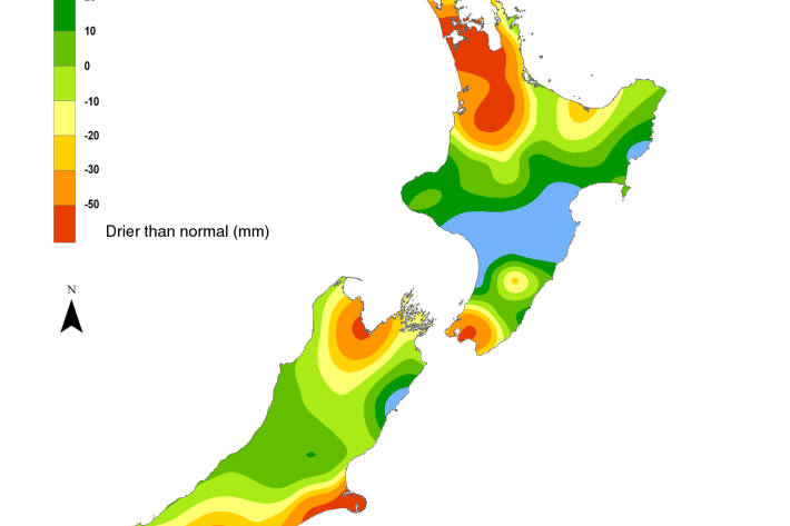
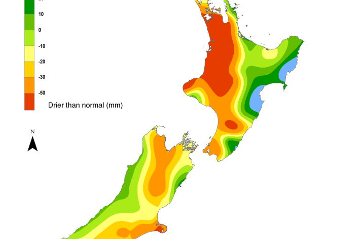
Hotspot Watch 20 May 2022
Hotspot20 May 2022A weekly update describing soil moisture patterns across the country to show where dry to extremely dry conditions are occurring or imminent. Regions experiencing significant soil moisture deficits are deemed “hotspots”. Persistent hotspot regions have the potential to develop into drought. This will be the final update of the Hotspot Watch for this season. Weekly Hotspot Watch updates will resume in the spring. -
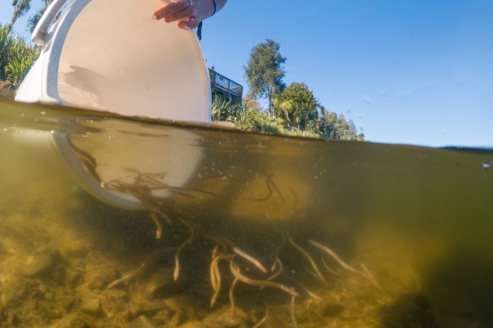
Removing barriers to ensure freshwater fish can complete their life cycle
Media release19 May 2022New Zealand has just over 50 native freshwater fish species. Of these, 85 % are endemic and 75 % are deemed to be at risk of decline or are threatened. -
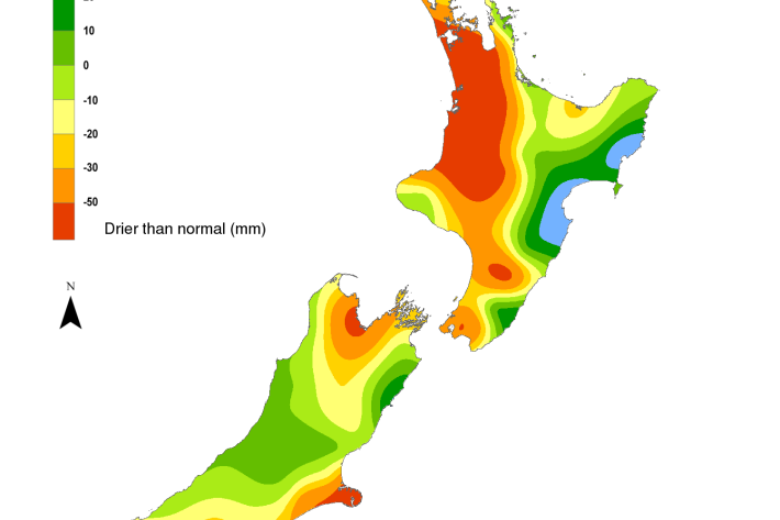
Hotspot Watch 13 May 2022
Hotspot13 May 2022A weekly update describing soil moisture patterns across the country to show where dry to extremely dry conditions are occurring or imminent. -

Anchors cause “extensive, persistent” damage to seafloor
Media release12 May 2022High-resolution mapping has produced the first ever global estimates of coastal habitat damage caused by anchoring. -

Survey provides snapshot of harbour’s health
News article10 May 2022Greater Wellington Regional Council regularly assess sediment quality and seafloor community health in the subtidal areas of Te Awarua-o-Porirua (Porirua Harbour) and Te Whanganui-a-Tara (Wellington Harbour). -
Guide explores the benefits of combating marine biofouling
News article10 May 2022NIWA is contributing to an international effort to help developing countries reduce the impact of biofouling on aquatic-based industries and environments. -
Hotspot Watch 6 May 2022
Hotspot06 May 2022A weekly update describing soil moisture patterns across the country to show where dry to extremely dry conditions are occurring or imminent. Regions experiencing significant soil moisture deficits are deemed “hotspots”. Persistent hotspot regions have the potential to develop into drought.