-

Methane
FacilityMethane (CH4) is the second most important greenhouse gas after CO2 that is produced by human activities. -

Climate mapping
Read about how NIWA can map any aspect of climate to help guide your organisation's response to a changing and variable climate. -
Mitigation and best practice options
Some simple steps to minimise the effects of mining activities on water quality and mahinga kai. -
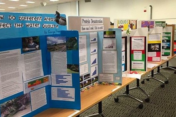
Science and Technology Fairs
NIWA is a major sponsor of the Auckland, Manukau City, North Harbour, Waikato, Wellington, Canterbury and Bay of Plenty – Science & Technology Fairs. -
Soil Moisture Deficit (SMD)
The 3-panel Soil Moisture Deficit (SMD) map shows the historical soil moisture deficit at the date shown (left), the soil moisture deficit at the same time last year (middle) and the current soil moisture deficit (right). -
Weather plots: temperature and relative humidity
Objective: to observe the relationship between temperature and relative humidity. -

Climate Summaries
Publication seriesView annual, seasonal and monthly summaries of temperature, rainfall and sunshine data from across New Zealand. -
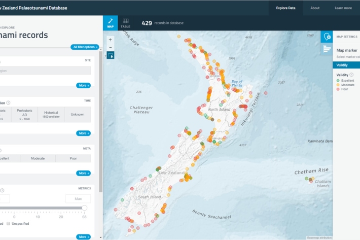
New Zealand Palaeotsunami Database
Software Tool/ResourceThe New Zealand Palaeotsunami Database (Database) brings together all known information about tsunamis that occurred prior to written records. -
Cloud Imagery
On this page
NZ Region Cloud Analysis Australasian Region Infrared Hemispheric Infrared NZ High-res Visible Contact
All transmissions from GMS-5 are no longer received at NIWA’s satellite reception station in Wellington. We are working on an alternative data feed and will be able to bring back these images later this year. Once we start receiving data again, it will then be calibrated, re-mapped onto standard map projections, and archived. -
Proud of your plants? 1 June 2017
News article01 June 2017NIWA is doing a nationwide study to discover what makes the best riparian projects. Help us give you the knowledge to make the best riparian management decisions possible by taking our 5 minute survey. -
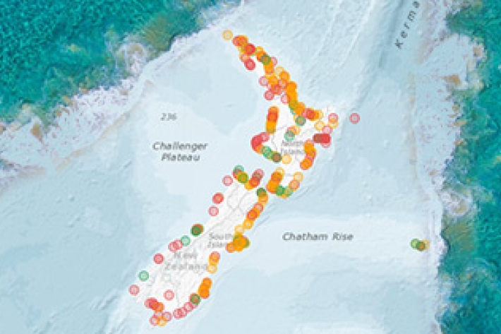
New database sheds light on prehistoric tsunamis affecting New Zealand
Media release31 May 2017The scientific records of palaeotsunamis to have affected New Zealand shores can now be accessed in a new one-stop information shop.