A cool and dry autumn for much of New Zealand
Overview
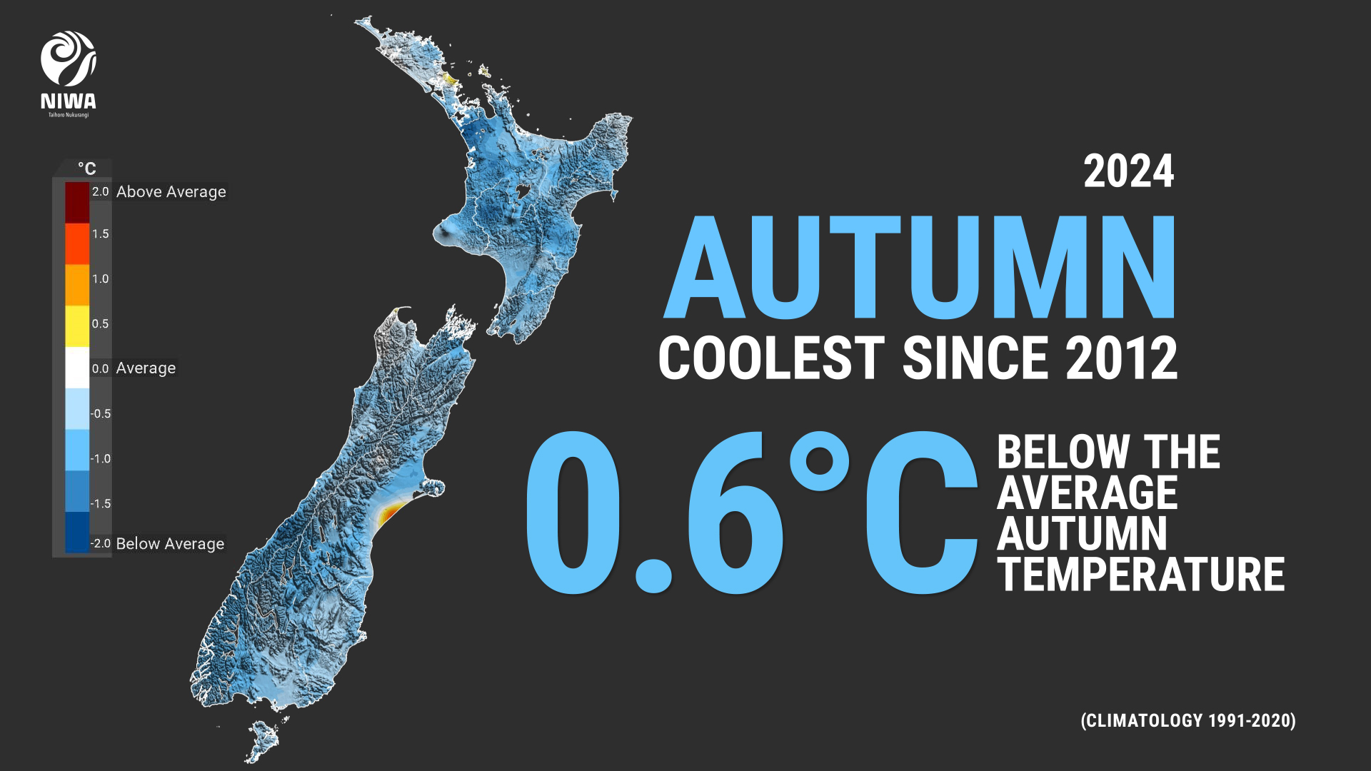
| Temperature | Autumn temperatures were below average (-0.51°C to -1.20°C of average) across large portions of both islands, including parts of Auckland, Waikato, Bay of Plenty, the Central Plateau, Gisborne, Hawke’s Bay, Taranaki, Manawatū-Whanganui, Wellington, Marlborough, West Coast, central Canterbury, interior Otago, and western Southland. Elsewhere, near average temperatures (±0.50°C of average) were observed. No areas experienced above average autumn temperatures. |
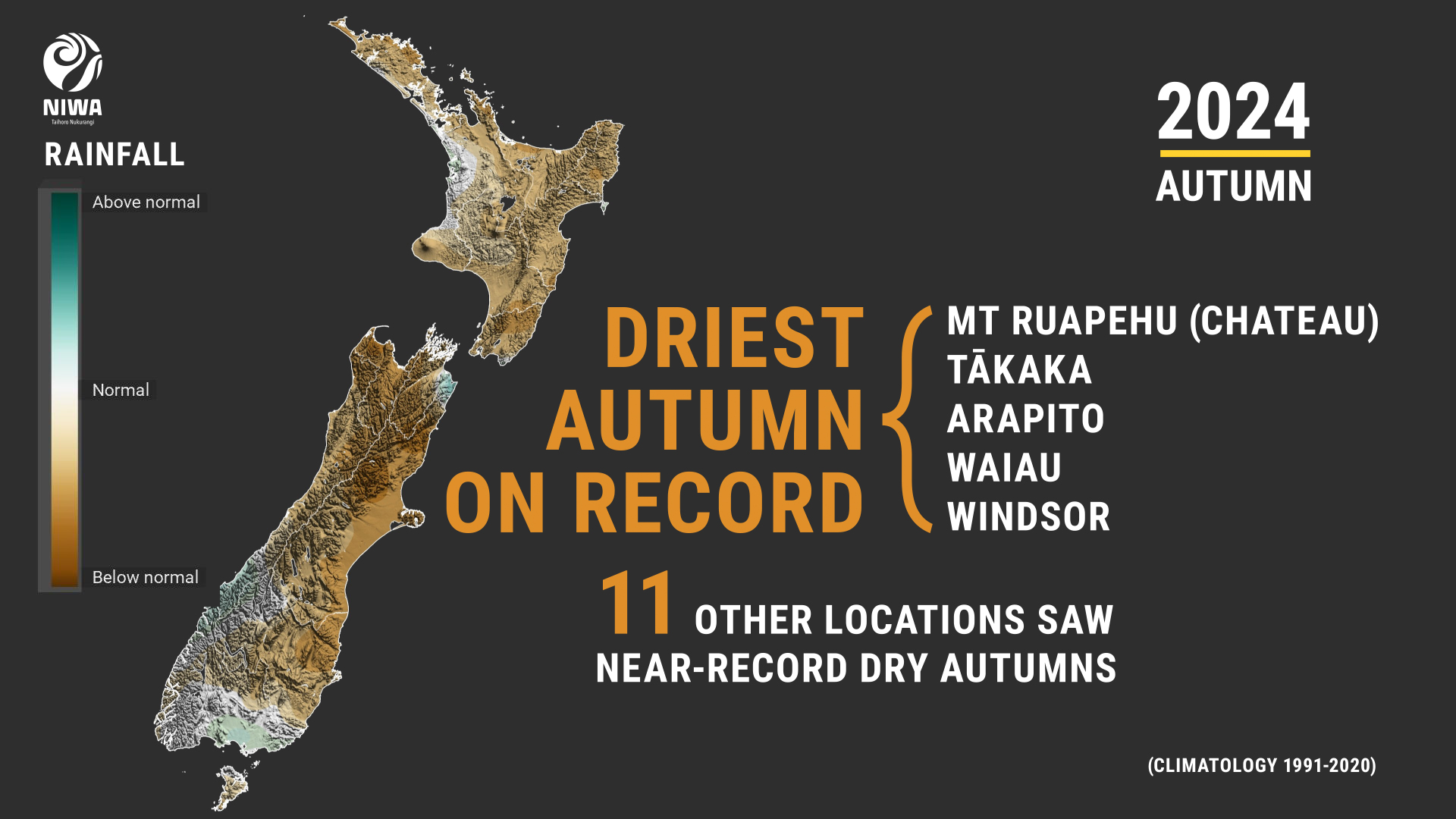
| Rainfall | It was a dry season for large swaths of New Zealand, with below normal (50-79% of normal) rainfall observed in eastern Northland, parts of Waikato, Bay of Plenty, the Central Plateau, southern Taranaki, much of the eastern and lower North Island, Nelson, Tasman, the upper West Coast, Canterbury, and northern Otago. Pockets of well below normal rainfall (<50% of normal) occurred in Tasman and northern Canterbury. Elsewhere, autumn rainfall was near normal (80-119% of normal), with the exception of small areas of above normal rainfall (120-149% of normal) in eastern Marlborough and western Southland. |
| Soil moisture | At the end of autumn, soils were drier than normal for northern, eastern, and inland parts of the South Island, and western and southern parts of the North Island from southern Taranaki to the Greater Wellington region (excluding Wellington city). Soils were wetter than normal about Mahia Peninsula. |
Autumn 2024 was characterised by higher than normal mean sea level pressure (MSLP) west of Aotearoa New Zealand and lower than normal MSLP south and east of the country (see Figure 1 below). This generally resulted in more southwesterly winds than normal, resulting in cooler than average seasonal temperatures and drier than normal conditions for much of the country.
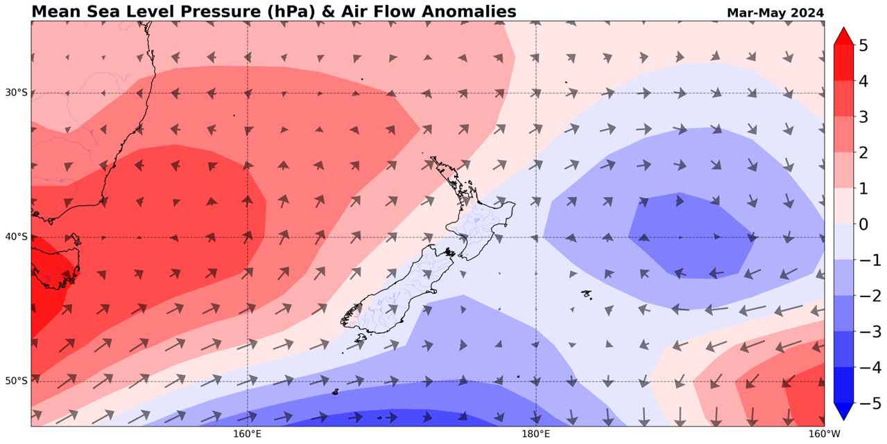
The season was characterised by a weakening El Niño, which drove the southwesterly air flow anomaly from the Southern Ocean. In addition, New Zealand coastal water temperatures were slightly below average during autumn, which contributed to cooler air temperatures.
Overall, the nationwide average temperature for autumn 2024 was 12.8°C (0.6°C below the 1991-2020 average from NIWA’s seven station temperature series which begins in 1909), making autumn 2024 the coolest autumn since 2012, and the 4th-coolest autumn since 2000.
However, the season did feature monthly variations in temperature. Autumn began on a very chilly note, as March 2024 was New Zealand’s most unusually cold month since January 2014, and the coldest March since 2012. After near average temperatures in April, temperatures were well below average in May. In fact, May 2024 was the coldest May since 2009.
The prevailing southwesterlies during autumn resulted in occasional fronts impacting the lower South Island, West Coast, and western North Island, especially during March and April. However, regions in the upper and eastern portions of both islands were generally sheltered from these rains and observed a drier than normal season overall, including five locations that had their driest autumn on record.
An exception to the overall autumn rainfall pattern occurred in the eastern North Island in May, when a heavy rain event affected areas from Gisborne to Wairarapa from 20-21 May.
One of the most significant events during the season was an atmospheric river that brought high-impact weather to the country from 9-12 April (an atmospheric river is a narrow corridor of concentrated moisture in the atmosphere, capable of carrying large amounts of water vapour). Very heavy rain affected the West Coast, where high-elevation stations including Tuke Tuke and Cropp Waterfall received around 1,000 mm of rain, or about 10% of their annual normal rainfall in just three days. This resulted in slips and closed roads in the West Coast and Southland. In addition, between 10-12 April, 56 locations around the country observed record or near-record warm night-time temperatures as northerly winds brought a warm, humid air mass from the subtropics. (see the Highlights and extreme events section below for more details).
Further highlights for autumn 2024:
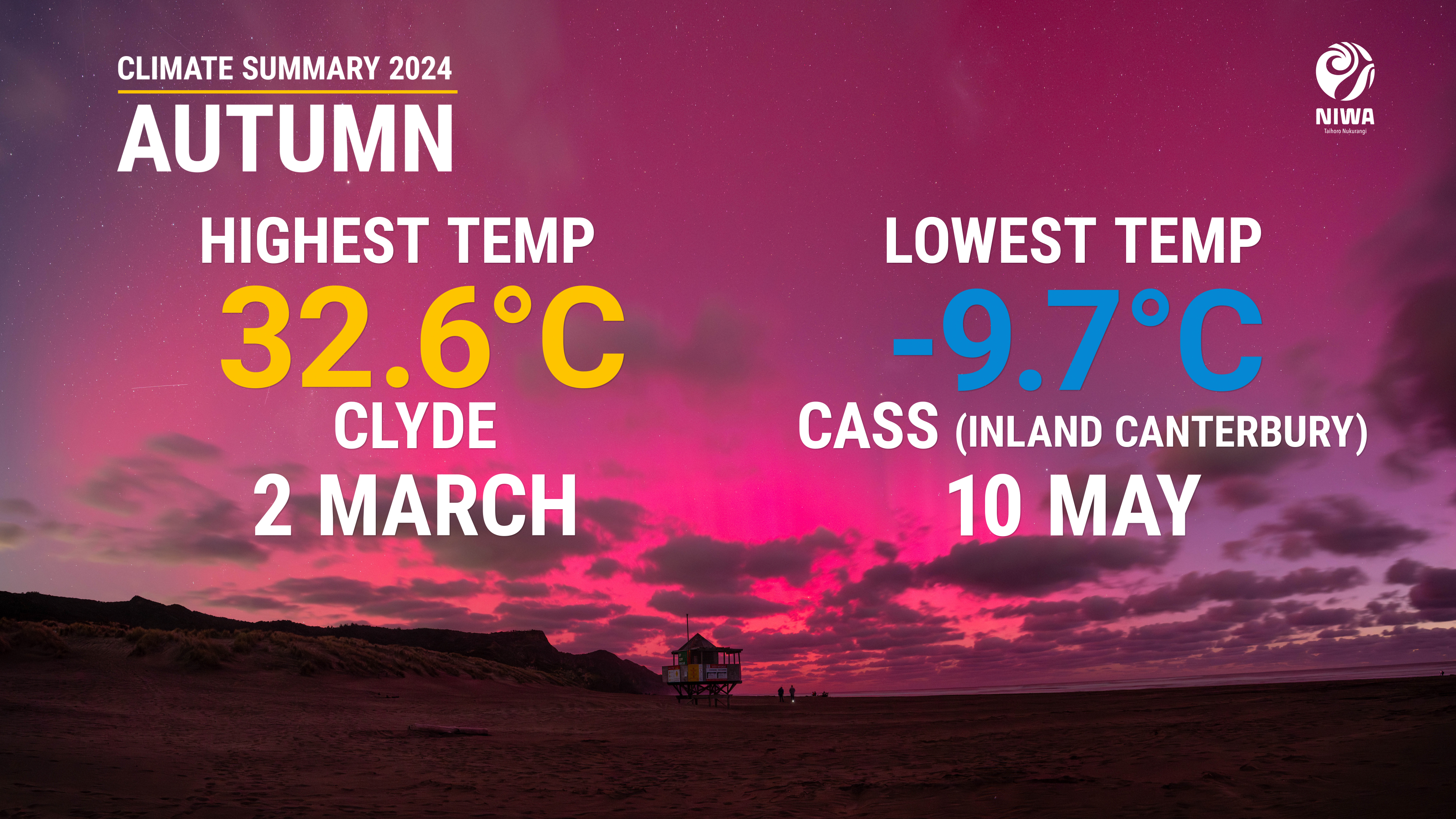
- The highest temperature was 32.6°C, observed at Clyde on 2 March.
- The lowest temperature was -9.7°C, observed at Cass (inland Canterbury) on 10 May.
- The highest 1-day rainfall was 265 mm, recorded at Milford Sound on 10 April.
- The highest wind gust was 178 km/h, observed at Cape Turnagain on 26 March.
- Of the available, regularly reporting sunshine observation sites, the sunniest four locations in 2024 so far are Marlborough (1265 hours), wider Nelson (1251 hours), Bay of Plenty (1220 hours) and Taranaki (1218 hours).
- Of the six main centres in autumn 2024, Auckland was the warmest, Christchurch was the coolest and driest, Hamilton was the wettest, Tauranga was the sunniest, and Dunedin was the least sunny.
