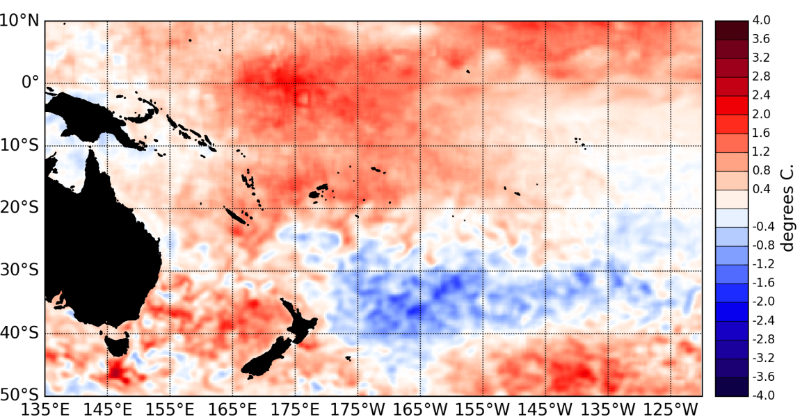
Sea Surface Temperatures (SSTs) across the Equatorial Pacific Ocean continued to reflect conditions between weak and neutral El Niño states in February 2015. Equatorial SSTs are warmer than normal in the central and western Pacific, and the anomalies in the eastern Pacific remain weak.
The latest monthly anomaly values for the NINO SST indices are: +0.43°C for NINO3.4 (was +0.39°C in January), +0.18°C for NINO3 (was +0.10°C last month), and +0.87°C for NINO4.
Subsurface ocean temperature anomalies have dramatically increased in the central Pacific and now reach over +4°C at about 150m depth just east of the International Dateline, these anomalies have also spread eastward and positive anomalies (+2°C) are present in the upper Ocean (~ 50m depth) in the eastern Equatorial Pacific. Positive upper Oceanic heat content anomalies (300m to surface) have also spread eastward to reach east of ~120°W.
The Southern Oscillation Index (SOI) is at 0 for February 2015, but showed considerable short term variability related to the passage of two tropical cyclones over Northern Australia. Convection and rainfall was enhanced in the central and western Pacific, but the South Pacific Convergence Zone (SPCZ) was displaced south of normal in the eastern Pacific, leading to dry conditions in parts of French Polynesia.
The latest value for the TRMM ENSO index for the 30 days to 4 March is -0.13 (reflecting neutral conditions). The MJO was mostly inactive in February. The CPC dynamical MJO forecast shows a very intense MJO event reaching in the western Pacific over the next two weeks.
The consensus ENSO forecast from the IRI/CPC places the chance of El Niño developing over the March – May 2015 period at about 45%. The likelihood of El Niño increases later during the year to reach ~60% in June - August.

