River plumes form one of the primary connectors between river-estuary systems and the coastal ocean.
NIWA, in conjunction with past support from DOC, is enabling development of knowledge and tools about where material ends up in the coastal ocean. We seek to develop quantitative maps that enable us to determine the ultimate resting place of material injected into the coastal ocean by rivers.
Problem
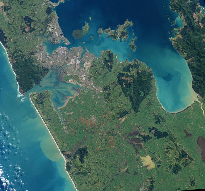
When viewed from the air, it becomes obvious how river plumes dominate the transfer of suspended material from freshwater sources to the coastal ocean.
These plumes carry the signature of our land-based impacts: 'natural sedimentation' as well as increased sediment loading, dairy-affected run-off and urban pollution.
The ocean can no longer be considered an infinite sink for such material. Knowledge about ultimate fate (where material finally settles), dilution and cumulative effects (both over long times and from multiple sources) will enable environmental managers to better understand and balance activities on land and in the coastal space.
Solution
The solution is challenging as it requires knowledge of freshwater sources, offshore ocean variability and the small-scale hydrodynamics of the river plume itself.
By combining models at the ocean and plume scale and placing these results in the context of some new, specifically designed observations, we are developing a vastly improved picture of transport of sediment in the coastal zone.
There is an initial focus on the Hauraki area because of the pressure it's under due to its multiple uses, but ultimately the approach will be applicable to all of New Zealand's coastal waters.
You can see videos of similar model outputs in our project Coastal and oceanic disperal modelling.
More information on the Coastal and Oceanic Dispersal Modelling project
Result
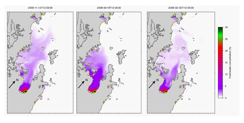
The observational basis for the work is at two scales:
- we are presently collecting data relating to the water column structure at the medium (~ 10 km) scale
- we have conducted some targeted experiments to determine how thick and dilute the plumes are.
The plume thickness is a key point. It is relatively easy to observe plumes from space but it is more challenging to estimate how thick the plumes are – they often extend to a depth of less than a meter beneath the water surface.
Initial model-derived maps of sediment pathways have been very encouraging but challenges remain about how to determine final deposition. Work is on-going about the best way to account for how storm-driven waves and currents resuspend and redistribute sediment that has only recently settled.
Once this has been solved, we can build connectivity matrices where source and sink locations can be captured under a range of conditions. These matrices take the quantitative information about transport in the coastal ocean and allow it to be viewed from a range of perspectives including the source and the sink, and to isolate sources or view cumulatively.