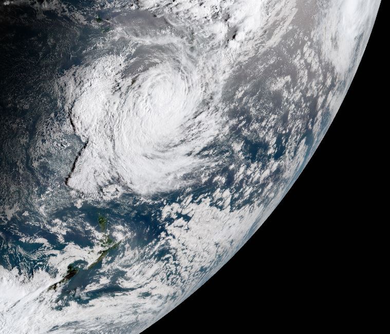
Tropical Cyclone Winston is showing some signs of weakening as of this morning, now located about 600km southeast of Vanuatu’s southernmost islands.
The storm’s southeastward movement into cooler ocean waters is contributing to this weakening.
The storm still has sustained winds of 130km/h with gusts of 157km/h.
A continued weakening trend is expected tomorrow as the cyclone makes a turn toward the west. It is forecast to pass 200 to 300km north of Norfolk Island later tomorrow.
Through Friday, the cyclone is forecast to track slightly south of west toward the far southern Coral Sea. The storm may weaken into an area of remnant low pressure over the weekend in this region.
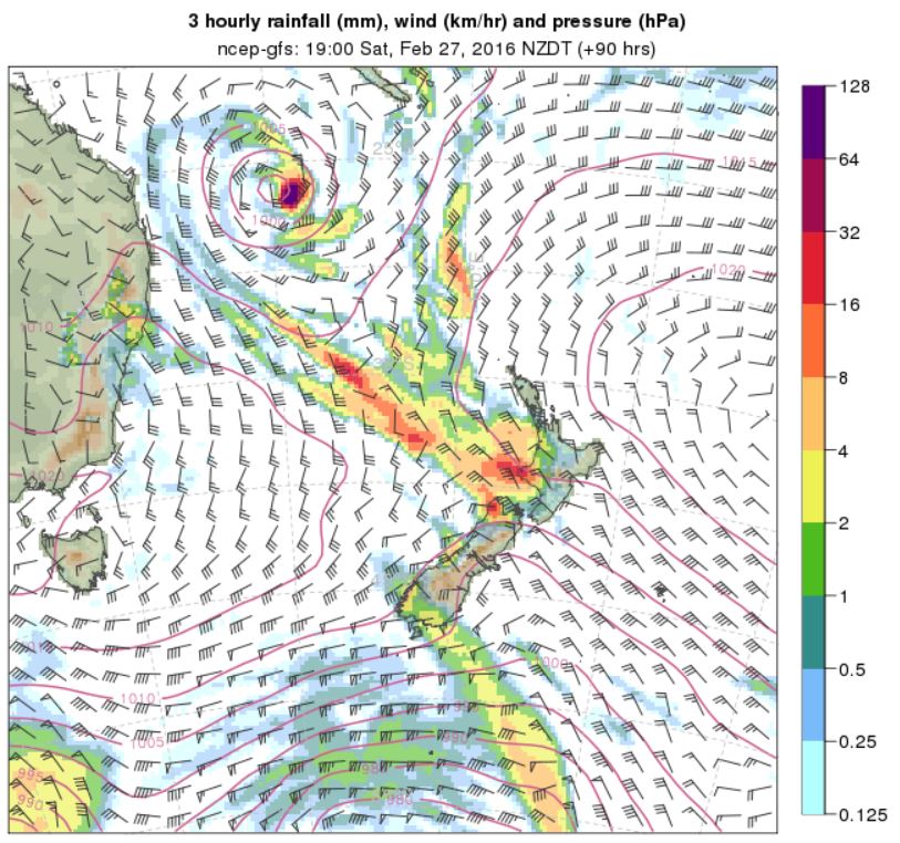
Though the storm’s track is currently forecast to be well to the north of New Zealand through the weekend, some indirect impacts may be felt across the country.
A moderate northeast swell is forecast to develop across the northern North Island tomorrow, lasting into Friday. Additionally, a plume of tropical moisture may stretch across the northern Tasman Sea over the weekend, resulting in high levels of humidity and the potential for a few rounds of downpours across New Zealand’s North Island later on Saturday and Sunday. The threat for isolated downpours may continue into the early part of next week.
At this time, NIWA meteorologists believe that the remnants of Winston should remain over the southern Coral Sea or northern Tasman Sea into early next week.
Further information