The term “joined-up government” was coined in the late 1990s to describe the coordination modern governments need to deal with large problems.
Despite the hype and attractive logic of integrated policymaking, it has often proved hard to do. The multidimensional nature of problems, society and organisations make it a challenge. In the face of such challenges, it is imperative that science informs policy and planning.
Challenging, but certainly not impossible. Our Government’s National Science Challenges are proof. Big issues affecting the nation’s environmental, social and economic objectives were identified, and then packaged into research programmes to be undertaken by multi-disciplinary teams across science institutions and the wider community.
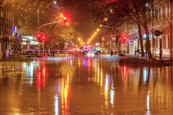
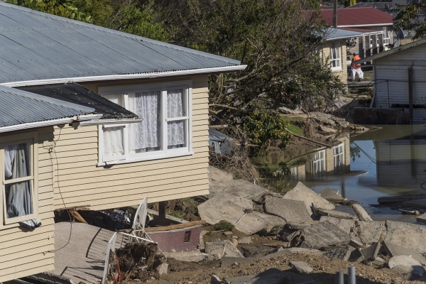
There are few bigger challenges for joined-up government than dealing with the growing impact of weather-related hazards – especially floods like those we experienced again this year in New Zealand.
Weather caused 90% of global disasters
Weather caused 90% of global disasters in the twenty years to 2015. These disasters killed more than 600,000 people and otherwise harmed 4.1 billion people.
Flooding was responsible for just under half these worldwide disasters, and it’s getting worse. The US, for example, is experiencing a higher frequency of billion-dollar flood events.
Flooding is responsible for a greater share of the weather disasters in New Zealand than the world average. Sixteen of the 25 weather disasters tracked for insurance purposes since 2015 were floods, and they caused an estimated $200 million in insurance-claimed damage.
There are places that suffer repeated floods, but a look at New Zealand flood records over the past 30 years shows that most parts of the country have been affected. As our climate changes, and where we live and work evolves, the past may not be a good predictor of future flood exposure and impact.
We do know that the number of floods, and their costs, are rising. New Zealand’s increase in population, development and wealth means we have more people and assets located where floods could happen, and the assets at risk are more expensive.
Increased frequency of extreme weather
Changes in our climate are also increasing the frequency of the extreme weather that leads to floods. Heavy rainfall events and the ensuing flood risks are increasing because warmer temperatures load the atmosphere with more water vapor.
Crucially though, NIWA now has the scientific capability to predict and provide advanced warning of floods to help mitigate these risks, using a combination of models that predict rainfall, how much and how soon it will get into waterways, and whether they will flood. This service is currently operational for two major catchments, but it needs to be rolled out over the whole country.
A programme called RiskScape, a joint venture between NIWA and GNS Science, can look at what would happen if areas flood. It can estimate possible human casualties and displacement, building damage and replacement costs, and economic losses. This allows city planners to work out how to avoid such problems – such as by limiting habitation and enforcing certain building restrictions.
City planners can use science to help them organise on an even grander and longer-term scale. For example, the Greater Wellington Regional Council recently commissioned NIWA to examine, for the first time, what the region’s climate could look like in 2090.
Wellington could become hotter than Northland
Using NIWA’s forecasting and climate modelling expertise, the scientists’ findings were sobering. The NIWA report found that, in a world with ongoing high emissions of greenhouse gases, Wellington could become hotter than Northland is now, and end up with a temperature closer to that of Sydney today.
NIWA’s modelling showed Wellington City would have warmer autumns, almost a month of days over 25°C and up to 10 per cent more winter rain by 2090. One of the more startling projections was an increase for Wellington City from 6 hot days (over 25°C) a year now, to 26 days by 2090. In the Wairarapa, that figure goes from 24 days now, to 94 – in just over 70 years.
That climate might sound nice, but it would require significant adjustment if Wellingtonians want to avoid consequences more serious than occasional sunburn. There are many possibilities brought about by the prospect of heavier downpours and warmer temperatures – such as the potential for more floods, and for drought during summer – all affecting suburban and rural lives and industries differently.
“We’re all in this together - how do you future-proof the system?" - Chris Laidlaw
Councils are responsible for an enormous amount of community and regional infrastructure, and for things like land-use planning. GWRC Chairman Chris Laidlaw said, “We’re all in this together” and that the big question was “How do you future-proof the system.”
What was most rewarding after the NIWA report was released by GWRC, was the public reception. Community discussion centred on what it would be like to live in that climate. One of the key issues was what extreme storms and sea-level rise would mean for people living on the region’s coastline. The public looked at the future, and appreciated that changes and some tough decisions would need to be made.
Resilience to big weather-related issues
Science is critical to help join the dots and make our communities resilient to the big weather-related issues. We not only need to provide adequate warning of imminent floods, but also predictions of future climate to enable better planning and risk mitigation.
John Morgan is Chief Executive of NIWA
[This feature appeared in Water & Atmosphere 19]


