Long-term protection of Otago’s coastal habitats took a step closer to reality after more than 100 marine Significant Ecological Areas (SEA) were identified as part of a research project led by NIWA.
The research was produced for the Otago Regional Council to help inform the Regional Plan: coast review, which is planned to start in 2024/25.
The plan must include objectives, policies and rules that govern what activities the councils will allow, control or prohibit in the coastal environment.
It can also be used to manage any effects from the use, development, or protection of the coastal marine area.
Resource Management Act dictates that councils must protect indigenous biodiversity within their coastal marine areas, to 12 nautical miles.
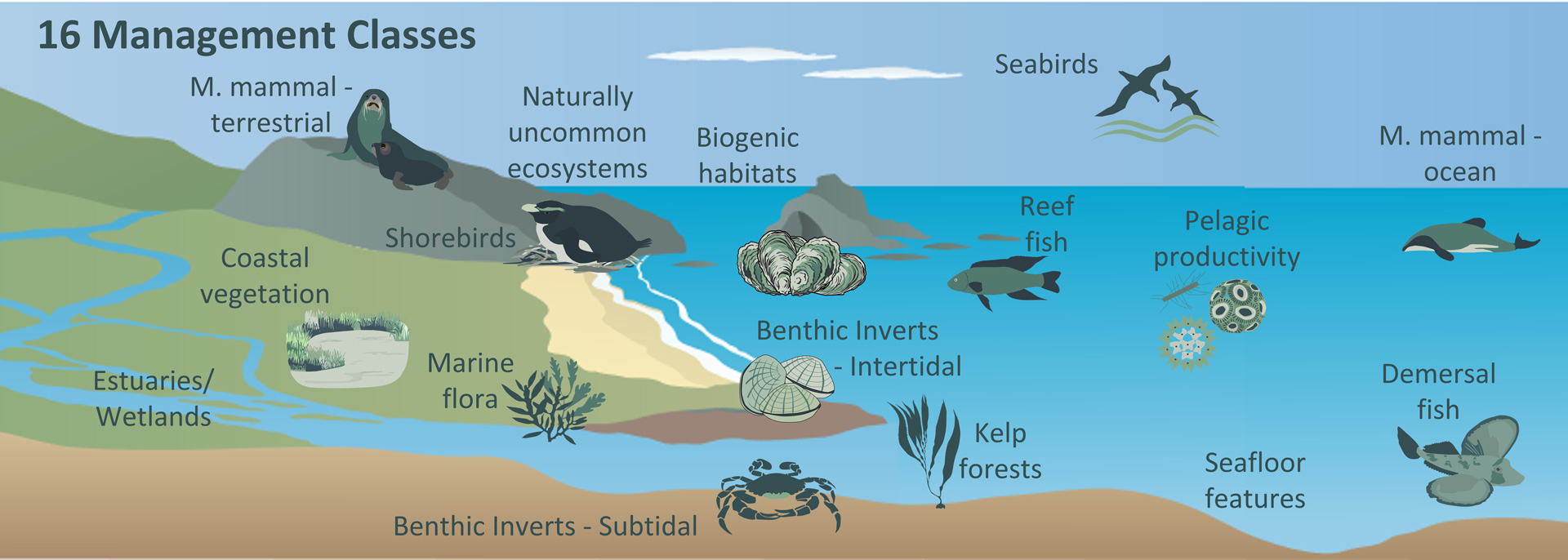
Councils must identify SEAs that meet defined ecological significance criteria based on the distribution of species, habitats and ecological processes.
Many councils do not have access to information or the expertise to identify SEAs but are partnering with other councils and agencies to gather the data.
The Otago Regional Council contracted NIWA to pool data on the distribution of important ecological features within its coastal marine area and to identify SEAs.

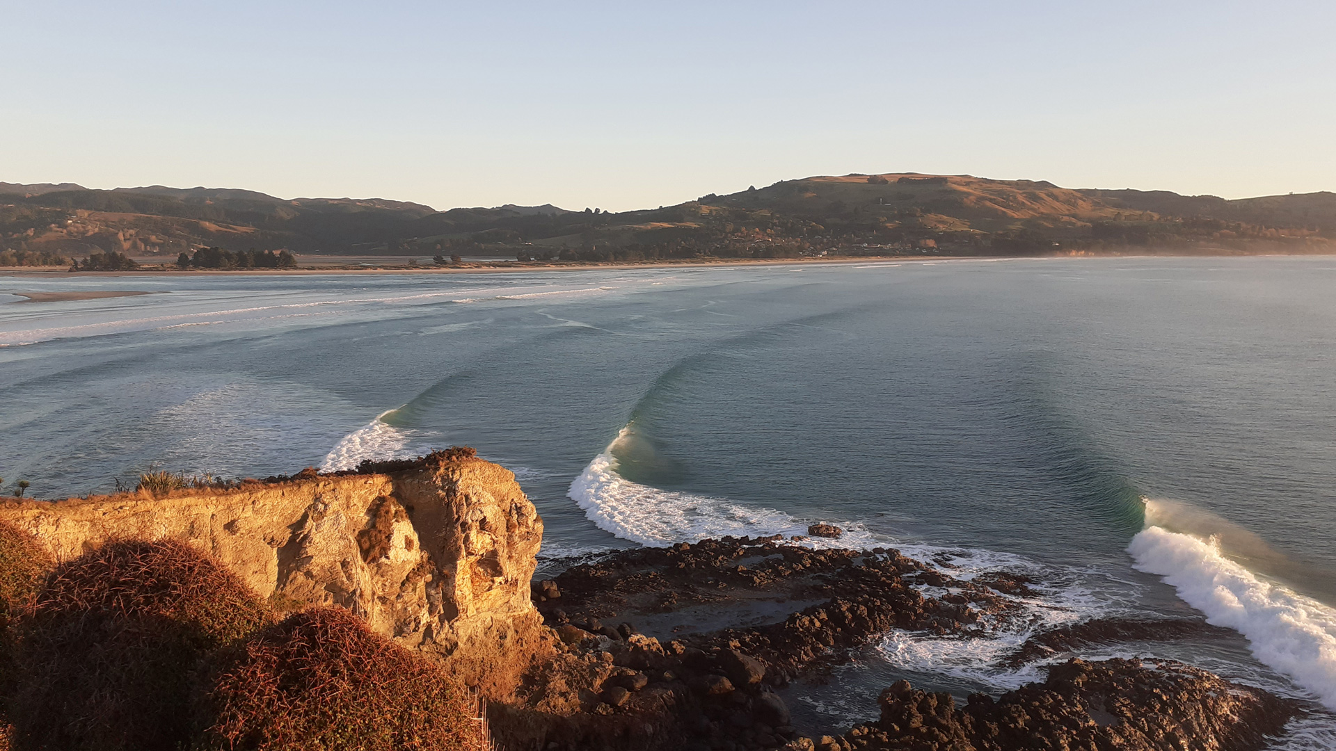
The council’s coastal boundary is on the east of the South Island, from Oamaru to Tautuku Peninsula, about 260kms.
Tom Brough, a marine ecologist at NIWA based in Dunedin, led the research.
“We established a regional stakeholder working group with representatives of mana moana, central government agencies including Department of Conservation, Ministry of Primary Industries, Otago Regional Council, Otago University, NIWA, NGOs and industry.
“The working group identified a range of datasets held by NIWA, Otago Regional Council and third-party groups with useful information on the distribution of SEAs.”
Analyses of the data using the decision support tool Zonation, led to the identification of more than 100 SEAs, confirming the richness of the Otago region in terms of biodiversity.
“The Otago coastal shelf is important for marine wildlife and outstanding habitats. For example, it has kelp forests that provide shelter, food and habitat for many other species."
“There are the Otago sub canyon systems which are important foraging locations for marine mammals.
“In fact, there is incredible diversity of marine mammals in the Otago coastal region, up to four species of dolphins, sperm whales and one of the few places where Shepherd's beaked whale has been regularly seen.
“It is also an area with an abundance of seabird species.”
Brough said the 12-nautical mile zone covered by the Coastal Management Plan is where most human activity occurs.
“This is the area where there is a lot of interest in aquaculture and commercial fishing, for example. It is a rich area for biodiversity but also an important area for human use as well.”
Estuaries formed part of the 12 nautical mile coastal environment too and the council was keen to identify SEAs within coastal wetland systems.
The research for the council was completed near the end of 2022. It produced a significant compilation of data on marine biodiversity in Otago to help the council and stakeholders manage the coastal environment.
There were still some coastal areas where there was no data for researchers to analyse but the council has a plan to fill those gaps.
In 2023, NIWA was contracted by the council to complete aerial mapping of the Catlins Estuary to assess the coverage and distribution of the nuisance bloom-forming macroalga Agarophyton spp.
In total, 4.5 km2 was mapped with multispectral cameras, making this the largest aerial campaign for multispectral imagery completed at NIWA.
The aerial mapping was completed by NIWA researchers Hamish Sutton and Stephanie Mangan.
Further aerial mapping of the Otago coast is planned to monitor kelp forests.
Coastal Scientist at Otago Regional Council, Sam Thomas, said the extra aerial mapping assignments will help provide a more complete picture of the Otago coast.
“The research highlights the diverse range of significant marine ecological areas along the Otago coast.
“It shows how productive and biodiverse the Otago region is with many different habitats and ecosystems."
“But it also highlights the large knowledge gaps in our coastal environment which will help direct future research to better understand these diverse habitats for management and monitoring.”
Researchers involved in this research: Tom Brough, Eva Leunissen, Carolyn Lundquist, Leigh Tait, Hamish Sutton Stephanie Mangan (NIWA) and Sam Thomas (Otago Regional Council).
