03 March 2014
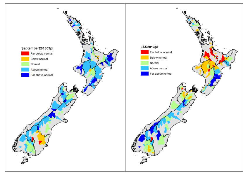
The September map shows the effects of rain events nearly everywhere, with the exception of Bay of Plenty and Rangitikei in the North island, and northern Marlborough, South Canterbury, Central Otago and eastern Southland.
The July - September map (on the right) shows that the longer term drought effects persist in the western, north and central North Island and to a lesser extent in Nelson-Marlborough. The North Island east coast and Southern Alps are above normal to far above normal for the time of year.

