River water temperatures (OND)
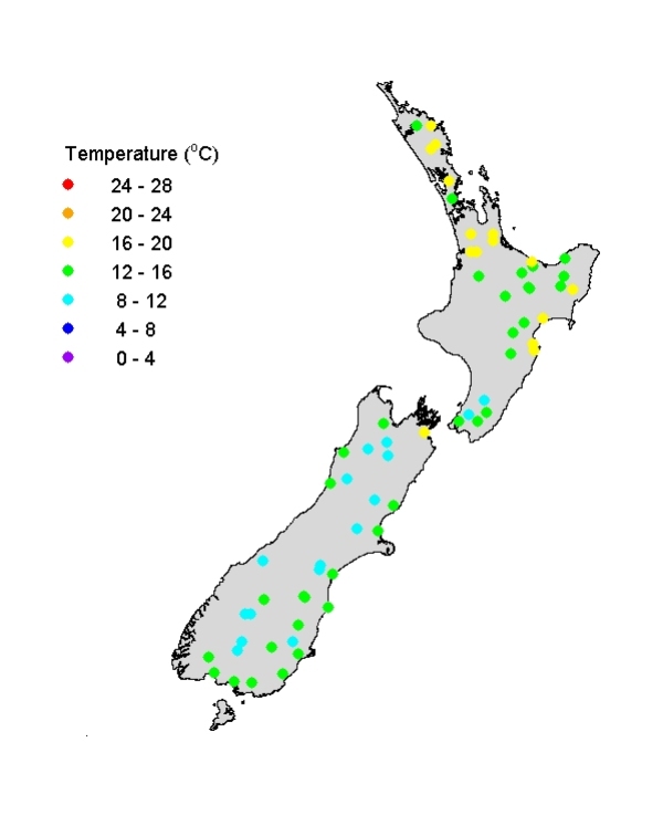
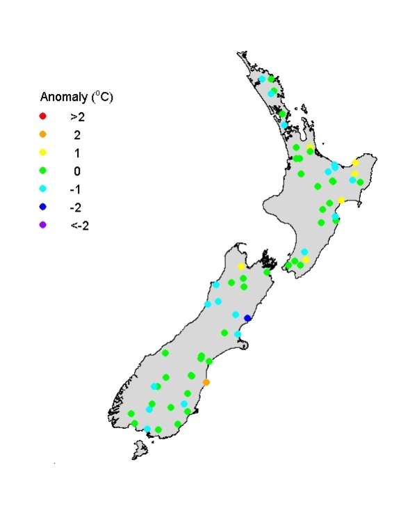
Spring river water temperatures were mostly in the range 8-20oC. As is typical, river water temperature exhibited weak trends of decreasing temperature with increasing latitude (moving N to S) and with increasing altitude (moving into mountainous areas). Rivers in the coastal eastern North Island (Gisborne and Hawkes Bay) tended to be rather warm. The temperature anomaly graph shows that river water temperatures were typical for spring at most sites, with few large anomalies either above or below normal. However, the Waimakariri River just north of Banks Peninsula (eastern SI) was unusually cold, consistent with high spring flows with snow melt, while the (hydro-lake-fed) Waitaki River, further south in eastern South Island, was unusually warm, probably reflecting solar heating during sunny weather in this region.
[No temperature data was available at time of writing from 11 NRWQN sites in Western North Island, including Taranaki.]
Visual clarity of rivers (OND)
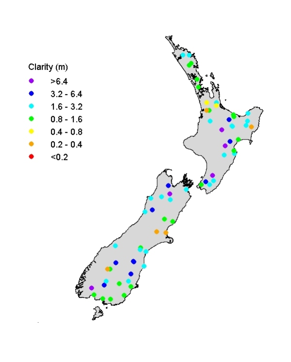
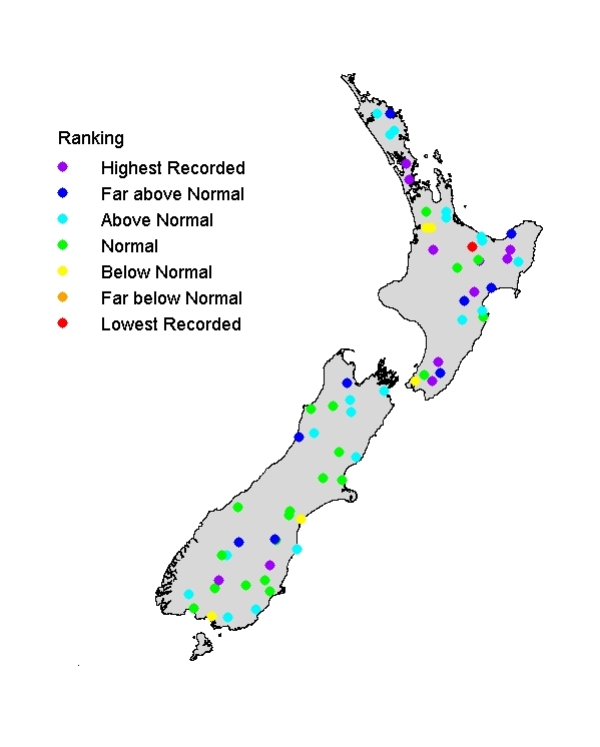
Visual clarity of rivers ranged widely (from <0.4m to >6 m), reflecting New Zealand's diversity of soil and rock types and the interaction of these patterns with land use. (Rivers with pastoral catchments tend to be less clear than those with forested catchments.) Visual clarity is strongly inversely related to flow state in rivers, and low flows over much of the North Island (also some parts of South Island) resulted in some unusually high visual clarity readings. The upper Tarawera River (lake-fed from Lake Tarawera) was the only river site to be appreciably less clear than typical (long-term mean visibility = 5.5m), although still fairly clear in absolute terms at 4.3 m visibility (average of three readings). [No visual clarity data was available at time of writing from 11 NRWQN sites in Western North Island, including Taranaki.]


