Climate developments in December 2005

A large area of suppressed convection affected the central equatorial Pacific extending to parts of the Northern and Southern Cook Islands, and the Society and Tuamotu Islands of French Polynesia. The South Pacific Convergence Zone (SPCZ) extended from the Solomon Islands to just north of the Southern Cook Islands, resulting in above average rainfall over parts of Fiji, Tonga, and French Polynesia. The Intertropical Convergence Zone was well north of the equator.
Rainfall was less than 50% of normal in the Southern Cook Islands, New Caledonia, Norfolk Island, and southern parts of both Tuvalu and Tonga.
Mean air temperatures were about 1.0 °C above average in central and southern French Polynesia, and at least 0.5 °C above average in Vanuatu, New Caledonia, Tuvalu, and the Southern Cook Islands. Unusually warm December air temperatures were recorded at several sites in parts of New Caledonia, Fiji, and French Polynesia.
Tropical Southwest Pacific mean sea-level pressures continued the tendency to be below average east of the Date Line, although this was not as marked as in previous months. They were above average over northern Australia, and across New Caledonia toward Fiji. Equatorial surface easterlies were persistent along the equator, occurring in about 92% of observations at Tarawa.
| Country | Location | Monthly Max Temp (°C) | Comments |
|---|---|---|---|
| New Caledonia | Pouembout | 37.1 | Equal high |
| Fiji | Labasa Airfield | 32.6 | Equal high |
| French Polynesia | Tahiti – Faa’a | 28.1 | Record high |
| French Polynesia | Rikitea | 25.2 | Record high |
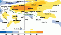
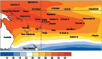
Sea surface temperature anomalies (°C) for December 2005. (Click for enlargement)

The tropical Pacific Ocean is in a neutral state with some features of a weak La Niña. Negative sea surface temperature anomalies continue to strengthen off the South American coast, while those near the Date Line have eased to near normal. The NINO3 sea surface temperature (SST) anomaly was about -0.7 °C in December (-0.3°C for October-December), while NINO4 was about +0.2°C (+0.4°C for October-December). The cold subsurface temperature anomaly has surfaced across from the Date Line eastwards, and further cool anomalies occurred in the subsurface.
The Southern Oscillation Index (SOI) was near neutral in December (-0.1), with the 3-month October-December average at +0.2. The equatorial trade winds have strengthened near the Date Line and across the Pacific. Outgoing longwave radiation (OLR) anomalies indicate suppressed convection near the Date Line, but much enhancement north of Australia into Asia. Although the monsoon trough appears to be becoming organised over north Australia, the Madden-Julian Oscillation (MJO) continues to be weak.
Four of the ENSO forecast models show weak La Niña conditions for the January to March period, with all trending back to neutral conditions through April-September 2006. The latest NCEP/CPC statement calls for neutral conditions or a weak La Niña over the next 6-9 months. The IRICP summary gives a 10% chance of La Niña in the next few months, with neutral conditions most likely through the summer.
