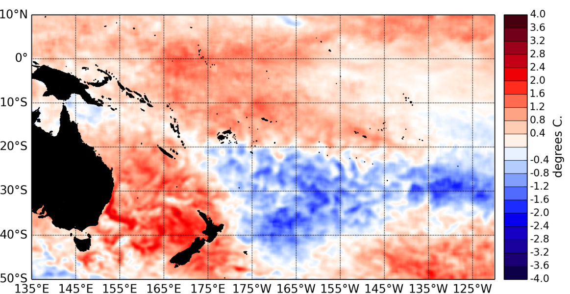
The tropical Pacific Ocean continued to hover between neutral and weak El Niño conditions in January 2015. Equatorial sea surface temperatures (SSTs) remain warmer than normal over most of the basin, with the exception of the far eastern Pacific, where slightly cooler than normal SSTs have recently appeared.
The latest monthly anomaly values for the NINO SST indices are: +0.39°C for NINO3.4 (down from about +0.8°C the preceding month), +0.10°C for NINO3 (a sharp decrease from about +0.8°C last month), and +0.87°C for NINO4 (was +1°C in December 2014).
Subsurface ocean temperature anomalies over +2°C persist at about 150m depth just east of the International Dateline. Oceanic heat content anomalies (300m to surface) are positive in the western and central Pacific but negative east of about 120°W.
The Southern Oscillation Index (SOI) is at –0.7 for January 2015 (on the El Niño side of neutral). However patterns of convection and rainfall are still inconsistent with El Niño, with convective activity and rainfall at higher levels than normal in the western Pacific Ocean. The latest value for the TRMM ENSO index for the 30 days to 4 February is +0.03 (reflecting neutral conditions).
The MJO very recently (as of 3 February) increased amplitude in the western Pacific, coinciding with a strong Westerly Wind Burst that occured around 160°E. The CPC indicates increased levels of intra-seasonal convective activity are likely in the western Pacific over the next two weeks.
The consensus ENSO forecast from the IRI/CPC places the chance of El Niño developing over the February – April period at about 60% (reduced probability compared to previous months forecasts). Note that the current forecast period (February – April) is reaching into what is typically the decaying phase of the El Niño – Southern Oscillation.

